Photos
|
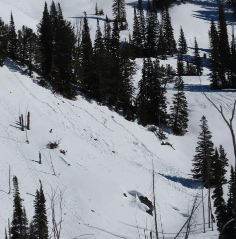
Southern Madison, 2025-03-02 Another day of warm temps and clear skies allowed us to cover a lot of ground in the Southern Madisons. We rode into the Taylor Fork, up to the weather station, to the top of Carrot Basin, through Sage Basin, up and over into Cabin Creek, and all the way up to the head of Red Canyon. There were a handful of small wet-loose avalanches on solar aspects that we noted throughout the day. While northerly aspects stayed cold, solar aspects became wet a couple inches down. Photo: GNFAC Link to Avalanche Details |
|
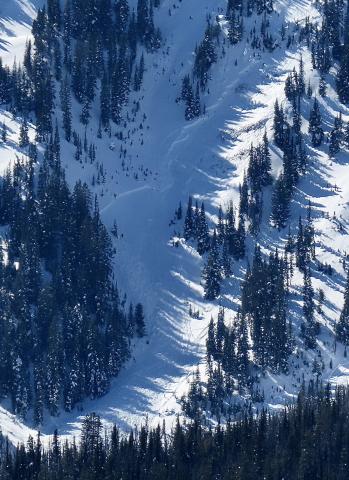
Southern Madison, 2025-03-02 |
|
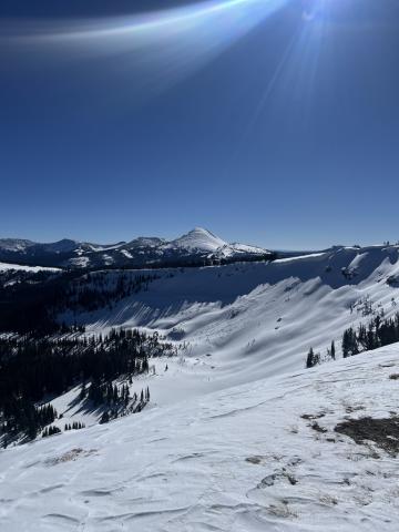
Southern Madison, 2025-03-02 We also spotted an old wind slab avalanche (R1-D2) that broke earlier this week in Sunlight Basin. Photo: GNFAC Link to Avalanche Details |
|
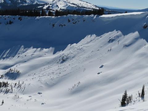
Southern Madison, 2025-03-02 On Mar 1 we also spotted one older cornice-fall triggered avalanche in Sunlight Basin. Photo: GNFAC Link to Avalanche Details |
|
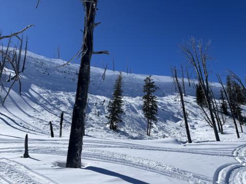
Southern Madison, 2025-03-02 On Mar 1 we also spotted two cornice-fall triggered (R2-D2) avalanches that broke earlier this week - one in Sunlight Basin and one in Sage Basin. Photo: GNFAC
Link to Avalanche Details |
|
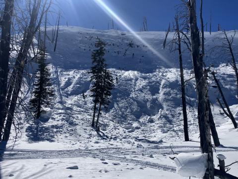
Southern Madison, 2025-03-02 On Mar 1 We also spotted one cornice-fall triggered (R2-D2) avalanche that broke earlier this week in Sage Basin. Photo: GNFAC Link to Avalanche Details |
|
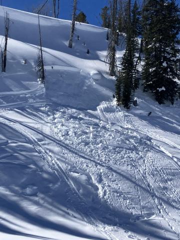
Southern Madison, 2025-03-02 At the top of Carrot Basin, we saw a small avalanche (R1-D1) on a N aspect that likely broke yesterday on buried weak layers. Photo: GNFAC Link to Avalanche Details |
|
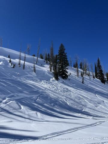
Southern Madison, 2025-03-02 At the top of Carrot Basin, we saw a small avalanche (R1-D1) on a N aspect that likely broke yesterday on buried weak layers. Photo: GNFAC Link to Avalanche Details |
|
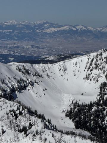
Northern Gallatin, 2025-03-01 Pictures of two cornice triggered avalanches way up the South Cottonwood drainage that was viewed from Alex Lowe. Looks to be in the recent days, around 9,000 feet North facing. Photo: S Lipsteuer Link to Avalanche Details |
|
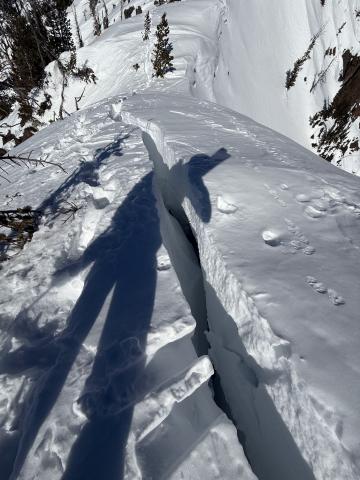
Northern Gallatin, 2025-03-01 A massive cornice had cracked and was slowly making its way towards falling down. Cornice was around 50 feet long, and largely overhanging. Photo: S Lipsteuer |
|
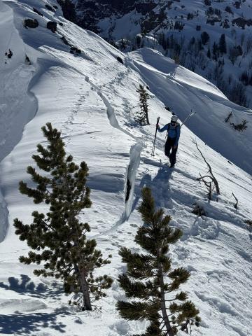
Northern Gallatin, 2025-03-01 A massive cornice that has cracked and is slowly making its way towards falling down. Cornice was around 50 feet long, and largely overhanging. On the standard ascent of the East Ridge of Alex Lowe, the skin track usually travels below this cornice while ascending to the ridge. Photo S Lipsteuer |
|
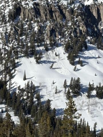
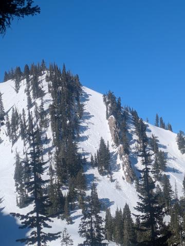
Northern Madison, 2025-03-01 Natural point release avalanche observed from the YC. Occurred out of bounds on the South side of Pioneer Mountain. Photo: YC Ski Patrol Link to Avalanche Details |
|
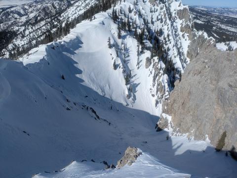
Bridger Range, 2025-03-01 Observed multiple wet loose slides naturally triggering and running on south facing slopes beyond bradleys and on the south facing aspects of hourglass chute. Link to Avalanche Details |
|
Bridger Range, 2025-03-01 Observed multiple wet loose slides naturally triggering and running on south facing slopes beyond bradleys and on the south facing aspects of hourglass chute. Photo: T McGarry Link to Avalanche Details |
|
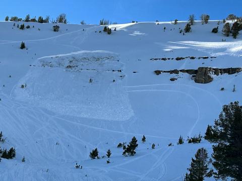
Lionhead Range, 2025-02-28 Airplane bowl this afternoon after a rider triggered slide. There is a down track in the middle of the crown face Link to Avalanche Details |
|
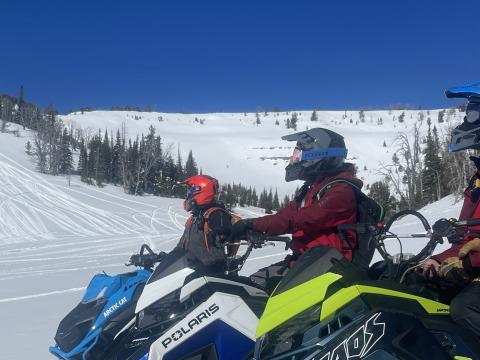
Lionhead Range, 2025-02-28 Airplane bowl this morning, no avalanche Link to Avalanche Details |
|
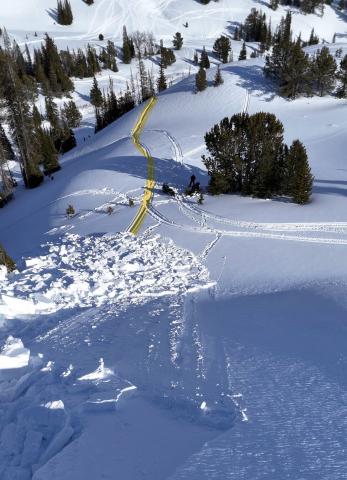
Lionhead Range, 2025-02-28 A rider triggered a huge avalanche in the uppermost reaches of Targhee creek on a north facing slope at 9200' Link to Avalanche Details |
|
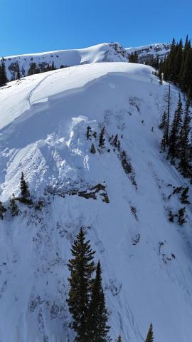
Lionhead Range, 2025-02-28 A rider triggered a huge avalanche in the uppermost reaches of Targhee creek on a north facing slope at 9200' Link to Avalanche Details |
|
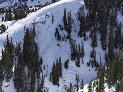
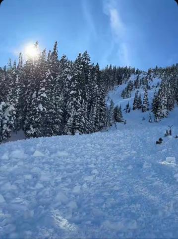
Lionhead Range, 2025-02-28 A rider triggered a huge avalanche in the uppermost reaches of Targhee creek on a north facing slope at 9200' Link to Avalanche Details |
|
Southern Madison, 2025-02-28 From IG message: "Getting word that a group triggered a decent slide today out at cabin creek. I’ll attach the coordinates to the general area, to the best of my knowledge. No burials. They were able to outride if. But thought I’d send coordinates in case you guys were gonna be in the area and wanted to check it out." Link to Avalanche Details |
