Snow Observations List
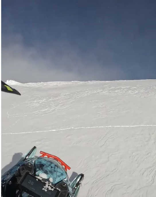
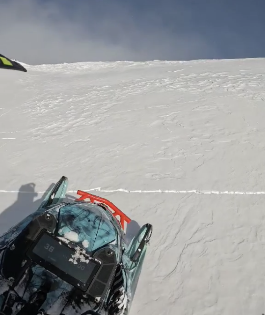
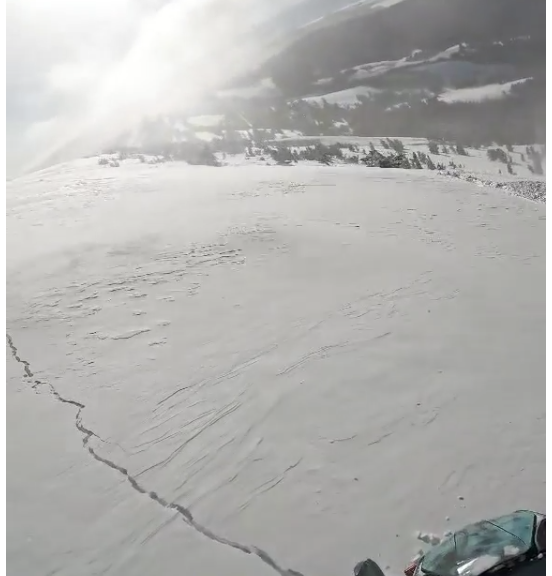
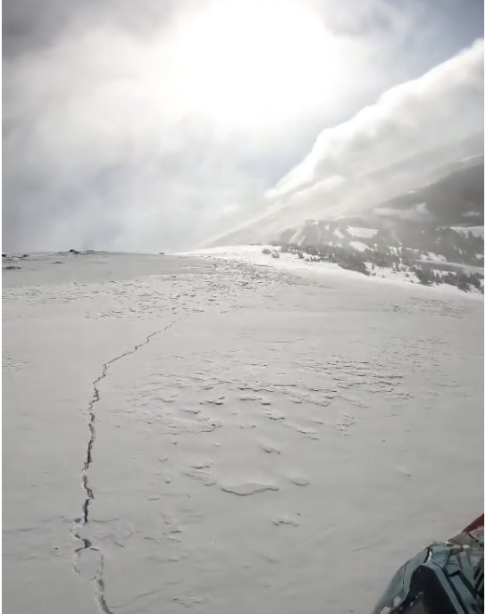
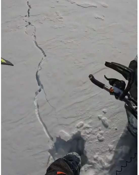
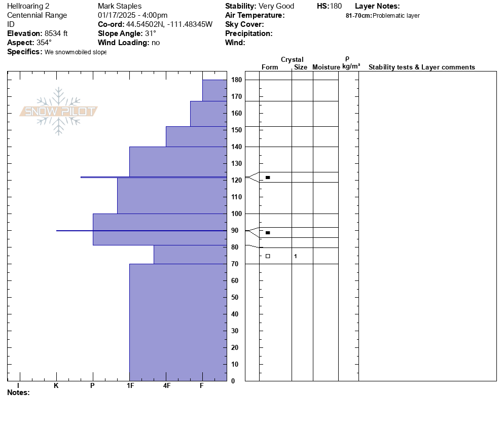
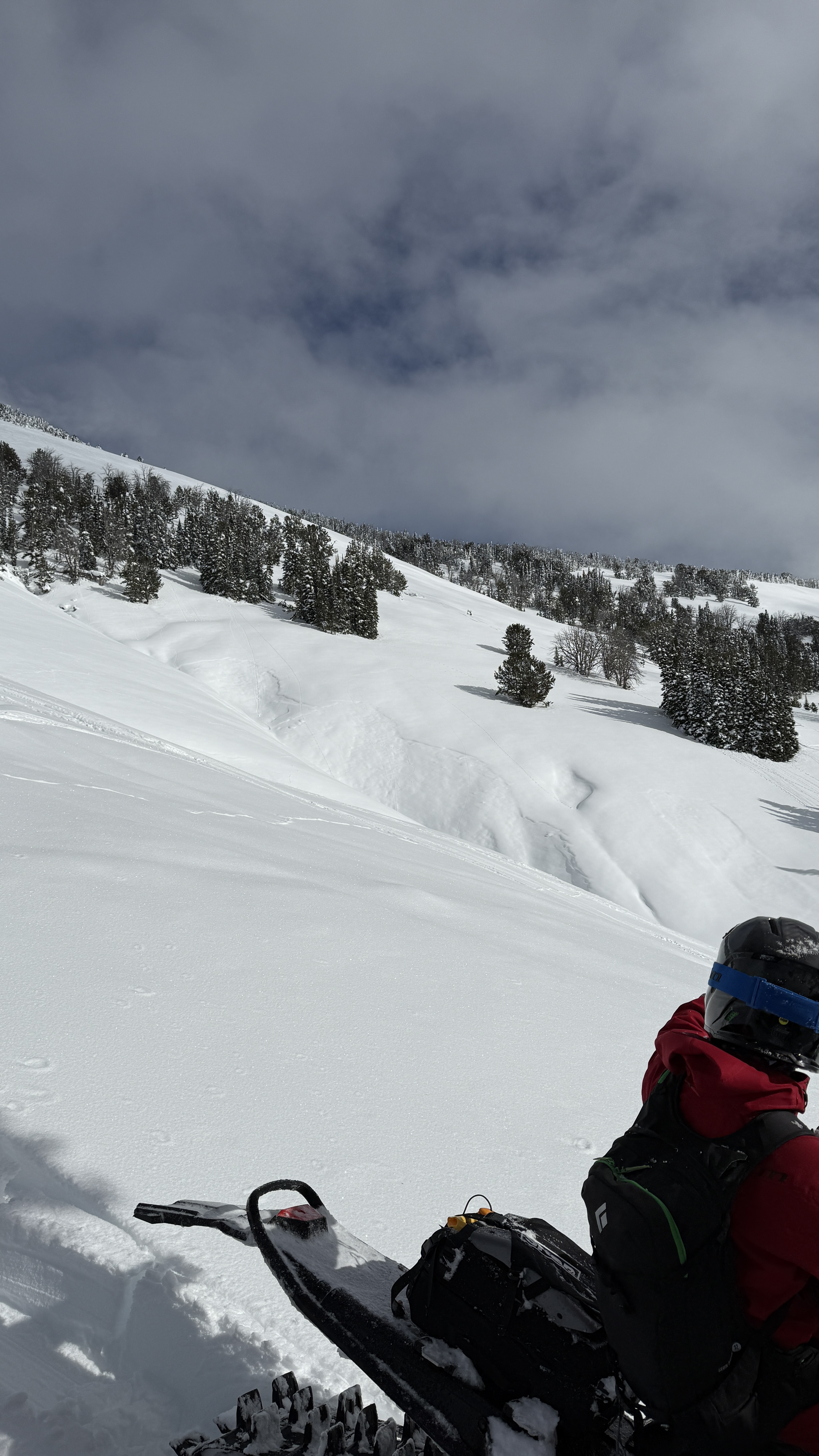
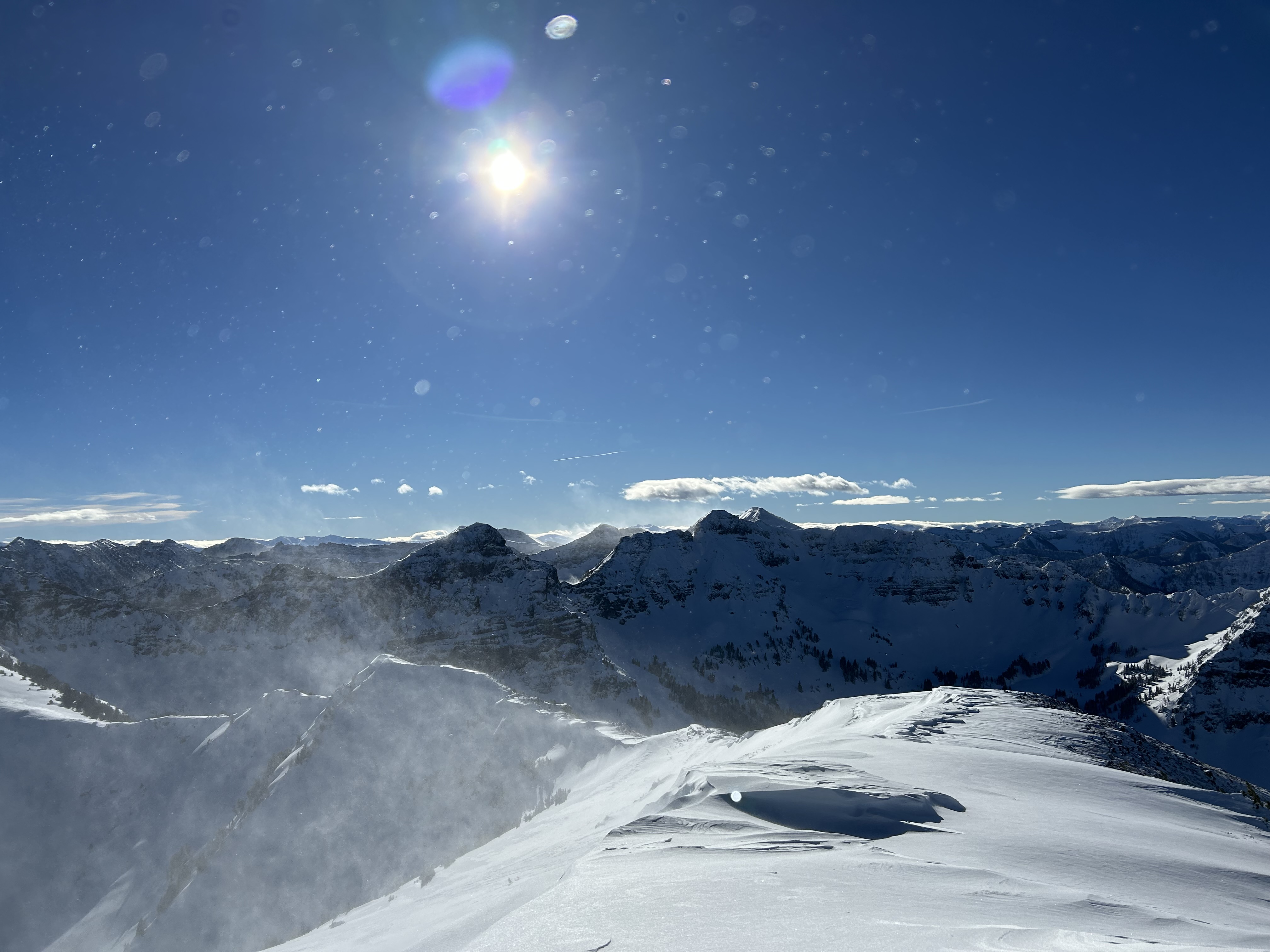
Wind loading on all aspects due to swirling winds. Cracking about 3-12” thick around top of wolverine forest. No signs of persistent slab instability, deep snowpack throughout.
Full Snow Observation ReportFrom FB message 1/19: "In between redstreak peak and white peak... The whole slope cracked... the one I stopped on I put my leg in the crack and went to my knee inside the crack"
Screenshots from videos sent in messenger
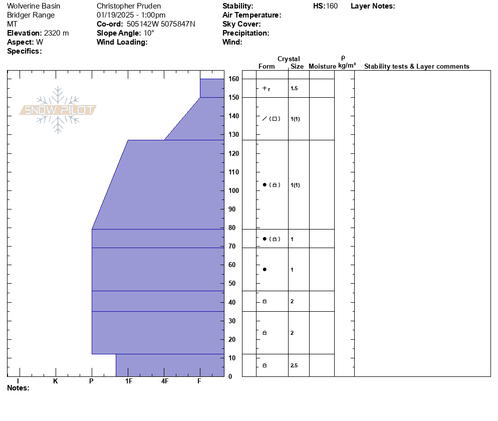
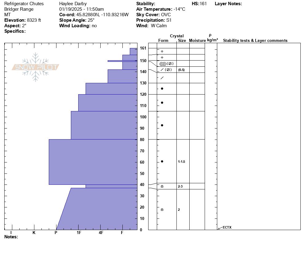
Full Snow Observation ReportSnow depth 160 and generally stabile conditions with the lower layers gaining some strength at this location. ECTX x3 in this area. Old wind slab observed in the area but no signs of instability on that layer.
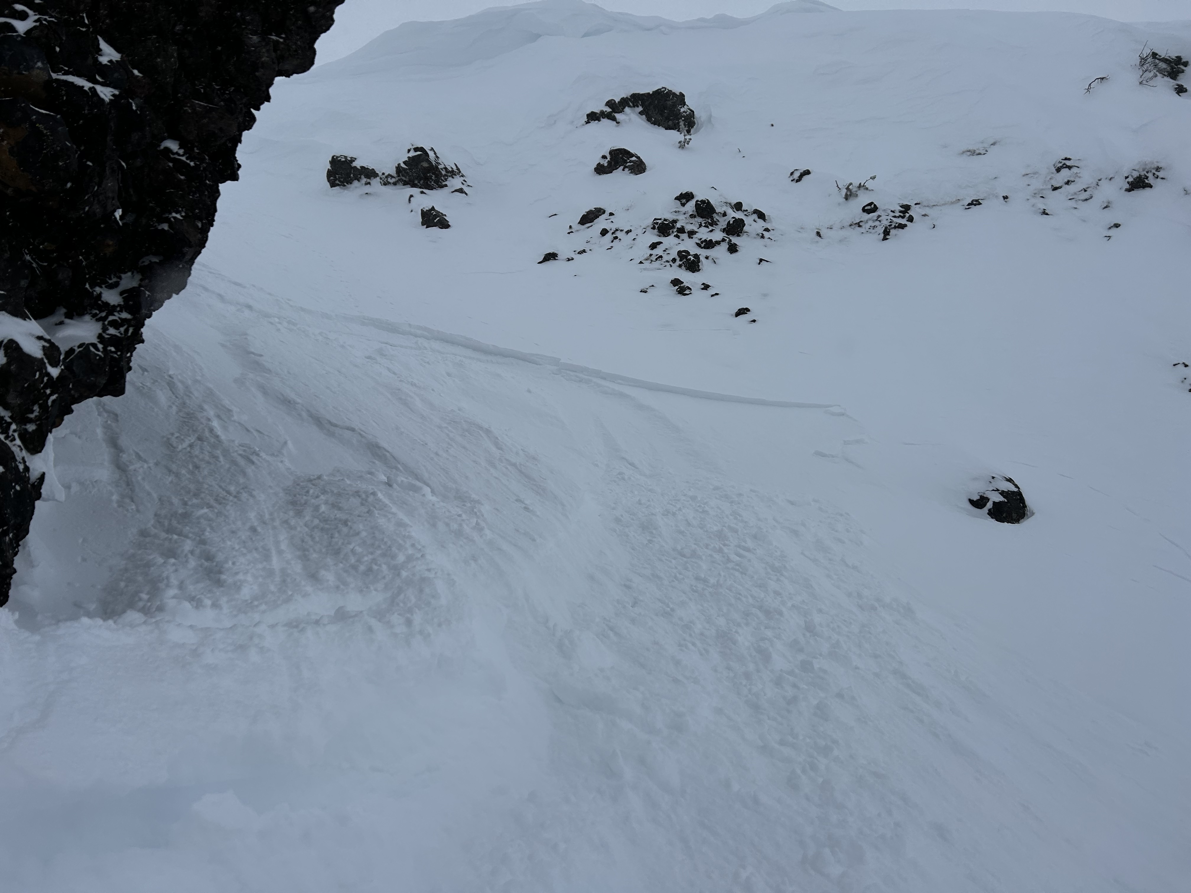
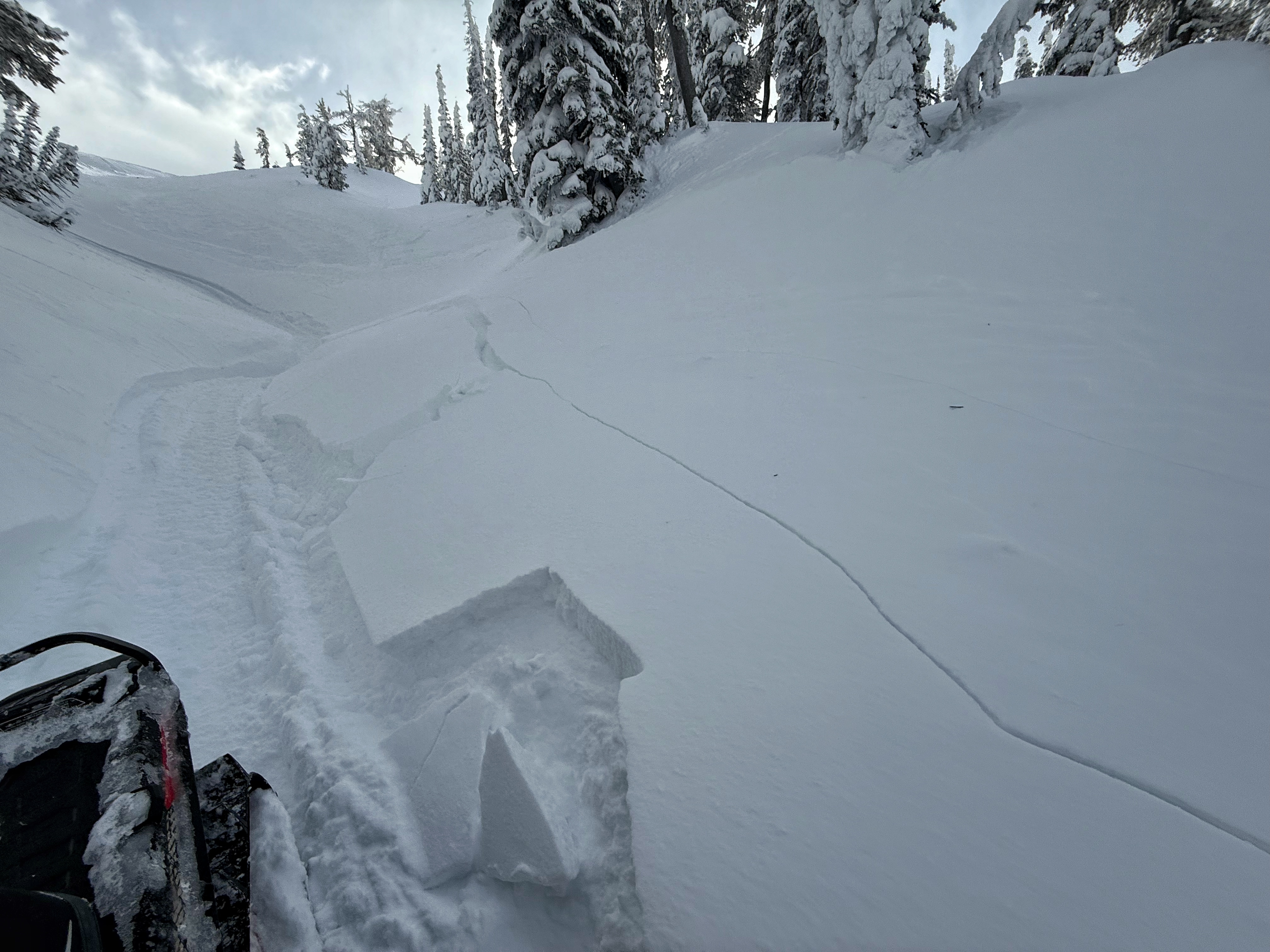
Full Snow Observation ReportWind was swirling in Maid of the Mist yesterday, mostly upslope winds that were transporting snow, but inconsistently and were difficult to predict where they were loading. We did not find widespread wind loading, but did get a very small windslab to release just below the top of the ridge (max 3-4" thickness, see image).
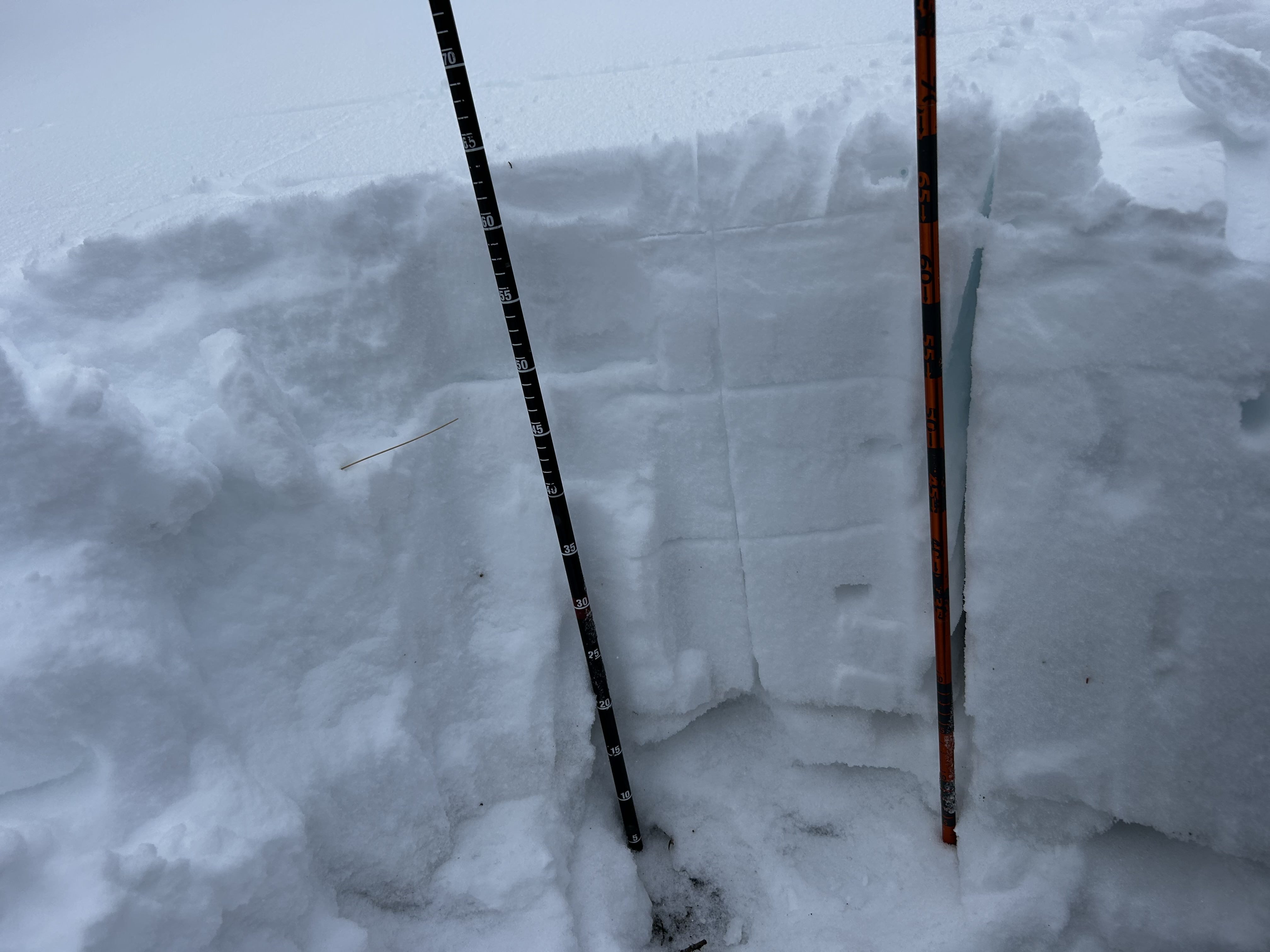
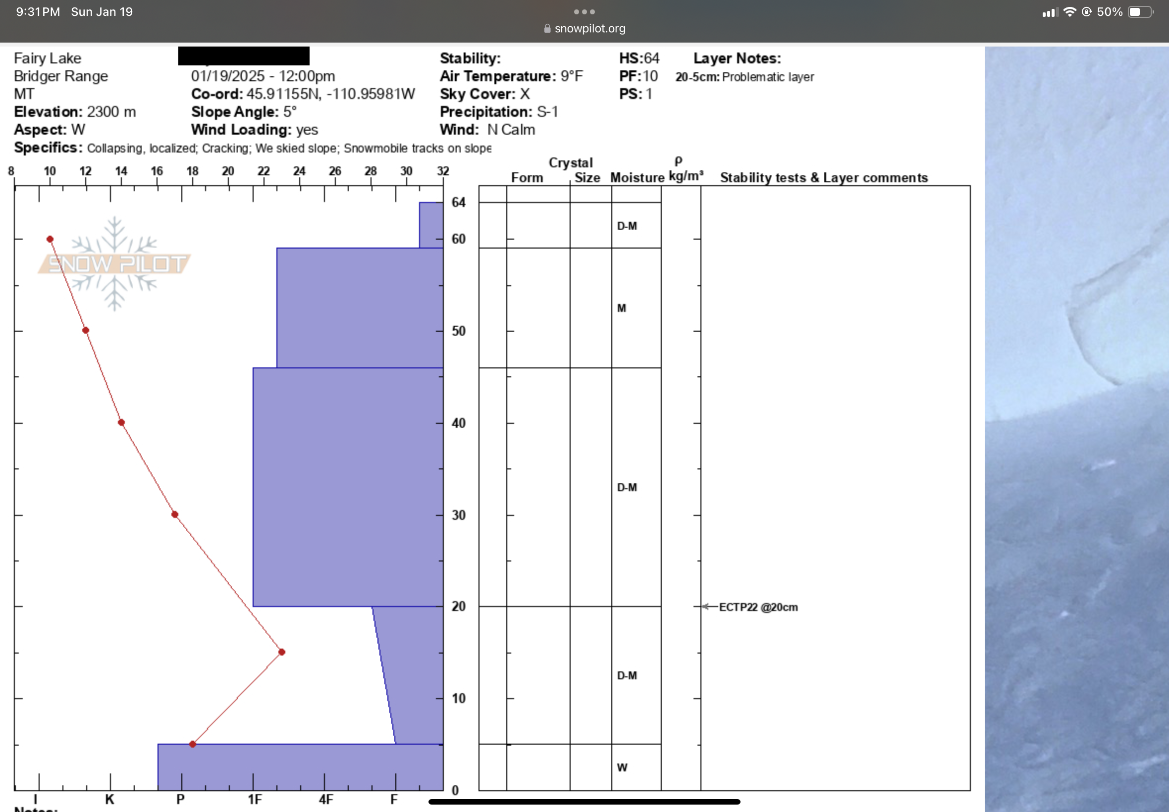
Full Snow Observation ReportECTP22 at 20CM. Bottom layer is a high concern to me. We experienced whumphs the entire walk in from the parking lot and had a pretty sketchy time attempting to ski a glade directly above fairy lake. The refrozen snow above the weak layer also adds some false security at a glance.
Full Snow Observation ReportAspect: East
Elevation: ~9000ft
Snow Depth: 155cm
Pit:
- 155-20cm 1F
- 20-0cm 4F/Fist
- ICT7 (Thin Crust layer at 135cm)
- ECTX
Snow:
- Wind affect up higher. Stayed out of bowl as our chief concern was triggering a wind slab loaded on the crust layer at 135cm. Did have shooting cracks at the top wind affected area. Great snow otherwise!
Full Snow Observation Report
Today, we braved the frigid temperatures and toured out of the Bradley's Meadow gate north of Bridger Bowl. Above Bradley's Meadow, we triggered a small soft slab avalanche on a south facing aspect around 7800'. This avalanche broke in a wind drift, 4" deep in low density new snow, likely on a sun crust or near-surface facets.
We toured up the Ramp and dug a snowpit on north facing aspect at 8200' Here we found a strong, deep snowpack just over 5' deep. Under 4" of new snow, we found a decomposing melt-freeze crust with near-surface facets, and underneath, a mostly right-side-up snowpack structure. The facets near the bottom of the snowpack have gained strength and were hard and rounding. We did not get unstable results in our pit tests here.
Additionally, during steady snowfall from late December through early January, in the Bridger Range and mountains near Bozeman we saw minimal (if any) avalanches break on weak snow near the bottom of the snowpack. This minimal activity combined with what we have been seeing in snowpits indicates deeper avalanches are unlikely.
Cracking within shallow wind slabs was the only sign on instability we saw today. We chose to ski 30-35º terrain, assessing for and steering clear of wind drifted snow as we made our way down.
Light snow fell all day (S1) and winds were calm on the ridge. There was also evidence of the strong winds earlier in the week in the form of large drifts in unusual locations across lower elevations. These drifts are worth being cautious of, though they are now stubborn to unreactive and being disguised by the new snow.
Full Snow Observation ReportDug a pit on divide peak on a southwest facing aspect that was about 210cm deep. ECTX, PSTX on sun crust 15cm down from surface that the new snow had fallen on. Entire snowpack 4F-1F from the thin sun crust to the buried facet layer than began around 165cm deep. Saw evidence of some wind slabs beginning to form near the ridge line. It was cold.
Full Snow Observation ReportSkied a few laps above Deer Creek today, E through SE aspects between 7000' and 8250'
Only about an inch of new snow in past 24 hours
Calm to light winds from E; blowing and drifting snow filling the skin track on isolated, wind-exposed terrain features above 7400'
No recent avalanches, whumphing, or shooting cracks observed
Average ski penetration 15-20 cm above 7000'
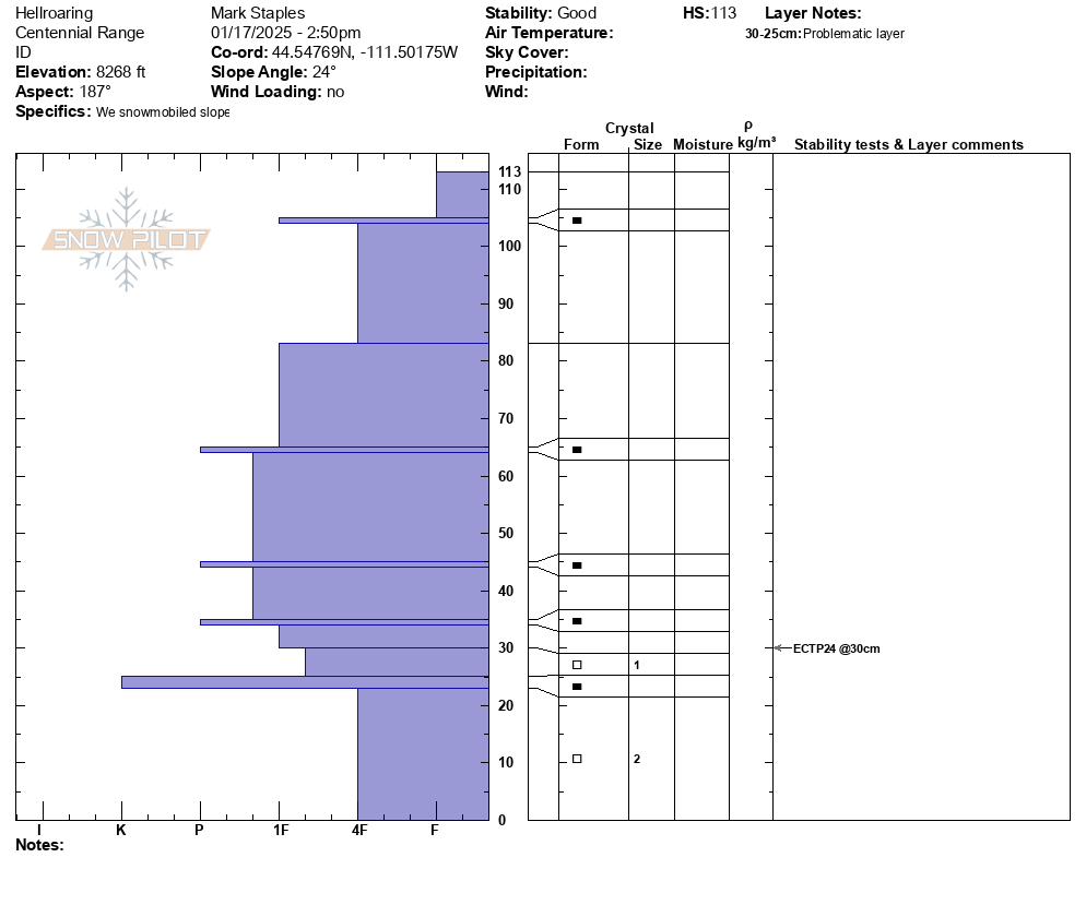
Dug a test pit on an E aspect at 8200'; HS 110 cm
ECTN 28 down 25 cm from top
Pit showed poor snowpack structure (30 cm of F-hard, 2mm facets at base) with 1F-hard slab sitting above. We were unable to affect the facet layer with our ECT and we were too cold to do a PST! A little extra force after the ECT did get a sudden collapse at the ground.
Full Snow Observation Report
Toured up W. Facing terrain on Mt. Nemesis coming out of the hut. Full range of sun crust, rime crust, wind crust, and consolidated powder between SW to NW aspects. Snow structure felt consolidated and stable in most areas but became hollow and slabby in rocky terrain ~8,800’ . We turned back and found a lower angle path down to the skin track.
Full Snow Observation Report
We rode around the north and south sides of Mt Jefferson, and Yale Creek. The danger has definitely dropped and the snowpack has stabilized a lot since I was last here on New Year's Eve when we experienced big thunderous collapses. The peak instability was around the first week of January. We could see evidence of just a few slides from that time. All the snowfall during that time made conditions dangerous then....but stable now. Since Xmas eve, this area has received snow containing 4.5-6.5 inche of water.
Today we didn't see any recent avalanches. We didn't experience any collapsing or cracking. We had stubborn stability tests with columns that took a lot of hard hits to break even where the snowpack was thinner.
I'm not ready to climb up steep chutes on Jefferson, but I'm feeling really comfortable in many other areas - especially places with a 5-6 ft deep snowpack.
Winds were moving a little snow. One wind slab/drift produced a shooting crack but we couldn't get any others to crack.
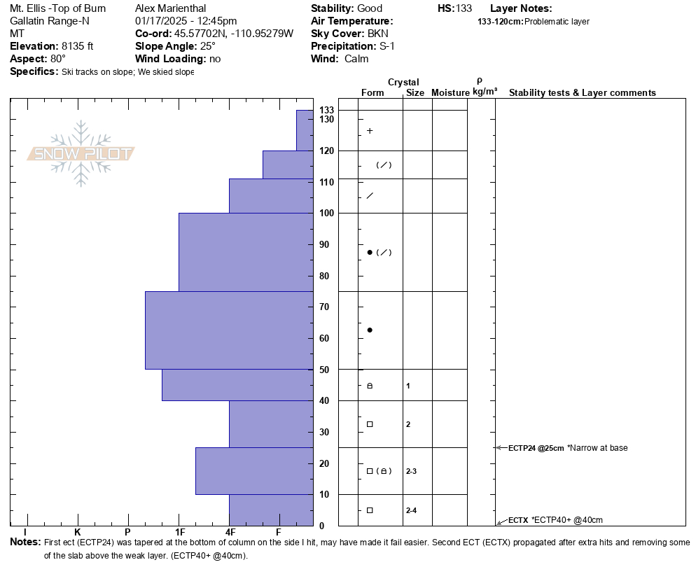
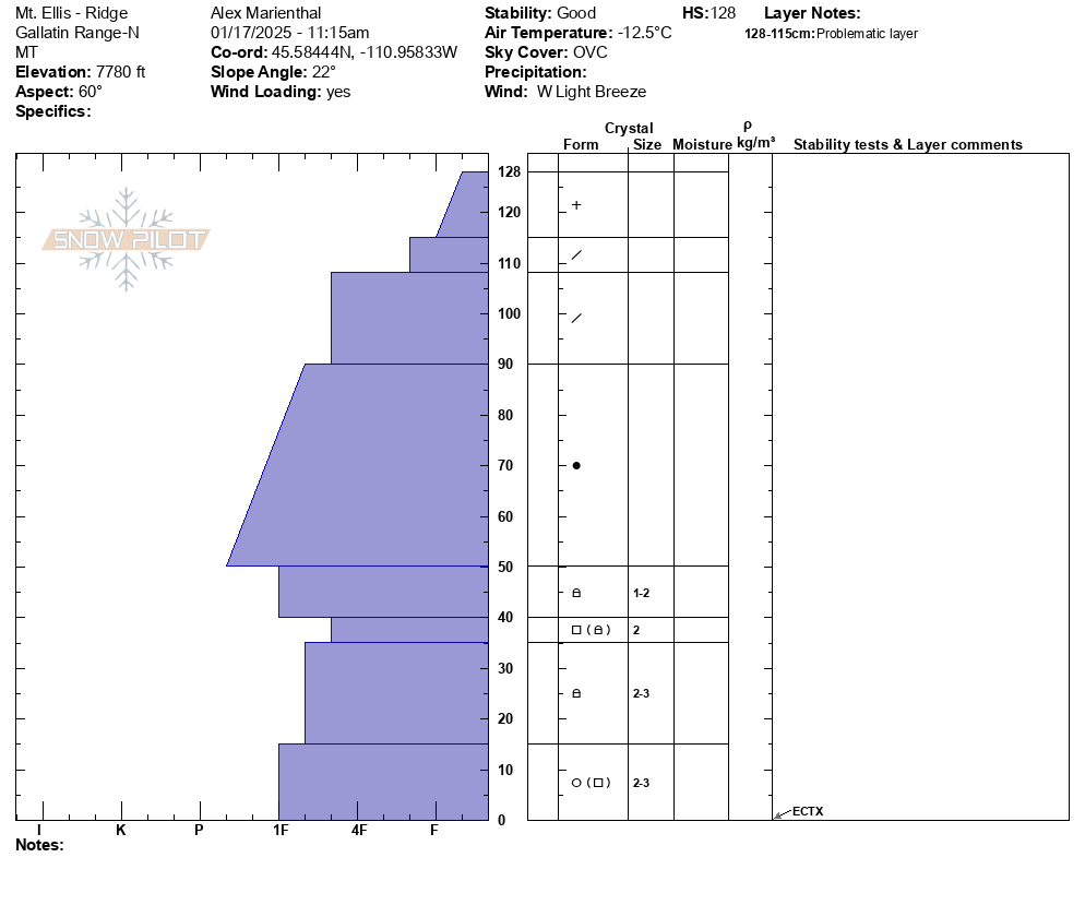
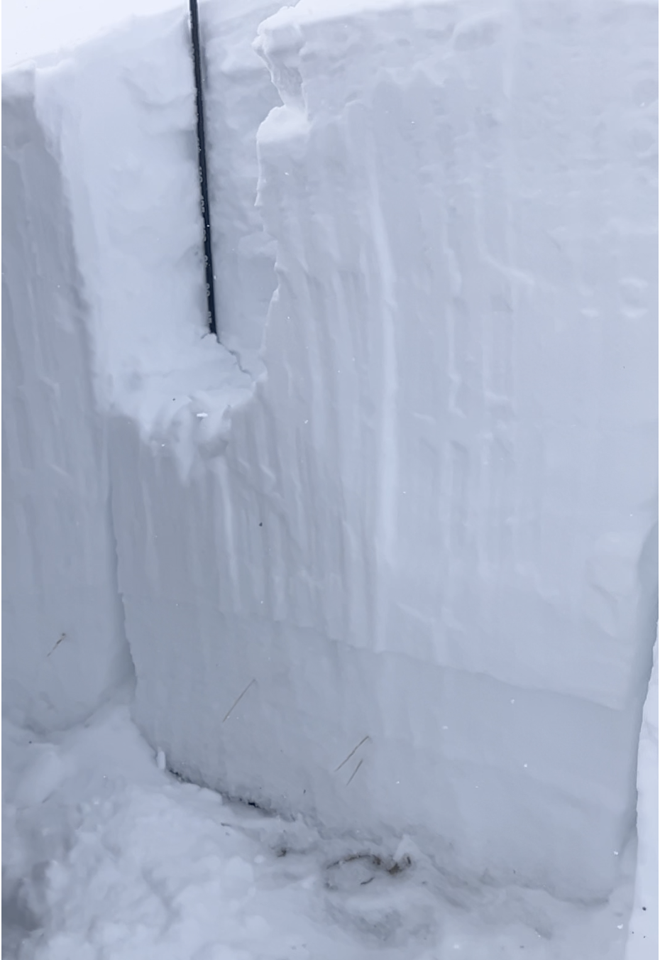
Full Snow Observation ReportWe skied to the top of Mt. Ellis via the ridge from the north. There was light wind on the ridge, otherwise calm. Snowing steadily this morning and tapered off by noon-1pm with skies clearing after noon. There were 2-4" of low density new snow. We dug a pit off the ridgeline on a northeast facing slope at 7,800' and one pit at the top of the burned slope, east facing at 8,100'. Profiles attached.
The first pit had an ECTX and the second had propagation with extra force. There were 2mm facets 30cm off the ground in both pits which were slightly softer in the higher pit. Snow depth was 3-4 feet up high and around 2 feet lower in the thicker trees and along the trails.
Beyond what we saw today, evidence of good stability in the northern Gallatin Range also includes not having heard of any avalanches (or only 1-2 small pockets) breaking on the weak layers near the bottom of the snowpack during the 2-3 weeks of steady snowfall from late Dec to early Jan. The snowpack has had a break from loading for the last few days which has allowed avalanche potential to continue to become less likely.
In general, stability was good and we felt good skiing slopes steeper than 30-35 degrees, while exposing only one person at a time.
Full Snow Observation ReportAnother day of nice skiing on Mt. Ellis. Dug a quick pit to the ground at the top of the burn, east aspect. 100 cm total snow depth, top 20 cms was was light snow with increasing in density with depth. At 20 cms there was a bump in density and no real "crust" layer. We skied some steeper slopes and saw no signs of instability.
...Additonal information for my mt ellis post, 1/17/2025. My description of the pit snow profile left out the bottom 15-20 cms which was the ever present sw montana faceted snow. It did show signs of healing.
Full Snow Observation ReportAdditonal information for my mt ellis post, 1/17/2025. My description of the pit snow profile left out the bottom 15-20 cms which was the ever present sw montana faceted snow. It did show signs of healing.
Full Snow Observation ReportToured up Elephant Mt via the Blackmore approach yesterday.
4 to 6" of light density snow with some deeper, wind loaded areas on the way in.
Very little wind noted throughout the day.
One small point release on Blackmore. Appeared to be new snow, less than 1' in depth, 30 to 40' wide, and running for 200'. No other avalanches noted in the area.
NE side of Elephant Mt had a snow depth of 110cm. 10" of fresh light snow, over a denser 12" layer that was fist hardness.
Zero collapsing throughout the tour. No cracking on any aspect at any elevation.
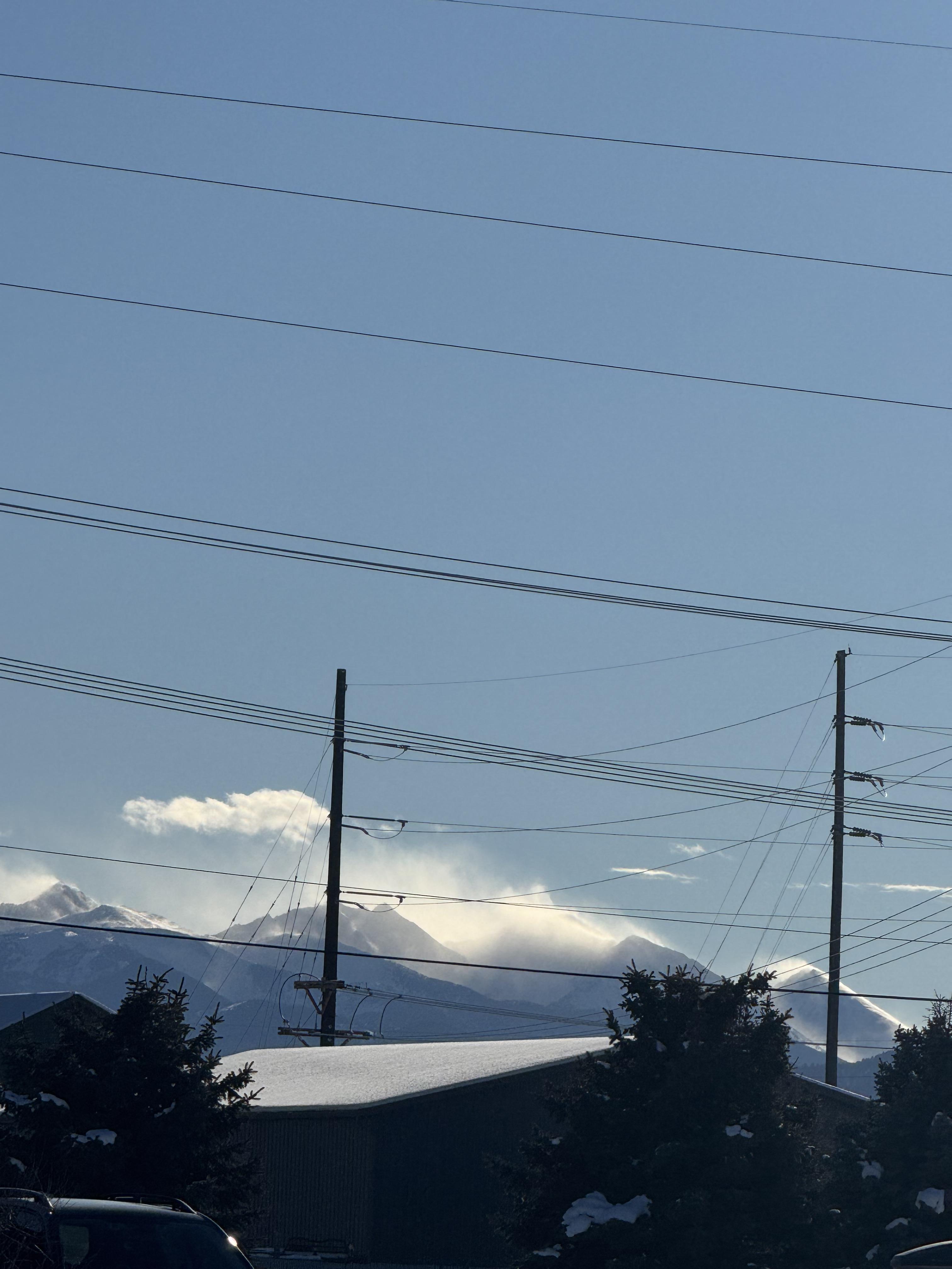
Full Snow Observation ReportBridger Bowl Ski Patrol shared this photo of wind transport on Saddle Peak on 1/16/25.
Full Snow Observation ReportLarge wind transport in Spanish peaks
Full Snow Observation ReportWe rode under the full length of Skyline ridge under all the south facing slide paths.
The only avalanches we spotted were from 1-2 weeks ago. No cracking or collapsing observed.
Snowpack
- Depths ranged from about 1m to 1.5 m. The snow really got shallow as we rode west and down the cabin creek drainage. Above 8800ft and closer to the Teepee/Cabin divide, coverage was great.
- The layer of facets from early December is much weaker where the snow is less than 1 m deep and gaining strength where the snow is around 1.5m deep.
- Conditions didn't seem dangerous. Remotely triggering a slide seems very unlikely. The odds of triggering a slide on those facets seems pretty low but still something that could happen.
- What mainly felt dangerous is letting your guard down. With tracks everywhere, sunshine, great traction, and supportable snow, we felt that it would be easy to be complacent. If an avalanche happened, then we'd be unprepared.
- The odds of triggering a persistent slab avalanche will continue to step down unless there is another loading event (ie - more wind and snow).
Moving foward
- The danger and avalanche conditions will be dependent on weather. A small amount of snow and very cold weather is expected in the next 5 or so days
- Wind could still form more wind slabs
- The inch or two or three of snow that could come Fri/Sat will be subjected to bitter cold weather and could create a new faceted layer...time will tell
- Continue to maintain safe travel practices: exposing only one person at a time to avalanche terrain, having everyone else watch from a safe location, ensuring everyone has rescue gear and knows how to use it.
Overall impression - The snowpack in this area probably isn't as stable or strong as it is in the Northern Madison Range closer to Big Sky. The snowpack is probably stronger and more stable than on Lionhead.
Full Snow Observation ReportThis morning we went touring at Hebgen up to the ridgelines near the northern end of the lake. Winds were calm for the duration of our tour. Snow depths are still pretty shallow relative to much of the advisory area, around 95cm HS on the ridgelines at 9000 feet. We experienced no cracking or collapsing but kept a high degree of suspicion due to the shallow, weak snowpack and stayed off avalanche terrain.
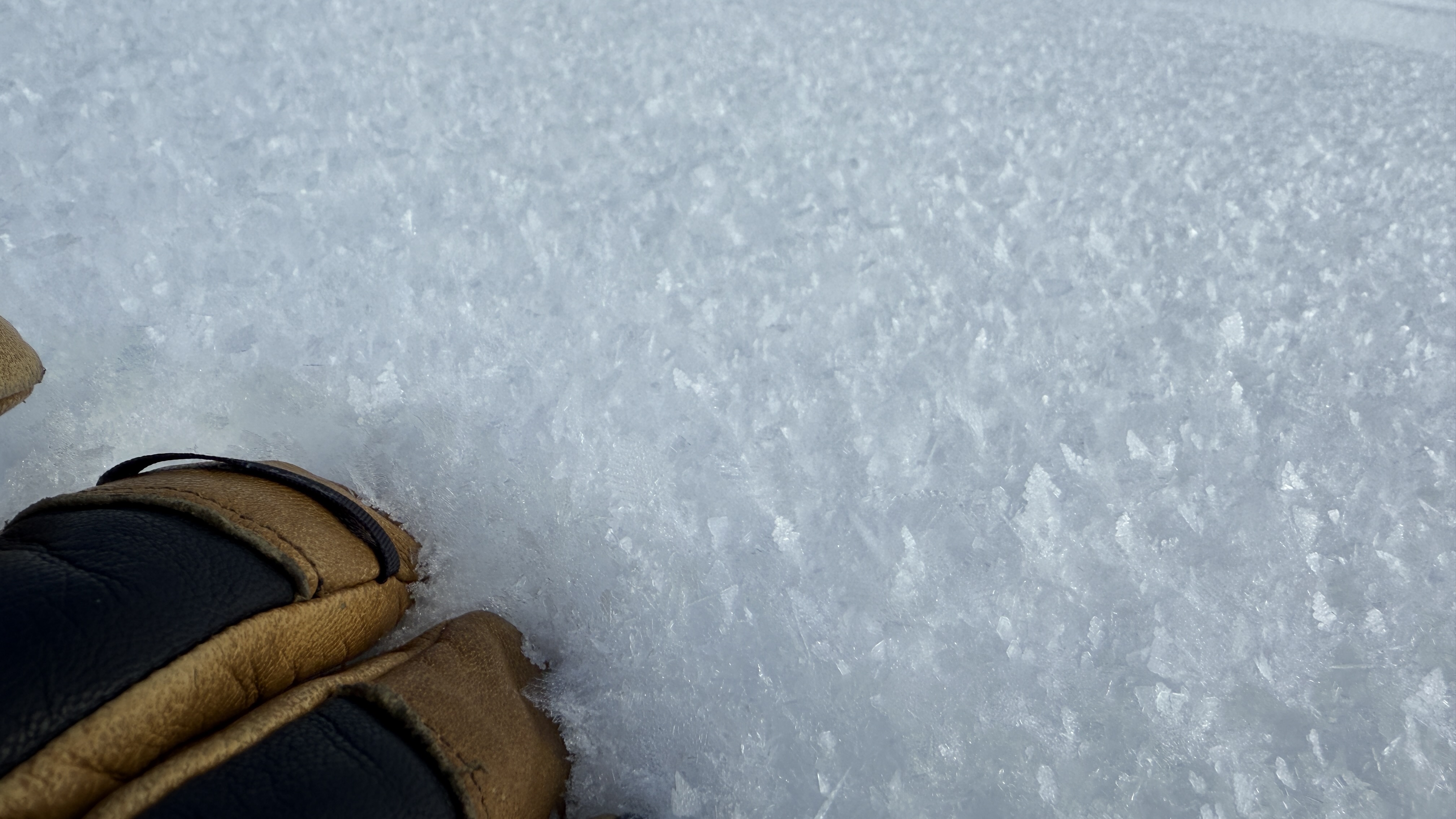
We encountered widespread surface hoar on east aspects above 8000 feet. There were enough intermittent clouds and lack of winds that I suspect it could be buried by the next round of snowfall. Time will tell!
Full Snow Observation ReportLots of snow moving around in Hyalite this morning! Strong winds were moving snow at/above treeline, Lee aspects getting loaded. Observed a fresh slide on the north side of Mt Blackmore, crown was already filling in, but looked to be a foot or two deep in steep rocky terrain to the skiers left of the north couloir. Some big snow bombs coming out of the trees on the trail right onto your head.
Full Snow Observation Report
