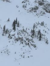
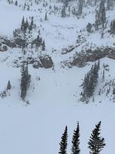
All Avalanche Incidents for Advisory Year 2022-23
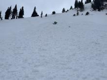
SS-NC-R1-D1-O
Coordinates: 45.4494, -111.0760
Caught: 0 ; Buried: 0
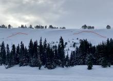
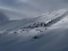
From Obs: "Observed recent small wind slab avalanches under the ridgeline as well as one larger slide that broke on weak snow near the ground, likely caused by cornice fall."
More Avalanche Details
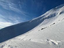
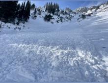
HS-AEc-R4-D3.5-O
Elevation: 9,800
Aspect: SE
Coordinates: 45.2726, -111.4470
Caught: 0 ; Buried: 0
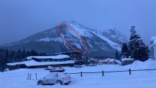
From BSSP: "The avalanche factory that is The Wave did indeed go into production today. A 2lb. shot in skier’s right Castro’s Shoulder initiated an impressive deep slab avalanche that took out Castro’s Shoulder through Wave South above Vuarnet Cliffs. The secondary start zones under these paths- Castro’s Beard (south half) and Mike’s Rodeo- also avalanched away.
The bed surface appears to be the top of the original big storm in October that forms the base of the snowpack on Lone Mountain. There is a melt/freeze crust at the top of that layer, with
small grained (mostly) facets on top of the crust, with the rest of the season’s snowpack sitting on that weak
interface.
This [wide] propagation may be the result of the surface wind slab formed in the past few days finally tying the paths together enough to allow for such propagation.
The numbers are impressive- estimated crown length of 1,100 ft., crown depth of 3-4’, vertical run
of 1000 ft., and linear run of 2000 ft. We classified the slide as HS, AE (2lb.), R4/D3.5, O/G. Unfortunately,
conditions rendered good photos difficult. All the paths that avalanched have been shot repeatedly, almost
daily, all season long...."
More Avalanche Details
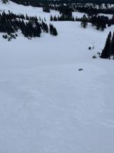
SS-N-R1-D1-O
Elevation: 9,000
Aspect: N
Coordinates: 45.0607, -111.2720
Caught: 0 ; Buried: 0
This natural avalanche looks to have broken about 1 foot deep and stepped down to the ground on the steeps. It likely released during the storm.
More Avalanche Details


HS-N-R2-D2-O
Elevation: 7,500
Aspect: NE
Coordinates: 45.7967, -110.9270
Caught: 0 ; Buried: 0
On 12/28/2022 from the lower south boundary of Bridger Bowl, ski patrol saw an old avalanche crown and debris on steep rolling terrain below the large cliffs on Saddle Peak. Appeared to be 1-2 days old, 2 feet deep and 60 feet wide, N-R2-D2-O
More Avalanche Details
L-N-R2-D2-O
Elevation: 7,500
Aspect: SE
Coordinates: 45.8322, -110.9280
Caught: 0 ; Buried: 0
From BBSP: "North of our boundary a natural avalanche was observed on the south end of the lower Bradley's Meadows ridge. A point release originated in the south facing cliffs. When it hit the steep knob above the gully it pulled the facets off of the rocks and willows, depositing an approx 4ft deep pile of debris. There were old tracks on the slope and no one was caught."
More Avalanche Details
AR
Coordinates: 45.0202, -109.9380
Caught: 0 ; Buried: 0
A rider triggered shooting cracks on a slope northwest of Cooke City.
More Avalanche Details
SS-ASc-R2-D1
Elevation: 8,700
Aspect: SE
Coordinates: 45.0202, -109.9380
Caught: 0 ; Buried: 0
From email: "There was upside-down trail breaking in the lower elevations today, and hazardous conditions around 8700' as the slab got thicker. The cold temps of last week definitely weakened/ faceted the snow in the thinner snowpack areas.
I intentionally triggered some cracking and a D1 soft slab remotely. The slab was about 6"-1.5' deep and about 50' wide. It was a SE aspect around 8700.
Above 9k', the snow structure was looking better, and I was getting ECTNs (snowpit attached), and no more collapsing nor cracking."
More Avalanche Details

Aspect: SE
Caught: 0 ; Buried: 0
location:
Northern Madison Range
9,400 ft (below ridge top leeward and trees)
130° SE aspect
110cm Depth of Snow
24° slope
CT 12
ECTN 11 @ 20cm down
Widespread collapsing.
Terrain choices: very simple
More Avalanche Details
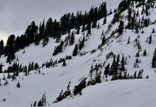
HS-N-R3-D2-O
Elevation: 9,400
Aspect: N
Coordinates: 45.1719, -111.3800
Caught: 0 ; Buried: 0
We saw two large avalanches in the 2nd Yellow Mule that were probably 2-3 days old, and likely broke on the weak layer near the bottom of the snowpack. Hard slabs on heavily wind-loaded slopes.
More Avalanche Details


SS-N-R2-D2-I
Elevation: 9,500
Aspect: NE
Coordinates: 45.0202, -109.9380
Caught: 0 ; Buried: 0
photos attached of some recent natural avalanches observed north of Cooke City today.
They all appear to be on N through E aspects, and primarily NE.
Elevations between 9,000'- 10,000'.
More Avalanche Details


HS-N-R2-D1.5-S
Elevation: 7,500
Aspect: E
Coordinates: 45.0034, -110.0430
Caught: 0 ; Buried: 0
While driving from Cooke through Yellowstone saw a couple recent natural slab avalanches. One on Amphitheater peak appeared to involve recent storm snow. And there were many relatively large wind slabs in Yellowstone (4-5 that I saw).
More Avalanche Details


SS-N-R2-D2
Elevation: 9,000
Aspect: N
Coordinates: 45.0003, -109.9540
Caught: 0 ; Buried: 0
GNFAC forecasters watched a natural avalanche come down from Republic Mountain from the motel door in Cooke City at 8 am on 12/21/22. Couldn't see details of the slide other than the debris running over the cliffs and powder cloud in the trees below. Likely involved new and windlbown snow, but that is pure speculation.
A local guide reported watching several other natural avalanches running off Republic Mountain as he drove into Cooke City around 7:30 am.
More Avalanche Details

SS-N-R1-D2
Coordinates: 45.0733, -109.9480
Caught: 0 ; Buried: 0
On 12/21 we observed the remnants of a small natural avalanche (probably failed last night) on Scotch Bonnet immediately to the north of the Rasta Chutes. Approx 100 ft wide and ran 200 vertical ft.
More Avalanche Details
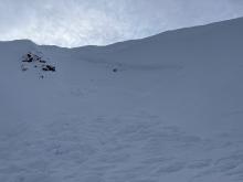
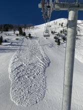
SS-NC-R0-D1-O
Elevation: 9,000
Aspect: E
Coordinates: 45.3257, -111.3800
Caught: 0 ; Buried: 0
Today we toured up Beehive Basin to Prayer Flags and down into Bear Basin. We found moderate winds transporting snow at Prayer Flags. We also observed a recent small natural avalanche that broke just below the cornice at prayer flags (9200'). It was unclear if a cornice collapse triggered the avalanche. We did not go to the crown, but estimated it to be about 20-30 feet wide, 6-8 inches deep, and running less than 100 feet (Photo attached).
During our tour we saw lots of pillows of wind drifted snow and locations where slabs of wind drifted snow collapsed and cracked under our skis.
In Bear Basin we dug a pit and found weak faceted snow on the ground. We did not have any significant test results, but the structure along with the wind and recent avalanche activity was enough to keep us off steep slopes for the day.
The snow surface was powder in protected places, breakable wind crust in others, and either scoured or wind board at ridge lines.The skiing was best on low angle slopes protected from the wind.
More Avalanche Details


Elevation: 7,700
Coordinates: 45.8512, -110.9480
Caught: 0 ; Buried: 0
From obs "I skied on the east side of the Bridgers south of the ski area today. We dug a pit on an east aspect around 7300' and found 80 cm of snow with a similar structure to the more southerly parts of the advisory area. Well developed 2mm FC with a few DH cups sprinkled in made up the lower 40 cm or so of the snowpack (ECTP 21 on this layer) with the remainder consisting of 4F to F+ DFs. There was a razor thin "wind skin" I felt while skiing in more open areas below treeline but no major wind loading was present until at or near the ridgeline (pretty robust cornice development already for this time of year though). On our way back up just below the ridge around 7700' I felt a very large collapse that radiated out from my skis and shook some snow off of nearby branches."
More Avalanche Details
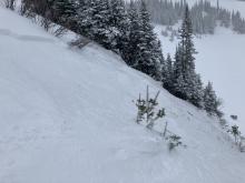
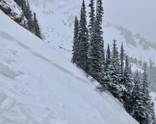
SS-NC-R1-D1-O
Aspect: SE
Coordinates: 45.0709, -109.9580
Caught: 0 ; Buried: 0
We skied on the knob Saturday and Sunday. Dug a pit on the east facing slope just above the steeper roll over. ECTX. No result. Minimal wind loading next to the tree bands. We skied the slope 20+ times (between 4 skiers).
We took the sled up track around the north side of the knob and below the avy debris from the slide triggered a last week. Only sign of avalanche activity (other then the obvious one) was a small wind slab release on a south facing slope near the top of the pass. Marked on the map below. Photo attached is of the previous slide but the wind slab release would be where the red X is if the photo continued. Looked to be 30ft across, ran for 15-20ft and about 6inches deep.
More Avalanche Details
SS-N-R2-D2
Coordinates: 45.9837, -111.0240
Caught: 0 ; Buried: 0
From obs: "Natural wind slab, likely triggered by cornice fall in the last day or two, on a NE aspect at 8500’. Propagated ~150’ wide and ran probably 300’. Slab thickness seemed to be 18-24” at the thickest. No sign of stepping down deeper into facets in the snowpack, although adjacent to this slide there was evidence of an older slide (previous to recent storm cycle) that failed deeper in the snowpack."
More Avalanche Details


SS-N-R1-D1.5-I
Elevation: 9,600
Aspect: NE
Coordinates: 45.4164, -110.9700
Caught: 0 ; Buried: 0
Went on a tour today with a buddy and traveled through twin falls basin as well as the maid. We skied a NW slope off of Palace Butte and found touchy conditions below the ridge line, but great skiing in the trees. We also skied the bowl of Arden peak. We observed numerous recent wind slabs that released naturally in the past 24 hours on NE and E aspects with some crowns starting to get covered up throughout the day. Judging from afar, I would estimate these crowns to be 6 inches to 1.5 feet deep.
More Avalanche Details

Coordinates: 45.0265, -111.0480
Caught: 0 ; Buried: 0
From obs: "Thin and variable snowpack in the Specimen Creek drainage. The Max depth was less than 100cm, and the minimum was the depth bare ground. Active wind loading on exposed ridges, multiple whumphs when skinning over wind loaded, low angle slopes. Decent skiing, albeit thin, on low angle W aspects from 8200’ down."
More Avalanche Details
SS-ASu-R2-D2.5-I
Elevation: 9,000
Aspect: SE
Coordinates: 45.7943, -110.9360
Caught: 1 ; Buried: 0
Skier triggered avalanche on Saddle Peak. 12/16/22.
From obs: "I got to the top of the south summit around 11am with lots of active wind loading. I traversed the ridge line for a couple hundred feet, kicking away at small cornices to see if I could trigger anything. Got two small 6-8” deep soft slabs to propagate 10’ wide and a couple hundred vertical but nothing major. The ridge line is too rocky to traverse right now so I dropped onto the face, still staying near the ridge line. A hundred feet or so further across my traverse, it got deep. Cross loading from the north grew a drift that was thigh deep at least. Very cautiously I tried to regain some elevation to get above anything that might pop off. A few steps up the drift, I heard a whumph and it started to slide. I would estimate 2-4’ deep, 150’ wide. It immediately caught my skis and started taking me down. I pointed them down hill and started to pick up speed hoping I could cut out of it. It started getting very deep and turbulent so after 200-300’ I pulled my airbag, while still trying to stay on my feet. Thankfully, I was able to stay up and cut out of the slide roughly 500’ below the summit. It ran full length into the bottom of Argentina bowl and south gut with a massive powder cloud. Way too close of a call. I skied down the avalanche path then back to the resort with my airbag deployed in case of any other slides coming down. Made it back to the resort touched base with ski patrol to alert them of the slide, give them information on my condition and the possibility of other skiers out there (no possibility, I was first person up and didn’t see anyone ascending from the gate when I crossed to south summit) and headed home."
More Avalanche Details

SS-N-R1-D1
Aspect: NE
Coordinates: 45.1719, -111.3800
Caught: 0 ; Buried: 0
Small natural avalanche along the 2nd Yellowmule ridgeline. Observed 12/15. Looks like it likely broke during the snowfall 12/14. ~20 ft wide and ran ~50 vertical feet. Less than a foot deep. Wind drifted snow.
More Avalanche Details
SS-N-R2-D2
Coordinates: 45.0497, -109.9640
Caught: 0 ; Buried: 0
From facebook on 12/15: "Saw a recent avalanche on a S/SW slope near Daisy pass. 2-3' crown and the avalanche arrested on the summer road. D2 in size. Also saw a large debris pile as you enter sheep creek on S/SW slope off of Miller ridge. Could not see crown, but debris was D2.5 in size."
More Avalanche Details
SS-ASu-R2-D1-O
Elevation: 9,000
Aspect: N
Coordinates: 45.9043, -110.9580
Caught: 0 ; Buried: 0
Went on a tour today with some buddies with hopes of skiing the great one. Once up in the sac bowl, we opted to back away given the wind was howling. We skied the white worm, and saw numerous cracks shooting across the slope. I opted to ski a short and sweet N facing couloir which started out pretty firm into avalanche bowl. About halfway down, I had a wind slab release after one soft turn with the deepest portion of the slide being one foot. I was not carried as I immediately cut out of the fall line, the slide rolled for about 200 vert. My friends opted to ski the direct headwall exit and had numerous small wind slabs pull out. Some areas were stripped to rock of snow.
More Avalanche Details


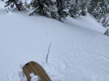
SS-NC-R1-D1-O
Elevation: 8,500
Aspect: N
Coordinates: 45.1719, -111.3800
Caught: 0 ; Buried: 0
Cornice dropped in Slats and propagated slab at a weak layer of facets around 70cm height from ground. Dug a snow pit of 140cm and got etc results on the same layer ECTP26 stubborn but holds a large consequence.
More Avalanche Details


SS-N-R1-D1-S
Elevation: 9,500
Aspect: NE
Coordinates: 45.4444, -111.0040
Caught: 0 ; Buried: 0
Small slide from the cliff bands at about 9500’, on a NE facing slope on Blackmore - looked like it broke pretty shallow sometime after the snow yesterday.
More Avalanche Details

HS-AMr-R3-D2.5-O
Elevation: 10,000
Aspect: NE
Coordinates: 45.0661, -109.9590
Caught: 1 ; Buried: 0
On Dec 9, 2022 around 1:30pm we triggered a large, deep slab avalanche while riding across a lower angle slope below. This occurred on Fisher Mtn. near Cooke City on an east-northeast aspect at 10,000'. It broke 3-6+' deep and 300' wide. One rider was caught and carried, not buried, and luckily nobody was injured.
More Avalanche Details


SS-N-R1-D1
Coordinates: 44.9731, -111.3100
Caught: 0 ; Buried: 0
We saw an R1-D1 across the bowl of Sunlight Basin that looked recent after digging a pit near the weather station. While sledding around the area, we noticed faceting snow at the bottom of the snowpack in multiple locations.
More Avalanche Details

SS-N-R1-D1
Elevation: 8,000
Aspect: E
Coordinates: 45.2268, -111.5120
Caught: 0 ; Buried: 0
Two small natural avalanches observed on likely wind loaded easterly aspects on slopes around Cedar Mountain at roughly 8,000’.
More Avalanche Details


HS-AMu-R2-D2-O
Elevation: 9,800
Aspect: NW
Coordinates: 45.0524, -109.9450
Caught: 0 ; Buried: 0
There was a human-triggered avalanche near Chimney Rock on Henderson Mountain. The avalanche failed on weak snow near the ground. We believe a snowmobiler triggered the slope.
From GNFAC visit to crown 12/8: "We rode to Daisy Pass to look at the avalanche that was triggered by a snowmobiler two days ago (12/6/22). It was on the slope east of the pass that people often climb up and out, steeper than the normal route out. It broke 2-3 feet deep and 250-300’ wide, R2-D2. At the crown it broke on a weak layer about 100cm above the ground, but it broke closer to the ground in many places lower on the slope where the snowpack was shallower and weaker. I would guess one of those areas is where it was triggered from."
More Avalanche Details


NC-R2-D2-O
Elevation: 10,000
Aspect: NE
Coordinates: 45.0558, -109.9470
Caught: 0 ; Buried: 0
From IG: “Avalanche spotted on Henderson bench today, appears to be cornice triggered yesterday or the day before. 2-5 feet deep, 600’ wide, ran 800 vertical.”
More Avalanche Details

SS-ASc-R1-D1-I
Elevation: 8,000
Aspect: E
Coordinates: 45.8156, -110.9230
Caught: 0 ; Buried: 0
Cut a wind slab from the top of the John at 2:30 in the afternoon.
3-6” crown. 50-75’ wide. Ran down to the low grade below
More Avalanche Details
SS-ASc-R1-D1-O
Elevation: 9,000
Aspect: E
Coordinates: 45.5243, -110.9560
Caught: 0 ; Buried: 0
Observed active windloading on the eastern side of Lick Creek today.
12-18 inch slab broke easily when ski cut and a small but very reactive cornice was rapidly building.
More Avalanche Details
SS-ASu-R2-D1.5
Elevation: 8,500
Aspect: SE
Coordinates: 45.8586, -110.9560
Caught: 2 ; Buried: 2
Two skiers triggered an avalanche while ascending the Banana Couloir on Ross Peak on the morning of 12/5/22. The skiers were approximately 150 ft from the top of the couloir. The avalanche broke 20 ft above the upper skier. The slide broke in wind drifted snow 6 inches deep and approximately 30 ft wide, across most of the couloir. The lower skier was waiting in a "safe spot on the side" but was also caught by the slide. The slide ran ~600 vertical feet, pulling out a deeper pocket of snow (1.5-2 ft deep) midway down the path. Both skiers were fully submerged as they were carried, but ended up partially buried near the toe of the debris. One skier had snow packed into his mouth and underneath his eyelids. They returned to the trailhead under their own power.
More Avalanche Details

HS-AM-R4-D2
Elevation: 9,500
Aspect: SE
Coordinates: 45.0437, -109.9180
Caught: 0 ; Buried: 0
Small avalanche below Henderson Bench. SE aspect. Likley Snowmobile-trigger did not confirm. 70-90’wide, 1-3’ crown, ran 40’
More Avalanche Details


AS
Elevation: 8,900
Aspect: SW
Coordinates: 44.9855, -109.9410
Caught: 0 ; Buried: 0
We dug a pit on a W/WNW slope at around 9100 ft in the republic creek drainage. CT 18 and ECTN34 (ECTX then we hit it extra hard 4 more times) on the weak layer about 70 cm down. But overall snowpack was upright and it seemed to be settling down more than we thought. But then as we approached the ridge we triggered 5 separate large collapses ("Whumphs"), all on WSW/SW slopes (between 8700 and 9200 ft). Pole probes revealed a light crust about 12 inches down.
More Avalanche Details
AS
Elevation: 9,500
Aspect: SE
Coordinates: 45.0202, -109.9380
Caught: 0 ; Buried: 0
Obs 12/3/22:
"Large collapses on primarily solar aspects (S/SE, ~9,500’)."
"Lots of whumphing but not much (if any) cracking...:"
More Avalanche Details
AS
Elevation: 9,300
Aspect: E
Coordinates: 44.9453, -111.1350
Caught: 0 ; Buried: 0
"We toured to Ernie Miller today and saw a natural avalanche on a NE slope around 9600 ft. We heard and felt multiple collapses on our way in. We dug a pit on an east facing slope around 9300 ft where we found 105 cm of snow. We got a ECTN 2 result, failing on an interface about 15cm from the surface and ECTP5 failing 40 cm from the surface."
"Toured up to Bacon Rind today and skied meadows off of the ridge. Noted many collapses and whumpfs in the snowpack as we ascended east aspects to the ridge."
More Avalanche Details
HS-N-R3-D2.5-O
Elevation: 9,500
Aspect: NE
Coordinates: 44.7145, -111.3180
Caught: 0 ; Buried: 0
From IG 12/3: It was natural. Happened last night or this morning. It hadn't slid when we left yesterday. We were first tracks in today, and there were no tracks above or below this slide. Crown at the peak was around 6'. Average 2-3' crown. 10' debris piles at least.
More Avalanche Details


N-R2-D2
Elevation: 8,500
Aspect: N
Coordinates: 45.0003, -109.9540
Caught: 0 ; Buried: 0
Leaving Cooke on 12/3 we saw eight natural avalanches that likely broke on 12/2. Estimate more than 50% of slopes facing north, 8,000-9,000' had crowns 2-4' deep. The largest on Old Man Ray's below republic was R3-D2.5, 500' wide, 1,000' vertical (separately recorded). There were a couple, possibly larger, on Thunderer in the park, but low light made them difficult to confirm.
More Avalanche Details


HS-N-R3-D2.5-O
Elevation: 8,600
Aspect: N
Coordinates: 45.0003, -109.9540
Caught: 0 ; Buried: 0
Leaving Cooke on 12/3 we saw many natural avalanches that likely broke on 12/2. Estimate more than 50% of slopes facing north, 8,000-9,000' had crowns 2-4' deep. The largest on Old Man Ray's below republic was R3-D2.5, 400+' wide, 1,000' vertical. There were a couple, possibly larger, on Thunderer in the park, but low light made them difficult to confirm.
More Avalanche Details


HS-N-R3-D3-O
Elevation: 11,000
Aspect: SE
Coordinates: 45.1212, -109.9300
Caught: 0 ; Buried: 0
From IG 12/3: Confirming more of what you saw, lots of large natural avalanches up high. Most notable was this massive slide on fox, looks to have broke 2-6’ deep and over 1000’ wide. Couldn’t quite see the toe from our tour but it looked to have run over 1000’ vertical. Never have seen one so large on Fox…
More Avalanche Details

N-R3-D2.5
Elevation: 10,400
Aspect: E
Coordinates: 45.0722, -109.9280
Caught: 0 ; Buried: 0
More Avalanche Details
SS-N-R2-D2-O
Elevation: 9,600
Coordinates: 44.9575, -111.0970
Caught: 0 ; Buried: 0
Toured up to Bacon Rind today and skied meadows off of the ridge. Noted many collapses and whumpfs in the snowpack as we ascended east aspects to the ridge. Looking toward Ernie Miller ridge, we noted an old crown in the main bowl just below the summit. It was on an E-NE aspect, 200 or more feet wide and looked to be filled in with new snow but was still visible. Looking east from the top of the ridge, we noted another crown on a west aspect that looked to be about 100' wide and deep.
More Avalanche Details


SS-ASc-R1-D1
Coordinates: 45.4444, -111.0040
Caught: 0 ; Buried: 0
From obs on Mt Blackmore 12/2: " we were able to easily trigger shallow, short running windslabs by knocking down small cornices."
More Avalanche Details
SS-R2-D2
Coordinates: 44.7145, -111.3180
Caught: 0 ; Buried: 0
A number of large avalanches observed along Lionhead Ridge on 12/2.
More Avalanche Details


N-R2-D2-O
Elevation: 10,000
Coordinates: 45.0202, -109.9380
Caught: 0 ; Buried: 0
Near Cooke City (12/2/22) we rode to the cabins at Lulu Pass, then to Round Lake, then to Daisy Pass. Visibility was 50/50, so we didn't see all terrain clearly. We saw multiple large natural avalanches that broke last night or early this morning.
The largest were 3 on Scotch Bonnet (R2-D2, south-souwest aspect at 10,000'), 1 on Henderson in the big east facing slide path (R1-D2. east aspect 10,000'). These appeared to be 3-4 feet deep, and we suspect broke on a layer of weak snow that formed last week and is now buried 2-3 feet deep, and deeper on high wind-loaded slopes.
(We also saw 4-5 smaller wind slabs (R1-D1).)
More Avalanche Details


SS-ASc-R1-D1-O
Elevation: 8,700
Aspect: E
Coordinates: 45.4444, -111.0040
Caught: 0 ; Buried: 0
Toured up to the NE shoulder on Mt. Blackmore yesterday. Winds were strong and variable, but mostly gusting from the S-SW. A lot of snow was moving around, skin tracks were filled in very quickly, and you could actively see small cornices starting to build on the lee side of the ridge.
On the descent, I intentionally triggered a small wind pocket in one of the chutes in the cliffs near the trail at 8700 ft. I included a video. It was D1 and about 5 inches deep at the crown. I think just a good reminder that even in the trees, the tops of those chutes get wind loaded and can definitely slide.
More Avalanche Details


AE-O
Aspect: N
Coordinates: 45.2760, -111.4360
Caught: 0 ; Buried: 0
From BSSP Observations: "A wind slab triggered near the top of Cold Springs ran down and triggered a persistent slab around constriction level (see pics). This deeper failure occurred about 20cm off the ground at the Oct/Nov interface in a snowpack that was only about 1m deep."
More Avalanche Details
HS-ASc-R2-D1.5-I
Elevation: 7,800
Aspect: NE
Coordinates: 45.8170, -110.9250
Caught: 0 ; Buried: 0
Skier triggered wind slab avalanche around 2pm, along the edge of north Bowl and Bronco near "The John". Crown 6-10" deep and 30 feet wide, hard slab of recent drifted snow. HS-ASc-D1.5. Strong wind blowing steady from the south-southwest and transporting snow, filling in tracks rapidly.
Immediately after this slide, I saw what I assume was skier triggered, slide of similar size a little further down the bowl with crown drifting in. Beacon check of debris produced no signal, barely deep enough to bury someone.
More Avalanche Details
HS-ASu-R2-D1.5-I
Elevation: 7,800
Aspect: NE
Coordinates: 45.8264, -110.9290
Caught: 1 ; Buried: 0
From obs: "Triggered a small(d1r1?) wind slab off the bridger chair in bounds at bridger. Little skiers right of bumble chute on the roll over skiers left of bronco. NE face. Rollover around 35 degrees mellowing throughout the run. The face had tracks from earlier today before i triggered the slide. I was able to self arrest and stop myself before being carried. The crown was around 20-25 ft wide and the slide ran roughly 100ft downhill before stopping. Both myself and my partner skied away unharmed."
More Avalanche Details

SS-AS-R1-D1-O
Elevation: 8,300
Aspect: E
Coordinates: 45.4472, -110.9620
Caught: 0 ; Buried: 0
Saw a group of skiers trigger a small wind slab avalanche on an eastern aspect at around 8,300' in the main fork of Hyalite in "Candy Land" just south of the climb Big League Chew at 2:00pm on Saturday (11/26). Crown looked to be around 2" to 1' and 90' wide. The slide ran maybe 100'. No skiers were caught. It was triggered as the first skier traversed out onto the intended ski line from the trees which they skinned up. The fracture extended from the tips of the first skiers skis and ran across the slope and underneath a small cliff band. The group skied out on a slightly lower angle slope adjacent to the slide. My group watched from below an adjacent ski run approximately 300 yards away as the slide happened. We had dug a pit on a similar aspect in the area approximately 30 minutes before the slide and found 85cm of snow with a weak layer at 42-45cm which failed CTs but we couldn't get propagation. (CT22, ECTN21). It looked like this was probably the layer that failed in this slide.
More Avalanche Details


L-N-R1-D1
Elevation: 9,700
Aspect: S
Coordinates: 45.3508, -111.4000
Caught: 0 ; Buried: 0
Obs from Beehive 11/25: "Lots of moving snow on south facing aspects. most of the chutes to the [lookers] right of the (4th of July couloir) had slid, it looked like it was mostly limited releases from sun warmed rocks."
GNFAC Forecaster at Bridger on 11/25 saw natural rollerballs and pinwheels on steep, rocky south facing terrain. (photo).
More Avalanche Details

HS-N-R3-D3.5-O
Elevation: 10,000
Aspect: N
Coordinates: 45.2760, -111.4360
Caught: 0 ; Buried: 0
From BSSP (11/24): "The Whale on the NSS slid naturally at some point in the past 24 hours,
likely broke into deeper layers, and ran well past the Meeting Trees- estimated D3 slide. There is
weakness in the alpine snowpack on some northerly aspects in the alpine..."
From BSSP (12/4): "[A] team got a better look at the natural avalanche that occurred out there around
Thanksgiving. It was a solid D3.5 and ran full track from the level of the Little Couloir down to the
mature tree line."
More Avalanche Details
SS-ASu-R2-D1.5-I
Elevation: 7,650
Aspect: E
Coordinates: 45.8156, -110.9230
Caught: 1 ; Buried: 0; Killed: 0
From IG Message: "I read the avalanche report this morning and felt comfortable skiing. we made a plan to ski Bradley’s Meadows but ended up skiing Bridger Gully to the 3 Bears after discussion and feeling comfortable and confident in the snowpack. we did not experience any whoompfing or have any other concerns on the approach.
The bottom of Bridger Gully to 3 Bears is where I triggered the avalanche. My partner dropped in first and skied safely out of the potential slide area. I followed up and on my first turn, triggered the slide. To me it looked like it was around 8” deep and was around 15’ wide at the crown.
My partner had eyes on me the entire time as the slide carried me about 40-45 yards. I was on top the entire time and was able to ski out at the end. I suffered no injuries.
We skied out and talked to other skiers about our experience."
More Avalanche Details
WL-ASc-R2-D2-I
Elevation: 10,300
Aspect: S
Coordinates: 45.3539, -111.4050
Caught: 0 ; Buried: 0
From Obs: "I wanted to share about a small avalanche I set off today. Snow was getting warm on my way up 4th of July couloir (pinwheels coming off lookers right wall started around 11:30) top half took a long time due to deep snow so I was suspicious of the pinch. Ski cut it during the descent (12:30p) and set off a wet slide (point release) that picked up quite a bit of steam as it came out the bottom. Big enough to injure/bury a skier."
More Avalanche Details

SS-R1-D1-I
Elevation: 7,500
Aspect: E
Coordinates: 45.8156, -110.9230
Caught: 0 ; Buried: 0
Skiers at Bridger Bowl observed a small avalanche that was likely human-triggered on the Lower Nose. New snow and wind combined to created instabilities on slopes. The ski area is closed and represents a backcountry snowpack until the ski patrol begins avalanche mitigation in preparation for the opening.
More Avalanche Details
SS-ASc-R2-D1.5-I
Elevation: 7,600
Aspect: NE
Coordinates: 45.8168, -110.9240
Caught: 0 ; Buried: 0
At 1:30pm on 11/23 I intentionally triggered a fresh drift of snow in a narrow avalanche path along the edge of the north bowl at Bridger. Northeast aspect at 7,600’ elevation. The crown was 6-8” deep consisting of snow that fell today, 20’ wide and ran 250’ vertical. SS-ASc-R2-D1.5-I.
Wind was moderate, gusting strong out of the north and west and transporting snow. There were 3-4” on lower mountain and 7-8” new up high. Snowpack is 1-2’ deep. Prior to this storm, snow close to the surface had turned to small (1-1.5mm) facets during previous cold weather, capped by a thin crust (wind or sun) on many slopes.
More Avalanche Details
L-N-R1-D1
Elevation: 9,500
Aspect: SW
Coordinates: 45.3407, -111.3910
Caught: 0 ; Buried: 0
From IG message: "We saw a few decent sized point releases in the same zone on Sunday, 11/20, the day after the wind slab. All occurred on SW aspect within approx 15 min at 2:30. The air temp rose noteably shortly before and the sun was baking the SW aspect."
More Avalanche Details
HS-AEc-R2-D2-O
Elevation: 9,000
Aspect: E
Coordinates: 45.2862, -111.4300
Caught: 0 ; Buried: 0
Triggered with 4lbs, after they were not affected by 2lbs shots yesterday. The crowns were in the 12” range and hard slabs. The weak layer is subtle-trapped lower density (but still 4F) above the crust, with tiny facets mixed with rounds. The slides were not running directly on the crust, but just above, leaving 2-3 cm’s behind on top of the crust.
More Avalanche Details
SS-ASu-R1-D1.5-G
Elevation: 9,000
Coordinates: 45.3407, -111.3910
Caught: 0 ; Buried: 0
My partner and I were skinning up a west-facing slope in Beehive Basin when we stopped out of the wind at a large rock outcrop.
Shortly after stopping to re-assess, a small, wind-deposited, pocket of snow popped off the rock face above us triggering a soft-slab slide which gained momentum and stepped down through a rocky choke, fanning out in the open face below the rocks, before coming to a stop directly at our skis.
We witnessed no additional natural avalanches that day or found any significant instabilities in the snowpack on adjacent slopes. We can only attribute our near-miss to luck, if the avalanche had occured five minutes before we stopped (while skinning across the slope), or five minutes after (while continuing upslope to our desired objective), our day might have ended quite differently.
More Avalanche Details


HS-N-R2-D2-G
Elevation: 10,298
Aspect: N
Coordinates: 45.3810, -110.9610
Caught: 0 ; Buried: 0
Toured into divide basin on Friday. Looking at the north face of hyalite peak we saw a slide that went to the ground, and was about 150 feet wide. It possible this slide propagated further, but severe wind loading was actively occurring and it was hard to tell if the crown had been filled back in. We dug a pit at 9300 feet on a SÉ aspect and found a 80-100 cm HS and right side up snow pack with minor faceting below a crust 30 cm from the bottom.
More Avalanche Details
AS-R1-D1
Coordinates: 45.8150, -110.9230
Caught: 0 ; Buried: 0
From obs: "triggered a small wind slab in sluice box today. this was not a surprise as all of the wind loaded areas had shown cracking and instability on the way up. though these other areas exhibited the same instability, this little pocket in sluice was the only spot steep enough to run."
submitted to us via IG: "triggered this large wind slab below Bridger Lift this morning [11/18]. It propagated quite a ways."
More Avalanche Details


AS-R1-D1
Coordinates: 45.3407, -111.3910
Caught: 0 ; Buried: 0
Small wind slab avalanches (both natural and skier triggered) along the Bridger ridge and in Beehive Basin.
See obs:
More Avalanche Details
SS-N-R2-D2-U
Elevation: 10,000
Aspect: NE
Coordinates: 45.0524, -109.9450
Caught: 0 ; Buried: 0
From email: "We noted one recent slab avalanche today on a NE aspect of Mt. Henderson, around 10,000. We were skiing nearby on Nov. 11-12 and did not notice this slide, but that may have simply missed it (that slope becomes shaded by about noon this time of year and there was lots of wind affected snow in that area.)"
More Avalanche Details

N-R2-D2
Elevation: 9,500
Aspect: E
Coordinates: 44.9041, -111.1850
Caught: 0 ; Buried: 0
A number of Avalanche Crowns on an east aspect at 9500 ft.
More Avalanche Details
AS
Elevation: 9,800
Coordinates: 45.0524, -109.9450
Caught: 0 ; Buried: 0
From email: "Skied around Mt. Henderson the last 2 days-... we experienced at least 6 large collapses while touring the last 2 days, often after 10+ people up the same skin track."
More Avalanche Details


SS-ASc-R1-D1-I
Elevation: 9,500
Aspect: N
Coordinates: 45.3810, -110.9610
Caught: 0 ; Buried: 0
From obs: "Skied Hyalite Peak today and found a wind slab ~10cm deep. Ski cut a small cornice below the main face and broke a small slide that carried ~20’ with little energy with a ~25’ wide crown"
More Avalanche Details

HS-ASu-R1-D1-I
Elevation: 7,800
Aspect: E
Coordinates: 45.8322, -110.9280
Caught: 0 ; Buried: 0
"... a small wind slab avalanche (R1 D1) from yesterday at approximately 7800 feet on the northern end of bradleys meadow. The slide was initiated by the second skier and although the rest of the slope was <30 degrees the starting zone was a NE facing steep cross loaded wind pillow just below the ridge.
As my friend was skiing down he saw a crack propagate up and to his left and was able to stop on the side of the path as the snow ran past him. The crown was approximately 30-40 feet and ran about 100 feet.
Here are the coordinates of a way point I dropped just above the top of the slide :
45° 50.0218′ N, 110° 55.7420′ W
we circled back and took a photo of the top as well... "
More Avalanche Details


ASr-R2-D1-I
Elevation: 8,700
Aspect: E
Coordinates: 45.9043, -110.9580
Caught: 0 ; Buried: 0
From IG: "Remotely skier trigger wind slab up on white worm near sac bowl".
More Avalanche Details

HS-ASr-R1-D2-I
Elevation: 9,800
Aspect: E
Coordinates: 45.4444, -111.0040
Caught: 0 ; Buried: 0
A skier remotely triggered an avalanche on Mt Blackmore (11/9/22).
From email: "I ski cut the top of the face and remote triggered a hard slab from 50’ above the crown. It broke full width of the couloir feature, 150’ wide and 10-18” deep. Broke on new snow/old snow interface which was another hard wind slab. The avalanche ran the length of the East face and stopped just below the last set of cliffs."
More Avalanche Details


SS-ASc-R2-D1-S
Elevation: 7,800
Aspect: NE
Coordinates: 45.8156, -110.9230
Caught: 0 ; Buried: 0
From obs: "Saw some cracking and propagation of a 6-8" storm slab on steeper terrain near the Bridger Lift. Gentle upslope winds seem to have compacted a slab near some terrain features, and I got a small propagation at the edge of the Sluice Box gully where the slope angle tipped up near 40."
More Avalanche Details

SS-AS-R1-D1-I
Elevation: 7,600
Aspect: NE
Coordinates: 45.8170, -110.9240
Caught: 0 ; Buried: 0
Small slab avalanche triggered by skier in a small chute near The John and Bronco runs in Bridger Bowl. Propagation from skier’s ski, slab slid down through the chute. Crown maybe 10 feet wide. Slab looked about 6 or 7 inches thick. Looked like a layer of new snow from today and yesterday’s storm sliding on top of an old crust layer. Nobody harmed, just spooked. Watch out!
More Avalanche Details

U-N-R2-D2
Elevation: 9,005
Aspect: NE
Coordinates: 45.9097, -110.9800
Caught: 0 ; Buried: 0
While traveling up the Fairy Lake road, we observed the aftermath of an avalanche in October Bowl. The avalanche was D2-D3, start zone was at approximately 9000 ft, north east aspect, crown depth and width is unknown.
More Avalanche Details

SS-N-R1-D1
Elevation: 8,000
Aspect: E
Coordinates: 45.8156, -110.9230
Caught: 0 ; Buried: 0
BB skiing in the past few days. Pretty impressive single-storm coverage. Skied from the top of the nose down to the base on Wednesday. Spotted a few micro wind slabs that had peeled during the storm but nothing large.
More Avalanche Details
SS-N-R2-D2.5
Aspect: NE
Coordinates: 45.2760, -111.4360
Caught: 0 ; Buried: 0
Big Sky Ski Patrol saw evidence of a natural avalanche in the closed ski area.
From email: "saw evidence of a large avalanche that ran in 3 Forks area of The Headwaters... NE aspect in the probable start zone (could not see a crown) that likely saw significant wind loading Monday. It ran full track and broke some branches and small trees in the runout.
That was the only activity I saw (3 Forks is an avalanche factory with large storms). Definite wind effect across the alpine."
More Avalanche Details
L-S
Elevation: 7,800
Aspect: E
Coordinates: 45.7943, -110.9360
Caught: 0 ; Buried: 0
A group skiing at Bridger Bowl observed at least one point release south of Saddle Peak above a cliff band. It appeared to be due to warming surface snow from the sun.
More Avalanche Details
Elevation: 8,500
Aspect: NE
Coordinates: 45.8156, -110.9230
Caught: 0 ; Buried: 0
A group saw debris from an avalanche coming out of Hidden Gulley and down into the Apron at Bridger Bowl. Bridger Bowl is closed and there is no avalanche mitigation or ski patrol activity.
More Avalanche Details
Coordinates: 45.3296, -111.3850
Caught: 0 ; Buried: 0
Skiers driving to Beehive Basin observed an avalanche from the road in the area. Minimal details
More Avalanche Details