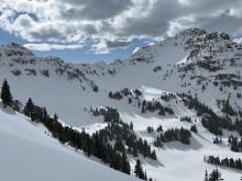
All Avalanche Incidents for Advisory Year 2022-23
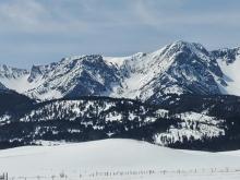
WS-N-R2-D2-O
Elevation: 10,000
Aspect: NE
Coordinates: 45.0524, -109.9450
Caught: 0 ; Buried: 0
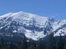
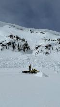
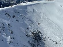
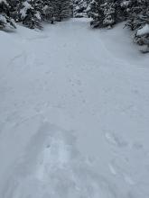
Snowmobilers saw a recent wet slab on the northeast face of Henderson Mtn. on May 20, 2023. Video attached.
Within last 4 days (May 16-19), but uncertain of exact date of occurrence.
More Avalanche Details

WS-N-R2-D2-O
Elevation: 8,800
Aspect: NE
Coordinates: 45.5289, -112.0180
Caught: 0 ; Buried: 0
Wet slab avalanche on Hollow Top Mtn., Tobacco Roots
ENE facing slope at 8,800’
More Avalanche Details
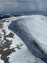
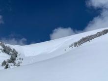
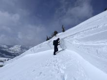
WS-N-R3-D2.5-O
Elevation: 10,000
Aspect: S
Coordinates: 45.0712, -109.9520
Caught: 0 ; Buried: 0
On May 14 and 15 we saw crowns and debris of wet slabs that ran naturally over the past couple weeks.
Scotch Bonnet, S aspect, 9800'; Sheep Mtn. SW aspect, 9800'; Crown Butte, SE aspect, 10000'.
Hard to say exactly when they all occurred. The slides on Scotch Bonnet and Sheep appeared slightly fresher, but could have been a week old.
More Avalanche Details

WS-N-R3-D2.5-O
Elevation: 8,500
Aspect: N
Coordinates: 45.0106, -109.9470
Caught: 0 ; Buried: 0
A natural wet slab avalanche that occurred just south of Cooke City yesterday May 3, around 6pm.
The slide is on a northerly spect around 8500'.
More Avalanche Details

WS-N-R3-D4-O
Elevation: 10,000
Aspect: S
Coordinates: 45.3179, -111.3360
Caught: 0 ; Buried: 0
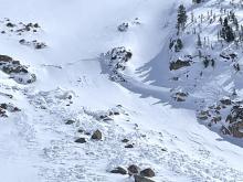
Natural R3-4, D4 ripped out a large chunk of the south face of Wilson during the last warm period I would assume. Debris everywhere and one large boat-sized pile even scoured a path further down than the rest of the debris. Looked to be a mix of wet loose and wet slab release from high up. Alpha angle at the bottom of the debris was 25 degrees
More Avalanche Details


WS-N-R3-D2.5-O
Elevation: 10,500
Aspect: SW
Coordinates: 45.1044, -109.8990
Caught: 0 ; Buried: 0
Natural wet slab avalanche, north of Cooke City, which likely happened on April 30th (observed May 1).
It's on a SW aspect, about 10,500'. Crown estimated to be 4-6' deep.
More Avalanche Details

WS-N-R2-D3
Elevation: 8,500
Aspect: E
Coordinates: 45.6075, -112.1280
Caught: 0 ; Buried: 0
While touring into the Dry Boulder Creek drainage, we noticed remnants of many recent wet loose slides, and one significant wet slab avalanche. The wet loose slides had occurred on all aspects, including low-elevation north facing slopes. I estimate that most of the wet loose slides we observed were no larger than R2 for their respective paths, and most were D2, with some large, high elevation slides, reaching a possible D3.
We observed the remnant of one large wet slab on an east facing slope at around 8500 ft. I estimated the crown to be around 500 ft wide, and 5 feet deep at its maximum. I estimate this slide was a R2 D3, with an unknown natural trigger.
We took these observations into account, staying off of solar aspects, and staying out of avalanche terrain once the snow began to soften.
More Avalanche Details


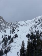
WL-N-R3-D2.5
Elevation: 8,000
Aspect: E
Coordinates: 45.8156, -110.9230
Caught: 0 ; Buried: 0
Pictures from this morning (May 1) but I’m sure these all ran late last week. They took out at least one or two skin tracks set during the big dump (40”) that ran right up the center.
Unconsolidated, dripping wet snow this morning mid mountain around 830 AM. Top 3-4” had frozen but soft by 830.
More Avalanche Details


SS-AS-R2-D1-I
Elevation: 10,100
Aspect: E
Coordinates: 45.3562, -111.3980
Caught: 0 ; Buried: 0
A skier triggered a small (D1) wind slab near the top of the Peruvian. Roughly 1ft deep and 20ft wide.
More Avalanche Details
WL-N-R2-D2.5-I
Elevation: 8,500
Aspect: E
Coordinates: 45.8230, -110.9230
Caught: 0 ; Buried: 0
Saw a number of large wet slides at Bridger Bowl the morning of 4/26. One running deep into North Bowl, and a couple other large slides in Bridger Gully coming off the ridge. These seemed to be recent -- likely from the past 48 hours.
More Avalanche Details


WL-N-R2-D2
Elevation: 7,800
Aspect: E
Coordinates: 45.8156, -110.9230
Caught: 0 ; Buried: 0
Yesterday 4/25, Walked to the top of Pierre's Knob. The snow was unconsolidated mush, very sticky skiing. While hanging out at the top shack (at 1130am) I heard 3 large avalanches running in the south bowl, white out conditions so was unable to see how big the slides were they sounded like they ran a long ways.
More Avalanche Details
L-AS-R2-D1.5-S
Elevation: 8,000
Aspect: E
Coordinates: 45.8156, -110.9230
Caught: 1 ; Buried: 0
From obs: "On 4/22 at 12:30pm we were part way up the boot pack (now skin track) up from Bridger chair to the ridge. We heard someone yelling and looked over to see a skier caught in an avalanche just above North Bowl Road. The slide came to a stop at the road (they were on top the whole time), and the skier yelled that they were ok. Seemed like they were skiing alone but more of the party may have been out of view. We had not seen wet snow concerns until about 30 minutes before the incident. By the time we left bridger, most chutes had slides out of them."
More Avalanche Details

L-ASc-R2-D2-S
Elevation: 8,000
Coordinates: 45.8156, -110.9230
Caught: 0 ; Buried: 0
By early afternoon on 4/19/23 the three feet of new snow was easily avalanching and running long distances with large volume. Video from Test Face/Lower Nose.
The new snow slid easily on steep slopes, mostly dry loose avalanches, but by the afternoon these were entraining large, dangerous volumes of snow. Video is from this morning, small test slope at 6,300', north facing. Now there is a lot more snow, and much more at higher elevations. It snowed heavily all day. Wind was moderate on the ridge, calm with moderate gusts below the ridge, and moderate/gusty on the lower half of the mountain.
Large avalanches of new snow will be easy to trigger for the next few days, and large natural avalanches are possible. Conditions will continue to become more dangerous if heavy snow continues.
More Avalanche Details


L-AS-R2-D2-S
Elevation: 8,000
Coordinates: 45.8242, -110.9280
Caught: 0 ; Buried: 0
From obs 4/19/23: "We observed a large slide at the Apron that was released from the Hidden Gully. In a whiteout, we couldn't tell the size, but it looked quite substantial. The slide didn't go all the way to the bottom."
"New snow is not bonding well to the old snow surface. Sluffing and running far on steeper terrain."
More Avalanche Details


WL-AS-R2-D1.5
Elevation: 9,900
Aspect: E
Coordinates: 45.0046, -109.9580
Caught: 0 ; Buried: 0
From Obs: "Had some loose wet slides on the fin today just after noon. Was about 3-6” deep at the new/old snow interface. Slide was slow moving but carried farther than we thought."
More Avalanche Details
SS-ASu-R2-D2-I
Aspect: N
Coordinates: 46.0312, -110.3050
Caught: 0 ; Buried: 0
From Obs: "This afternoon my group triggered a dry-loose avalanche on the north face of Big Timber Peak in the Crazies. The slide was about 12 inches deep, 50 feet wide, and ran about 1,000 vertical feet. Thankfully, no one was injured. We didn’t officially measure the slope angle but we’re estimating it to be in the 38-degree zone—prime avalanche territory. The slide consisted of new snow that fell during this recent storm. It hadn’t bonded to the thick crust underneath and released during the second skier’s run."
More Avalanche Details
SS-N-R1-D1
Elevation: 8,300
Coordinates: 45.8156, -110.9230
Caught: 0 ; Buried: 0
"Small storm slab off the steep drift on skier's R/skinner's L side of upper Thunder Road. Also felt some cracking and collapsing when I (briefly) stepped off the skin track to get to the top of Pierre's Knob."
"skinned up to the ridge and observed 5-9 inches of new and accumulating snow forming into wind drifts that were highly reactive. Multiple remote triggers occurred while traveling N on the ridge, propagating both on W and E faces of the ridge. Both Hidden and Northwest Passage slid with little effort down to an icy bed surface. Debris at bottom of hidden was substantial but great skiing."
More Avalanche Details


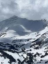
WL-N-R3-D2.5-O
Elevation: 9,200
Aspect: W
Coordinates: 45.3407, -111.3910
Caught: 0 ; Buried: 0
Pretty much the entire wall skiers right of the prayer flags back into beehive slid. Wet slide. Multiple crown lines and long running.
More Avalanche Details


WL-N-R3-D2-O
Elevation: 8,000
Aspect: SE
Coordinates: 45.8156, -110.9230
Caught: 0 ; Buried: 0
a natural wet slide came out of Close Call yesterday afternoon (4/11/23), debris ran to the bottom of moonshine.
More Avalanche Details


WL-N-R2-D2-O
Elevation: 10,000
Aspect: S
Coordinates: 45.2760, -111.4360
Caught: 0 ; Buried: 0
From Big Sky Ski Patrol: "Temps remained a little cooler than yesterday and generally topped out in the mid 40’s F. That didn’t stop the free water from moving
and continuing to destabilize the snowpack, primarily on solar aspects below 10,000’. Near full depth to full depth wet loose avalanches continued to naturally release in what was left of the A-Z’s as well as LRT which had not seen any activity yesterday."
More Avalanche Details

WS-N-R1-D2-O
Elevation: 8,700
Aspect: NE
Coordinates: 45.7964, -110.9340
Caught: 0 ; Buried: 0
From 4/11/23: Yesterday (4/10) Colters released a wet slide (approx 1-3pm) that filled the top of the wiggle and left debris 300ft past the south bowl traverse (separate avalanche log entry). Today Stupor had a similar sized release just after noon.
The best noted natural release was a wet slab release on the southern edge of the football field that put a pile of debris below the cave.
More Avalanche Details

WL-N-R3-D2-O
Elevation: 7,200
Aspect: E
Coordinates: 45.7326, -110.9620
Caught: 0 ; Buried: 0
While descending from a trail “run” (definitely more of a post hole) up towards Baldy, I saw a medium-sized wet slide on the eastern side of the ridge underneath some large rocks. The slide was roughly 15-20’ across at the portion I could see and traveled several hundred feet down the mountain. I could hear trees snapping (sadly in the video I don’t think you can, as my breathing is way too loud) and watched the avalanche move for almost a minute. I was very thankful for my careful route finding and avoidance of steep slopes!
~ (45.7311237, -110.9639991)
More Avalanche Details
WL-N-R3-D1.5-G
Elevation: 6,900
Aspect: NE
Coordinates: 45.0202, -109.9380
Caught: 0 ; Buried: 0
A full depth wet loose slide (D1.5) buried one lane of road in YNP on a steep, treed ENE facing slope at 6900'.
More Avalanche Details


WL-N-R2-D2-O
Aspect: S
Coordinates: 45.1719, -111.3800
Caught: 0 ; Buried: 0
Riders observed a small, full-depth wet snow avalanche on a southerly aspect near Pioneer Mountain.
More Avalanche Details

WL-N-R2-D2
Elevation: 8,300
Aspect: E
Coordinates: 45.8156, -110.9230
Caught: 0 ; Buried: 0
From 4/11/23: Yesterday (4/10) Colters released a wet slide (approx 1-3pm) that filled the top of the wiggle and left debris 300ft past the south bowl traverse.
More Avalanche Details

WL-N-R1-D2
Elevation: 9,500
Coordinates: 45.0202, -109.9380
Caught: 0 ; Buried: 0
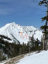
There were maybe 6-10 D1.5-D2 wet loose slides scattered around the area that we could see, similar to attached picture of Crown Butte (We could see Miller Mtn. east and north, Scotch Bonnet, Henderson, Crown Butte, Abundance, Wolverine). At lower elevations where the snowpack is shallower, closer to silver gate and the northeast corner of the park, there were some deeper wet loose slides (D2) and a couple small wet slabs (photo). I would estimate most of these happened yesterday (4/10).
More Avalanche Details
WL-N
Coordinates: 45.2981, -111.5240
Caught: 0 ; Buried: 0
A skier at Big Sky Resort saw three new wet snow avalanches on 4/10.
More Avalanche Details
WL-N-R2-D2
Coordinates: 45.8512, -110.9480
Caught: 0 ; Buried: 0
Drove Bridger Canyon to Seitz road around 5pm on 4/10. Saw 4-5 D2 wet loose, plus many D1 wet loose. No huge slides or widespread large wet activity, yet.
More Avalanche Details
C-N-R2-D2
Coordinates: 45.0202, -109.9380
Caught: 0 ; Buried: 0
Riders near Cooke City saw a couple of cornice falls that triggered the snow below on 4/10
More Avalanche Details

WL-N-O
Coordinates: 45.2760, -111.4360
Caught: 0 ; Buried: 0
From email referencing closed terrain within Big Sky Resort: "Numerous full depth wet loose naturals ran during the day on steep solar aspects in closed terrain including the Upper and Lower A-Z’s, Dirtbag Wall, Castro’s Shoulder and both Pinnacles. In addition, we pushed on numerous lower mountain road cuts that would generally run full depth onto the roads below."
More Avalanche Details

WL-N
Coordinates: 45.2952, -111.4100
Caught: 0 ; Buried: 0
From an email from a pilot flying over the mountains: "This afternoon en route back to Livingston from Idaho, lots of slide activity at all elevations…
Too many point releases to count in every range I’ve crossed today…"
More Avalanche Details
WS-N-R2-D2-O
Elevation: 9,800
Coordinates: 45.2952, -111.4100
Caught: 0 ; Buried: 0
From email: "This afternoon en route back to Livingston from Idaho, lots of slide activity at all elevations…
The first picture is the cornice collapse. One block in the debris pile was probably the size of my airplane - a giant ass snowball."
More Avalanche Details
HS-N-R3-D2-O
Aspect: N
Coordinates: 45.1582, -111.4770
Caught: 0 ; Buried: 0
Riders observed a natural, dry slab avalanche that occurred last week on a northerly aspect near the Sphinx.
Approx coordinates of slide #1: 45.15872, -111.46923
More Avalanche Details


HS-AS
Coordinates: 45.2771, -111.4640
Caught: 0 ; Buried: 0
From email: "There was yet another skier-triggered avalanche out in the Lone Lake Cirque this afternoon. Sounds a like a cornice trigger (not sure if it was intentional) that triggered a large slab on the slope below and ran full track. I do not believe the involved party rode the avalanche but it was another close call. This was adjacent to the one triggered a couple of days ago which was adjacent to the one triggered a few days before that."
More Avalanche Details
WL-N
Coordinates: 45.2311, -111.4410
Caught: 0 ; Buried: 0
From Obs: "Today we observed wet loose avalanche activity on the southerly aspects in the mountains around Pioneer mountain. We also observed one dry slab avalanche on a NE aspect of Sphinx mountain at approximately 9,000’."
More Avalanche Details
WL-N-R3-D2.5
Elevation: 7,500
Aspect: S
Coordinates: 44.8534, -111.4000
Caught: 0 ; Buried: 0
More Avalanche Details

N
Coordinates: 45.0202, -109.9380
Caught: 0 ; Buried: 0
Lots of naturals and maybe a rider triggered avalanche seen today. Steep solar aspects had lots of wet loose activity and small cornice/pillow fall.
More Avalanche Details


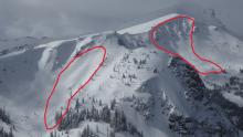
HS-N-R4-D3.5-O
Elevation: 10,000
Aspect: E
Coordinates: 45.3775, -111.2440
Caught: 0 ; Buried: 0
Went for a ski on Jumbo Mountain via the Lava lake parking lot....
The big surprises for the day were 3 separate deep slab avalanches since the most recent loading event (likely 4/3). Photos are attached. The first that we sighted was on the N/NE face of Jumbo. It appears to be cornice fall triggering a windslab that stepped down, photo attached.
HS-N-R2-D2-O @ around 10000ft on the N/NE face of Jumbo.
the next that we sighted was a large deep slab on the E face of the ridge just north of the true summit of Jumbo.
HS-N-R2-D2.5-O @ around 10,000ft.
The real show stopper was on the E face of Jumbo.
HS-N-R4-D3.5-O/G. Approximate crown width of 1000ft and average depth of 6-8ft. Total run of around 2000ft. A few photos attached.
other slides of note, a few D1-1.5 WL slides low in the basin SW facing. Also, an older deep slab on N facing terrain just south of Hell Roaring Lake, D2-D2.5.
More Avalanche Details


AMu-R2-D1.5-I
Aspect: E
Coordinates: 45.4469, -111.0760
Caught: 0 ; Buried: 0
From obs 4/7/23: "Small wind slab triggered by snowmobile. Slope was assessed by group as wind blown before climb. No one was caught. East facing slope, Storm castle Ridge. Photo one shows trigger point where the Snowmobiler carved hard and set off the slab deeper in the snowpack"
More Avalanche Details


N-R3-D1.5
Elevation: 10,000
Aspect: SE
Coordinates: 45.0202, -109.9380
Caught: 0 ; Buried: 0
Wind slab avalanche on a SE aspect around 10,000'. The crown looks to be about 1-3' deep and 75' wide.
More Avalanche Details

ASu-R2-D2
Elevation: 10,200
Aspect: SW
Coordinates: 45.0733, -109.9480
Caught: 0 ; Buried: 0
Skier triggered windslab in the Rasta Chutes on Scotch bonnet. Approximately 75 ft wide.
More Avalanche Details

SS-NC-R2-D2-I
Elevation: 8,500
Aspect: E
Coordinates: 45.7943, -110.9360
Caught: 0 ; Buried: 0
South of Saddle Peak, ~8500', ENE aspect, 2-3' crown depth estimated and likely cornice-triggered. N-facing snow remained dry until the latter afternoon when a high sun angle cooked everything but the truest due north. Avalanche appeared to be all new snow likely on a PWL buried near the end of March. Winds moving snow up high, but everything appeared locked on.
More Avalanche Details

HS-N-R3-D3-O
Elevation: 9,800
Aspect: N
Coordinates: 45.2952, -111.4100
Caught: 0 ; Buried: 0
From Obs: "Was able to spot a deep slab avalanche from Gallatin peak, slab was at the headwaters of S Fork Hellroaring (N aspect @ 9800) Hard to tell when this released as it was a few miles away, I would estimate the crown being around 10 feet. Observed a small storm slab on a north aspect as well (1-2 foot crown). Also saw a few dozen wet slides that released earlier this week, some tearing all the way to the ground."
More Avalanche Details

SS-AS-R2-D1.5
Elevation: 8,000
Aspect: SE
Coordinates: 45.8301, -110.9340
Caught: 0 ; Buried: 0
Skinner triggered slide north of the hourglass. Run name unknown. Remotely triggered from ridge line; snowboarder said he was skinning 35 feet away from trigger point; no one buried. I also observed point releases as I was skinning up to texas meadows; snow seemed to change quickly under blue skies and increasing temperature. Slide ran in front of me, taking out the skin track.
More Avalanche Details


HS-AMu-R3-D2-O
Elevation: 6,500
Aspect: NE
Coordinates: 44.9069, -112.3600
Caught: 1 ; Buried: 0
After a long day of riding 2 to 3 thousand feet higher in good snow I was getting close to the truck after 10 or so miles on a mostly hard pack trail I decided to climb this hill in a split second decision. My sled was overheating and my plan was to cool it down. As I ascended the hill I hit a pencil hard wind slab about a third of the way up, I knew instantly that I was in trouble as this slope ended up being much steeper than I had initially thought. I made a decision in the moment to continue up the slope as it was not many vertical feet in elevation. My thoughts were that I had lots of speed and momentum built up and that that would carry me up I also thought that if I tried to make an aggressive turn it would put more stress on the snow pack and I also figured the closer to the top of the slab I was when it fractured the better off I would be. I made it about 100 feet from the top of the hill when it first fractured, I was about 20 feet from the fracture and there was a point slightly to my right that was the closest point of the fracture to me. I turned slightly right heading to the closest point of snow above the fracture line. As I turned the slope started sliding. The top of the of the slide rolled over like a large wave and a block hit me in the ribs luckily not nocking me off my sled. I maintained full throttle and kept my momentum traverseing through the rolling blocks. My only thought was to try to stay on top of my machine and keep forward momentum. In the last few moments of the slide I could feel I was loosing control of my machine because it was starting to get sucked into the avalanche. When the slide stopped I was in snow to my knee on my uphill side. I want to end this with a warning of complacency. I had been in big terrain all day and didn't analyze the slope like I should have a simple glance for a moment and I would have recognized the dangers of the wind slab. I got complacent and it almost got me injured or killed. Just because a slope is small doesn't mean it isn't dangerous.
More Avalanche Details


HS-N-R4-D4-O
Elevation: 9,600
Aspect: E
Coordinates: 44.8496, -110.8820
Caught: 0 ; Buried: 0
I went through the area of Three Rivers Peak yesterday, and there had been a pretty nice cycle of large slides recently. One on the east face of Three Rivers broke 6-800’ wide 2-10’+ deep, and ran full track. It only had a couple inches of snow on it, so I think it ran sometime during the recent warm days. Some of the walls along the slide were over 20’ high, and I imagine the debris pile might make it through the summer.
I also observed a couple older slides on E\NE aspects that were older, but not a whole lot smaller.
More Avalanche Details


HS-N-R4-D3.5
Elevation: 9,800
Aspect: S
Coordinates: 45.0672, -110.0160
Caught: 0 ; Buried: 0
Documenting local avalanche cycles, attached is a photo of an avalanche on the south face of Mt. Abundance taken yesterday, that likely happened last Sunday (?) when we got 1" of SWE overnight. Lots of debris chunks the size of refrigerators. Crown mostly covered by wind blown snow.
More Avalanche Details
HS-N-R3-D3
Coordinates: 45.0367, -111.4590
Caught: 0 ; Buried: 0
From an email:
We rode back to the wilderness boundary in Bear Creek on Buck Ridge today. The riding was pretty good; new snow from earlier in the week had some wind effect but there were very few hard wind slabs to be found (maybe on the highest most exposed ridges). The day started calm but the wind picked up after noon. We didn’t notice any freshly drifting snow but some of the southern exposures were getting a little wet.
We didn’t see any recent avalanches in the terrain on or immediately around Buck, however we did spot 1 medium and one older, large avalanche in the Taylor-Hilgard range. The northern most one was smaller and was a pocket just below a ridgetop that appeared to be very wind loaded. The other appeared to be an entire basin that had slid, the crown was visible around the upper third of the bowl and there was a large, coarse debris pile in the bottom. This one was east of Koch Peak, above tumbledown creek. Couldn’t get a good picture of either but could see through binoculars pretty well. Aspect on both was N/ NE and both slid before the snow earlier this week, hard to say when.
(estimated 4/02, GNFAC)
More Avalanche Details
N-R2-D2
Coordinates: 44.7292, -111.3230
Caught: 0 ; Buried: 0
We saw three more avalanches that broke at least a few feet deep and several storm slab avalanches that failed within the new and wind-drifted snow. No other observed avalanches were as large as the one on Targhee Peak.
We stayed in terrain less than 30 degrees steep, with minor exceptions on small slopes. We avoided all large, wind-loaded slopes and crossed below them cautiously. The snowpack maintains the characteristics of mid-winter, and deeply buried persistent weak layers remain a concern. Going forward, we will continue to assess the upper few feet of the snowpack for instability before considering any steep slopes. We will continue to manage the deep slab avalanche problem through avoidance (of avalanche terrain) and consequence minimization (by selecting non-wind-loaded slopes that are smaller and free of terrain traps).
More Avalanche Details


HS-N-R3-D2.5-O
Elevation: 9,500
Aspect: E
Coordinates: 44.7292, -111.3230
Caught: 0 ; Buried: 0
There was a large natural avalanche that broke yesterday on Bald Peak it was bounded laterally by the terrain, so it only broke a three hundred feet across, but it appeared to be 4-6' deep and ran the full available vertical into the creek below. This avalanche was the key piece of information for the day and answered the question of whether or not the snowpack is continuing to produce deep slab avalanches with every storm, it is.
More Avalanche Details


SS-ASr-R4-D3-I
Elevation: 9,000
Coordinates: 45.0303, -109.9980
Caught: 0 ; Buried: 0
From IG: “Wanted to touch base about an avalanche we triggered on the shoulder of Mineral Mountain today. While skinning up there was obvious wind loading coming from the south. I kicked around a bit near the edge of the ridge (no cornice) and remote triggered this slide from 20’ away. It broke 12-18” deep, and propagated 700-800’ wide. Ran full length of the slope into old growth trees 1200’ below. Would estimate R4 D3. We found good stable skiing on the south aspect (~35°)”
More Avalanche Details

Elevation: 9,020
Aspect: W
Coordinates: 45.3214, -111.3820
Caught: 0 ; Buried: 0
From obs: "Experienced a very large whumpf on the Middle Basin Ridge at Beehive.
We had just finished digging pits in the first large open section of the ridge and one of our skiers was jumping on the snow above the pit when there was a large whumpf. We guessed that the whumpf could have extended out to be about 100 m total(of course this is an estimate), but the point is that it was very large. One other group experienced two separate smaller whumpfs about 200 m away on a different section of the ridge.
The large whumpf occurred at approx. 9020 ft on a west aspect. 2 smaller whumpfs occurred at approx. 9030 ft on south/southwest aspects."
More Avalanche Details
SS-N-R2-D2-I
Elevation: 9,200
Aspect: NW
Coordinates: 44.9855, -109.9410
Caught: 0 ; Buried: 0
From Email:
"Observed a fresh natural avalanche this afternoon on Woody Ridge. The avalanche occurred on a NW aspect, around 9200' (likely last night). I'd estimate the size to be 1-3' deep, and about 100' wide.
No other avalanche activity observed today. (ski tour up Republic Creek this morning, low visibility while I was up there).
No collapsing. Minor cracking of the fresh, dense wind drifts, though they felt quite stubborn.
New snow: about 10", dense/ rimed forms."
More Avalanche Details


HS-N-R4-D3-O
Elevation: 10,200
Aspect: SE
Coordinates: 45.2643, -110.6170
Caught: 0 ; Buried: 0
From email: "Saw this recent crown while xc skiing out above Mill Creek today. It's on the east-southeast aspect of Peak 10526 east of Emigrant Peak at ~10,200'. In what I like to call the Arrastra Ridge Avalanche Observatory Plot*. The photo is taken approximately 5 miles in line of sight from the crown. It is roughly 1000' wide. If I had to guess, the crown is 10'+ tall—definitely a very destructive avalanche. I won't venture a guess on the rating. I'd bet good money it ran all the way to the lake at the head of Burnt Creek and rearranged some timber.
*If one wanted to create a laboratory for observing large, regularly occurring naturally triggered avalanches, this would be one of the best locations in SW MT."
More Avalanche Details

N-R2-D2
Elevation: 9,000
Aspect: E
Coordinates: 45.8883, -110.9590
Caught: 0 ; Buried: 0
A group of skiers saw a natural avalanche on an east, facing slope off of Naya Nuki Mountain in the Bridger range. It likely avalanched early in the morning on April 2.
More Avalanche Details

HS-N-R3-D2.5
Coordinates: 45.5289, -112.0180
Caught: 0 ; Buried: 0
From IG: “North meadow creek tobacco roots today“
More Avalanche Details

HS-N-R3-D3-O
Elevation: 10,000
Aspect: E
Coordinates: 44.9739, -109.9240
Caught: 0 ; Buried: 0
From email: "Observed very limited terrain due to vis. Saw this very large avalanche on Climax. The crown looks fresh, so it likely occurred the day or night of 4/1?
Hard to tell but the crown looks to be about 4-6’ deep at its deepest. The debris ran to the creek.
E aspect at 10000’.
There were also several smaller soft slab avalanches that ran on the lookers right side of Climax.
On 4/1 we had a large collapse on a SE aspect at 9800’ where the MF crust was present under 60cm of new snow.
Winds were L-M with consistent gusts to S on Saturday."
More Avalanche Details


HS-N-R3-D3-O
Elevation: 10,000
Aspect: N
Coordinates: 45.0607, -111.2720
Caught: 0 ; Buried: 0
More Avalanche Details

SS-N-R2-D2-I
Elevation: 9,000
Aspect: NE
Coordinates: 44.8720, -111.3610
Caught: 0 ; Buried: 0
More Avalanche Details


N-D3
Coordinates: 44.5490, -111.4750
Caught: 0 ; Buried: 0
From obs: "Our party of 6 stayed at the Hellroaring Creek hut over the weekend. The winds and snowfall were intense, with the snow turning more graupelly by mid-Saturday. We dug a pit on a southerly aspect of Mount Nemesis, near the hut around 8000.’ We noted the complex layering, including a weak layer about 20” down that failed on the 23rd shovel hit.
On Sunday morning, the sun broke through for a bit and allowed us to view the widespread avalanche cycle that occurred overnight on all aspects. Across the creek, we saw a large crown (approx 3’ in depth) in the meadows.
An avalanche that occurred on Nemesis’s south face ran from mid-mountain all the way into Hellroaring Creek, running over our old skinner.
The natural slides on Nemesis’s north face were some of the biggest we have seen in any slide, knocking out a lot of trees towards the bottom."
More Avalanche Details

ASu
Coordinates: 45.9233, -110.9800
Caught: 1 ; Buried: 0
From Obs: "My ski partner and I toured into Frazier Basin on Saturday, April 1st. We observed obvious signs of wind loading as we made our way up from Fairy Lake to the Frazier ridge. We found a crust layer a few centimeters thick that was widespread throughout the basin. The crust was not shooting cracks as we moved but hand pits showed that it was cohesive and easily breaking on the soft snow below. My ski Partner popped off a small wind slab that had enough energy to knock him off his feet. This was the only slab we found that moved after skiing three lines on different aspects. The wind slab that broke was just below a ridge in a bowl feature that probably experienced more wind loading than most other areas in the basin. We also observed an old avalanche at the end of the basin possibly from a cornice fall that ran the whole length of the slope down to the trees in the center of Frazier Basin. Overall it was not feeling like a spring snowpack and you should continue to be skeptical of multiple layers in the Bridgers."
More Avalanche Details
N-R2-D2
Coordinates: 45.8825, -110.8820
Caught: 0 ; Buried: 0
From IG: A group of writers reported seeing three new natural avalanches on April 1.
More Avalanche Details

HS-N-R3-D3-O
Elevation: 9,000
Aspect: E
Coordinates: 45.9301, -110.9800
Caught: 0 ; Buried: 0
"Toured into Frazier Basin today [4/1/23] and noted a few instabilities.... Second, we saw a large natural avalanche above Ainger lake (E-SE facing) that ran from near the top of the ridge itself to propelling debris up, over, and past the lake. The crown ranged from 2-5ft high spanning 400-500ft across the face."
"Saw this crown from a distance today [4/1/23]. Possibly natural R3-D3 on ESE aspect, likely caused by wind loading. Unsure when it occurred, but crown looked large and debris ran into the flats mowing down some small flag trees."
More Avalanche Details


N-R3-D2
Elevation: 9,600
Aspect: E
Coordinates: 45.2282, -111.4990
Caught: 0 ; Buried: 0
This natural avalanche was observed in the afternoon around 1500. It was not seen earlier in the day and is thought to occurred at some point after 1200. It was seen from a distance on Pioneer mountain. It occurred on an E facing slope around 9600’. Active wind transport was noted on the ridge line above the avalanche. It looked to be around a R3-D2.
More Avalanche Details
AMr-R1-D1
Coordinates: 45.2890, -111.1410
Caught: 0 ; Buried: 0
We were snowmobiling up portal creek today near the hidden lakes trailhead and I set off a small slide remotely by riding below a small ridge. The slide was about 3 feet at its crown 30 or 40 feet wide and ran about 40 yards. It just came down to where my track had crossed underneath. Everything was fine and we stayed safe and continued on with our plan and had a nice day.
More Avalanche Details


HS-ARu-R4-D2.5
Coordinates: 45.2771, -111.4640
Caught: 1 ; Buried: 0
There was a large, deep slab avalanche snowboard triggered in Lone Lake Cirque this afternoon (3/30). The
slide ripped in a secondary start zone below ridgetop, and ran far into the flats, and may have run a bit uphill, where it encountered the rock glacier moraine in the runout. It looks to be a R4, D2.5. Snowboarder walked away unharmed.
More Avalanche Details

N
Elevation: 8,900
Aspect: SE
Coordinates: 45.1719, -111.3800
Caught: 0 ; Buried: 0
From IG:
Think this was a recent natural up buck I saw today. Didn’t get close enough to see but looked like it was a big crown… down low 8900ish SE
More Avalanche Details

SS-N-R2-D1.5
Coordinates: 45.4472, -110.9620
Caught: 0 ; Buried: 0
On my walk up to divide today 3/28 I noticed a few small storm slabs that broke on the west side of the main fork of hyalite off the summer trail. This area had similar storm slabs that broke back in mid February during a large storm
up in the alpine there were no avalanches to report
More Avalanche Details
N
Elevation: 10,000
Aspect: E
Coordinates: 45.7701, -110.9400
Caught: 0 ; Buried: 0
Two large, widely propagation fractures visible through a hole in the cloud cover Monday A.M. from Bridger Canyon Dr. Upper slab failure evidently stepped down to a deeper layer estimated 400' below upper crown. Both crowns appeared to be similar depth. Also visible were debris toes further to the North that had run mostly full path. Looked like it was already covered up yesterday (tues).
A second ob via phone message:
A large natural avalanche occurred on the north summit of Bridger Peak yesterday (Monday, 27 March). The crown line was complex.
More Avalanche Details
SS-ASu-R2-D2-I
Elevation: 9,800
Aspect: S
Coordinates: 45.2760, -111.4360
Caught: 0 ; Buried: 0
From email: "I was coming down Wyoming bowl today around 2 pm and I seemed to have remotely triggered this slab. As I began my descent over the rollover and toward the slight pinch point, I spotted the spider effect of a decent-sized slab, breaking maybe 75 ft to my right but no cracking under my board or anywhere near me. I traversed over to be on the bed surface for the rest of the run. I should have known better, and lucky I didn’t get the carpet ripped out from underneath me and go for a ride. Crown appeared to be 1-2 deep, and I would guess 75 ft wide"
More Avalanche Details
N-R2-D2
Aspect: SE
Coordinates: 45.8822, -110.9520
Caught: 0 ; Buried: 0
From IG: Battle ridge today/yesterday the 27th. Noticed this and a few other smaller solar releases as well as a couple storm slabs from during the cycle. Sun crust formed rapidly and there was a lot of wind loading in the afternoon
More Avalanche Details

SS-N-R2-D2
Aspect: E
Coordinates: 45.8822, -110.9520
Caught: 0 ; Buried: 0
We observed evidence a couple of recent slab avalanches at the throne
More Avalanche Details

SS-N-R2-D2-S
Coordinates: 45.2890, -111.1410
Caught: 0 ; Buried: 0
Saw a couple small natural slides breaking in the new snow. The one on the small slope beside the road actually appeared to have broken when a snow bike crossed the top just off the side of the road. The other was natural and occurred in the afternoon sometime
More Avalanche Details


SS-AS-R3-D2-I
Elevation: 7,500
Aspect: E
Coordinates: 45.5971, -110.9610
Caught: 1 ; Buried: 1
Came across debris of a recent skier-triggered slide near the top of Little Ellis in a small, protected, eastern facing gully around 7,500'. Crown was ~3.5-1.5' deep, ~35' wide and it ran ~150'. Ski tracks were observed near the top of the crown and next to a small hole near the surface ~70' from the crown where it looks like someone self extracted. No signal was found with a beacon search and my group felt that the one track from the hole must have been from the same skier as the track near the crown.
There was around 2-3' of heavy new snow at that location.
More Avalanche Details

SS-N-R2-D2-I
Elevation: 9,300
Aspect: SW
Coordinates: 45.3407, -111.3910
Caught: 0 ; Buried: 0
More Avalanche Details


HS-AMu-R3-D2-O
Elevation: 10,000
Aspect: SW
Coordinates: 45.0550, -109.9530
Caught: 2 ; Buried: 0
On the morning of March 23, 2023 near Daisy Pass, two snowmobilers were stuck on a slope and a third was snowmobiling up to help when a large avalanche was triggered. The two stuck riders were caught and carried, and one of them sustained potentially life-threatening leg injuries (later determined as a broken femur). The third rider was able to safely ride off the slope and was not caught by the avalanche.
One rider in the group rode into Cooke City to contact Search and Rescue. Cooke City/Park County Search and Rescue transported the injured rider back to Cooke City where he was transferred to an air ambulance.
The avalanche was on a southwest facing slope at 10,000’, it broke up to 4’ deep and 150’ wide, and is classified HS-AMu-R3-D2-O.
More Avalanche Details


HS-R3-D3-O
Elevation: 9,800
Aspect: NE
Coordinates: 45.4421, -110.9860
Caught: 0 ; Buried: 0
Large avalanche seen in the Bunny Ears on Elephant Mtn in Hyalite. Deepest part of crown estimated to be 8-10'. Observed by two parties on 3/23/23. Unsure on exact timing of the avalanche, but likely was between 3/22 and 3/23. An ice climber had a photo of the slope from the afternoon of 3/22 and the slide had not happened yet. Unknown trigger. On the evening of 3/23, a group of skiers saw multiple other tracks on slopes above and adjacent to the crown, but unsure if those triggered it or turned around after seeing the crown.
More Avalanche Details


WL-ASc-R1-D1
Coordinates: 45.4419, -111.0000
Caught: 0 ; Buried: 0
From obs: "I toured up Blackmore today and saw a lot of sluffing on steep terrain and very wet snow on s terrain. I pushed off a small wet slide that built a good amount of momentum and could've run far if the terrain allowed. I did dig a pit down to the new old snow interface and had no results in an etc."
More Avalanche Details
HS-N-R3-D2.5-O
Elevation: 8,900
Aspect: NE
Coordinates: 44.7118, -111.3130
Caught: 0 ; Buried: 0
Natural avalanche on Lionhead Ridge estimated date 2/21/23.
From obs: "Bowl after the climb up Denny Creek. The runout area is the first big downhill on the trail that follows the bottom of the ridge. Best guess is 24-48 hours old. Extremely deep runout."
More Avalanche Details

SS-N-R0-D1
Elevation: 9,700
Aspect: W
Coordinates: 44.9739, -109.9240
Caught: 0 ; Buried: 0
Skied on west and east sides of Woody Ridge. Observed a few small soft wind slab avalanches involving only new snow around the submarine. Dug a pit about a meter deep on west aspect about 9,700 feet. HS was 290cm. No result on extended column test. Fist to 265, 4F to 245, 1f to 200 where there is a crust layer, back to 1f below that.
More Avalanche Details

R1-D1.5
Elevation: 10,000
Aspect: N
Coordinates: 45.3934, -110.9690
Caught: 0 ; Buried: 0
I went for a walk up to divide basin today and noticed a slide in the back of the basin on a high north facing slope , there was 5” of low density snow up high
More Avalanche Details
L-N-R2-D1.5-I
Elevation: 9,200
Aspect: SE
Coordinates: 45.9233, -110.9800
Caught: 0 ; Buried: 0
As we returned to Frazier Basin from below, we saw five natural avalanches on the southeast-facing wall of the basin. These had occurred while we were skiing the terrain below. They entrained only the 1 to 2 inches of snow that had fallen during the day. However, they were notable in that they ran 500 to 700 vertical feet. They were likely initiated by warming from the proximal cliff faces. They indicate that the new snow may not bond well to the old snow surface. A crust formed by the recent warm temperatures and sunny skies is the subsurface that snow is falling on. This will become a more significant concern as more snow falls this week.
More Avalanche Details

WS-N-R3-D2-O
Elevation: 5,900
Aspect: N
Coordinates: 45.8512, -110.9480
Caught: 0 ; Buried: 0
I observed the results of a wet slide avalanche within the first mile of Middle Cottonwood Creek Trail. The slide came down from the south side of the canyon (north facing), and crossed the trail at about 4-5' deep and 10' across at the trail with debris and into the creek at the creek crossing about .75 mile from the trailhead. The crown was only about 100' up the side of the canyon. The avalanche would've occurred earlier in the week, there was just the skiff of snow on it from the previous light snow (22nd?). In the rest of that section there are pinwheels all along that south canyon slope (north facing).
This is the 3rd wet slide I've seen in the last 3-4 weeks on Middle Cottonwood in the same region where the trail is on the south side of the creek (mile .4-.80 from summer trailhead). This area is easily accessible by hikers (I was running) and I've seen wet slides in that area 3 of the last 4 years once the sun hammers that south slope in the afternoon. I would expect more at the next warm spell after this current storm cycle.
More Avalanche Details

HS-R3-D3.5-O
Coordinates: 45.3539, -111.4050
Caught: 0 ; Buried: 0
From Obs: "Toured around beehive peak today. Viewed 1 older large avalanche and other smaller slides. All were north to east aspects"
More Avalanche Details

HS-NL-R2-D2-O
Elevation: 9,900
Aspect: E
Coordinates: 45.2630, -110.7070
Caught: 0 ; Buried: 0
From obs 3/20/23: "Yesterday we toured up into Emigrant gulch. At around 2pm we observed a small point release on the East face of Emigrant, either a small cornice break or wet loose, that ran for about 200ft before stepping down to a deep slab that appeared to be about 3ft deep and 100ft across."
More Avalanche Details


SS-ASu-R4-D2-I
Elevation: 10,000
Aspect: NE
Coordinates: 45.6553, -110.5580
Caught: 0 ; Buried: 0
Myself and two partners were skiing in the crazies 3/17-3/18. Dug 2 pits and got similar results, ectn15 18cm down and n28 30cm down with depths of 300-400cm and no deeper pwls on N/NE aspects at 8300ft and 9600ft. No recent avalanche activity other than a few small 6in storm/wind slabs on southern aspects. Snowpack was very right side up everywhere we toured and had skied 3 different NW to E faces. On 3/18 we headed to ski a NE facing couloir at 10000ft, skinned/booted the first ~300ft and found similar snow to everywhere else. About halfway up hit a rocky section with some depth hoar, I noted plate crystals up to 1cm wide at ground. Should’ve turned around there but thought maybe it was just a short rocky section. I had also just measured the slope angle at 52 degrees which gave me false confidence there would be no developed slab. Wallowed through weaker snow for another ~50ft then finally decided to turn around due to the difficult boot packing, hitting our 3pm turn around time, and the weak snow pack. As I booted to the middle of the line to find better snow the slab broke off 10-20ft above me wall to wall. I was the only one caught and was carried 500ft of vertical. Didn’t get buried and no lost gear so extremely lucky all around. The avalanche was estimated D2/R4 with a 18-30in crown and 30ft wide.
More Avalanche Details
HS-AMu-R4-D3-O
Elevation: 10,000
Aspect: NE
Coordinates: 45.0576, -109.9520
Caught: 0 ; Buried: 0
From obs 3/18/23: "Watched two riders on the north side of Henderson / Daisy pass high marking. One triggered an large avalanche and got stuck at the crown. Crown was taller than him. Guessing 8-10’ deep and 200+ yards wide. His friend had his back turned to the slide and didn’t see it happen. We were across around the sheep mtn/ Scotch Bonnet area and watched the whole thing happen. We boogied over there as fast as possible to help."
More media and story: https://www.instagram.com/p/Cp8qvlfO4sM/ (Credit: C. Diffley)
More Avalanche Details


N-R2-D2
Elevation: 10,000
Aspect: N
Coordinates: 45.4272, -111.0140
Caught: 0 ; Buried: 0
More Avalanche Details
R2-D2
Elevation: 10,000
Aspect: S
Coordinates: 45.0733, -109.9480
Caught: 0 ; Buried: 0
Attached are a few photos of old deep slab avalanches north of town.
The second is the south face of scotch bonnet. Hard to tell the depth of the crown but it’s very visible from the lulu road, so probably pretty deep.
More Avalanche Details

HS-N-R3-D2-O
Elevation: 7,500
Aspect: NE
Coordinates: 45.0609, -110.8050
Caught: 0 ; Buried: 0
Slab avalanche on NE facing slope at 7,500 feet - slid to the ground.
More Avalanche Details


HS-N-R2-D2
Elevation: 10,200
Aspect: E
Coordinates: 45.4158, -110.9970
Caught: 0 ; Buried: 0
Big scary avalanche on a wind loaded slope on mount Bole.
More Avalanche Details

N
Coordinates: 44.5490, -111.4750
Caught: 0 ; Buried: 0
Toured into the hellroaring creek 3/15-3/19. Snowing and blowing hard on 3/15 till approx 1500 hrs when wind veered to the north and skies cleared for the rest of the trip with generally cold temps and light winds. Solar aspects heating up in the day with extensive sun crusting on steeper slopes facing the south half of the compass. Observed aftermath of extensive avy cycle(s) one of which prior party reported occurred approx 3/10-11 at higher elevations on Nemesis (above 8000 ft.). And another on lower elevation steep slopes above creek at approx 7500 ft that may have ran during the storm on 3/14 as less snow covered that debris than the higher elev runouts. Everything observed were on westerly aspects and deep slab avalanches breaking approx 90-120 cm down. We did not investigate the weak layer. Suspect it to be the crust facet combo observed by a previous party in early March. Heavy wet snow possibly mixed with rain on 3/14-15 likely tipped the scales for these lower elevation slopes below 7500. No signs of instability of the new storm/wind slab during the five day trip, however we did get a few large collapses but these were isolated to heavily wind loaded areas in more exposed terrain. No other natural or human triggered avalanches observed during the trip. Many machiners were out testing steep slopes after the storm and we saw no signs of any human triggered avalanches. We did not measure height of snow but judging by the buried hut and the non-motorized boundary signs barely poking out of the snow, thinking about 10 feet deep at 8000 ft.
More Avalanche Details


HS-N-R3-D2.5-O
Elevation: 10,000
Aspect: S
Coordinates: 45.0202, -109.9380
Caught: 0 ; Buried: 0
Attached are a few photos of old deep slab avalanches north of town.
The first photo is a south face north of round lake above 10,000’. The crown was mostly filled in but the deepest exposed part was 2-3’ deep.
More Avalanche Details

Coordinates: 44.7292, -111.3230
Caught: 0 ; Buried: 0
Riding around Lionhead and into the back bowls revealed an extensive avalanche cycle that occurred with the Avalanche Warning 2 days ago. Some slides were hard to see since they were buried in snow while others were more fresh. Crown lines near the ridges, debris piles at the bottom of slopes, and debris pushed high onto trees were evidence of the recent activity. Many slopes avalanched; more than we've ever seen in this area.
We dug in 1 crown and measured 11" of SWE above the weak layer (1mm facets) that avalanched. Every weak layer has a breaking point, and this layer needed about 11 feet of snowfall to get it to avalanche.
More Avalanche Details


N-R2-D2
Coordinates: 45.0202, -109.9380
Caught: 0 ; Buried: 0
From obs: "Saw this natural D2 soft slab off the east aspect of Miller Ridge. The crown looks shallow, so I’m guessing it ran at the storm interface."
From another obs: "A few recent slides were visible today on south, east and west aspect around goose lake zone."
More Avalanche Details


HS-N
Coordinates: 44.5611, -111.4430
Caught: 0 ; Buried: 0
From the FAA road up Sawtelle Peak outside Island Park we were able to see many crown lines and debris piles from the last 2 days of Avalanche Warnings. Most avalanches involved new snow, but there was 1 deep avalanche on Mt. Jefferson's east face that was large (D3). The FAA did avalanche control and an avalauncher round triggered a small, but deep slide (2-5' deep) and a larger explosive on another slope yielded no results. We saw 8 backcountry avalanches from the road. These were east and north facing, the only aspects available for viewing.
The snowfall totaled 3' and it will take a few days for the snowpack to become more stable. In the meantime, be patient and stay off of steep slopes.
More Avalanche Details


SS-N-R3-D2-U
Elevation: 7,300
Aspect: SW
Coordinates: 44.9609, -111.1000
Caught: 0 ; Buried: 0
We saw a natural avalanche that likely failed this morning near the Gallatin River across from Bacon Rind.
More Avalanche Details

SS-N-R2-D2-U
Elevation: 9,400
Aspect: E
Coordinates: 44.9041, -111.1850
Caught: 0 ; Buried: 0
We saw two natural avalanches with a brief period of better visibility. Both appeared to release within the new snow or at the interface. 1-3 feet deep. The large appeared to run about 500' vertical.
More Avalanche Details
N-R3-D2.5
Coordinates: 44.5490, -111.4750
Caught: 0 ; Buried: 0
Toured into the hellroaring creek 3/15-3/19. Snowing and blowing hard on 3/15 till approx 1500 hrs when wind veered to the north and skies cleared for the rest of the trip with generally cold temps and light winds. Solar aspects heating up in the day with extensive sun crusting on steeper slopes facing the south half of the compass. Observed aftermath of extensive avy cycle(s) one of which prior party reported occurred approx 3/10-11 at higher elevations on Nemesis (above 8000 ft.). And another on lower elevation steep slopes above creek at approx 7500 ft that may have ran during the storm on 3/14 as less snow covered that debris than the higher elev runouts. Everything observed were on westerly aspects and deep slab avalanches breaking approx 90-120 cm down. We did not investigate the weak layer. Suspect it to be the crust facet combo observed by a previous party in early March. Heavy wet snow possibly mixed with rain on 3/14-15 likely tipped the scales for these lower elevation slopes below 7500. No signs of instability of the new storm/wind slab during the five day trip, however we did get a few large collapses but these were isolated to heavily wind loaded areas in more exposed terrain. No other natural or human triggered avalanches observed during the trip. Many machiners were out testing steep slopes after the storm and we saw no signs of any human triggered avalanches. We did not measure height of snow but judging by the buried hut and the non-motorized boundary signs barely poking out of the snow, thinking about 10 feet deep at 8000 ft.
More Avalanche Details
HS-N-R3-D2.5-O
Elevation: 9,200
Aspect: N
Coordinates: 45.0607, -111.2720
Caught: 0 ; Buried: 0
We investigated an avalanche that broke naturally approximately one week ago on a north facing slope at the head of Sage Creek.
More Avalanche Details


HS-NC-R3-D2-O
Elevation: 9,200
Aspect: NE
Coordinates: 44.9513, -111.3140
Caught: 0 ; Buried: 0
On our ride up the Taylor Fork, we saw several natural avalanches that appeared to have broken about a week ago. This avalanche was in Sage Basin.
More Avalanche Details

HS-NC-R3-D2-O
Elevation: 9,400
Aspect: NE
Coordinates: 44.9731, -111.3100
Caught: 0 ; Buried: 0
On our ride up the Taylor Fork, we saw several natural avalanches that appeared to have broken about a week ago. This avalanche was in Sunlight Basin.
More Avalanche Details

ASu-R2-D2
Coordinates: 45.0733, -109.9480
Caught: 0 ; Buried: 0
From Obs: "Heard tree breakage, saw plumes of snow and sliding snow at the bottom of the slide path. Our group spoke with the sledders and skiers that were on the slope and confirmed none were caught. Skiers reported feeling slide tremble and backed down the mountain. The main breakage was near top of the third shoot from the lookers right."
More Avalanche Details

Coordinates: 44.8995, -111.0680
Caught: 0 ; Buried: 0
From Obs: "Big (tennis court size) collapse and whumpf on the upper meadows at Telemark Meadows in flat terrain. No other reactivity to report from a few laps on the main ski slope."
More Avalanche Details
SS-AMu-R2-D2
Coordinates: 44.9691, -109.4720
Caught: 0 ; Buried: 0
From obs: "I triggered an avalanche on the way back down the mountain. I'm unsure of the exact location but a buddy said it was under bear tooth butte. I was able to outrun the avalanche, and there were no injuries."
More Avalanche Details


HS-AMu-R3-D2.5-O
Elevation: 9,400
Aspect: SW
Coordinates: 45.0202, -109.9380
Caught: 0 ; Buried: 0
Snowmobile triggered on a path called "Marty's" above Daisy Pass road. This was similar aspect as the slide on Crown Butte yesterday, and likely had a similar snowpack structure. We checked the debris for a beacon signal to be sure no one was caught, and did not find one. This may have been triggered today (3/12). Photo: GNFAC
More Avalanche Details


SS-N-R2-D1.5
Elevation: 7,200
Aspect: W
Coordinates: 44.9609, -111.1000
Caught: 0 ; Buried: 0
From Obs: "I also saw another (much) smaller 1-2’ deep slide on the west-facing road cut just north of the Bacon Rind pullout."
More Avalanche Details

HS-N-R4-D3-O
Elevation: 9,800
Aspect: N
Coordinates: 44.9491, -111.1640
Caught: 0 ; Buried: 0
From Obs: "I went on a little loop up and around Red Mountain today and have a couple of slides to report. Most notable was one that spanned about 2000’ of the north side of Red Mountain. It seemed to be 1-3’ deep in the newer snow, for the most part, but a portion of it broke 15’+ deep and ran at the ground. Judging by how little snow was on the debris, I’d guess it ran sometime Friday night or Saturday. This bowl frequently produces large avalanches, but this one was a real peach."
More Avalanche Details


Coordinates: 44.9041, -111.1850
Caught: 0 ; Buried: 0
Via IG: “Large natural avalanche on the east side of redstreak peak down near West Yellowstone.
And then another natural one right on the shoulder of white peak on the boundary.”
More Avalanche Details


Coordinates: 45.0080, -110.8370
Caught: 0 ; Buried: 0
Via IG: “Electric peak via Betty gulch avalanches. Assuming they are natural!”
More Avalanche Details


SS-ASc-R2-D1.5-I
Elevation: 9,200
Aspect: SE
Coordinates: 45.2865, -111.2900
Caught: 0 ; Buried: 0
From Obs: "On Saturday we toured up Dudley Creek. At around 1pm we ski cut an isolated, wind loaded pocket on a SE aspect at approximately 9200ft elevation and released a wind slab (see photo). The slab was about 20 feet wide, about 1 foot at it's deepest, and ran for about 200 feet. Staying wary of wind loading, we dug a pit on a NE aspect, in a spot without evidence of significant wind loading, and received an ECTNX. Although we did not identify any failure on buried weak layers in this location, it will remain something to watch for with more snow and warmer temps on the way."
More Avalanche Details

HS-AMr-R4-D2.5-O
Elevation: 8,650
Aspect: NE
Coordinates: 45.0810, -110.0040
Caught: 0 ; Buried: 0
From obs: "Large avalanche with small tree and branch debris. Located on the lower NE bench face of Mt Abundance, near Lake Abundance. There were snowmobile tracks near the slide but could not determine if that was the cause. Approx 2000 feet across. Possibly 4-6 feet deep but couldn't tell from the bottom of the hill."
More Avalanche Details


HS-AMu-R3-D2-O
Elevation: 9,600
Aspect: SW
Coordinates: 45.0525, -109.9620
Caught: 0 ; Buried: 0
From FB message: "triggered this today (3/11/23) in Cooke City south side of Crown Butte."
More Avalanche Details


HS-N-R3-D2.5
Elevation: 10,000
Aspect: NW
Coordinates: 44.9855, -109.9410
Caught: 0 ; Buried: 0
From obs 3/11/23: "Saw a deep crown today in Republic Valley. This is peak 10383 (just north east of republic peak). Crown looks about 100 feet wide and probably 5 feet deep. Couldn’t see debris or how far it ran."
More Avalanche Details

HS-N-R2-D2-I
Elevation: 8,500
Aspect: S
Coordinates: 45.0256, -109.9370
Caught: 0 ; Buried: 0
While driving into Cooke City this afternoon (3/11/23) I saw recent large (D2) natural avalanches on north and northwest aspects above Silver Gate, and there was a large avalanche in the main gully on Town Hill (southerly aspect) above Cooke (photos attached).
More Avalanche Details

HS-N-R3-D3-O
Elevation: 10,200
Aspect: E
Coordinates: 45.0661, -109.9590
Caught: 0 ; Buried: 0
From obs "We rode up Lulu Pass at 8AM on 3/11/23 and saw the debris from a large D2.5-3 avalanche on the SE face of Fisher Mtn. Similar slide path to the large avalanche on Fisher earlier this season."
From GNFAC 3/12: "Today we rode north of Cooke City and looked at recent natural and Human-triggered avalanches. The slide on Fisher Mtn. was very large and appeared up to 10 feet deep. It had much more volume in the debris than the slide that was triggered on this same path in December."
More Avalanche Details


N-R4-D3
Coordinates: 44.7292, -111.3230
Caught: 0 ; Buried: 0
Riders observed many natural avalanches at Lionhead. They likely failed between Thursday night and Saturday (3/9-3/11).
More Avalanche Details


HS-N-R2-D2-O
Elevation: 10,500
Aspect: E
Coordinates: 45.0202, -109.9380
Caught: 0 ; Buried: 0
Today we rode north of Cooke City and looked at recent natural and Human-triggered avalanches...
We saw two slides that had not been reported previously. One natural on the east side of Sheep Mtn. that was a hard slab of wind-drifted snow on a heavily wind loaded slope near the high ridgeline at 10,500'.
More Avalanche Details

Elevation: 8,700
Aspect: N
Coordinates: 45.0256, -109.9370
Caught: 0 ; Buried: 0
While driving into Cooke City this afternoon (3/11/23) I saw recent large (D2) natural avalanches on north and northwest aspects above Silver Gate, and there was a large avalanche in the main gully on Town Hill (southerly aspect) above Cooke (photos attached).
More Avalanche Details
SS-N-R1-D1.5
Elevation: 9,000
Coordinates: 45.9233, -110.9800
Caught: 0 ; Buried: 0
From IG message 3/11/23: "...yesterday, at Fairy Lake, very windy and this slid naturally sometime between when we got to the area at noon and 3oclock. There was also a smaller natural wind slab in the northern bowl with arrowhead. Observed wind loading all day."
More Avalanche Details

N-R2-D2-I
Elevation: 9,700
Coordinates: 45.0303, -109.9980
Caught: 0 ; Buried: 0
From obs 3/11/23:
Several avalanches observed D2-D2.5.
Crown depth 80-120cm
ENE @ 10,000’
E @ 9700’
SSW @ 8800’
More Avalanche Details


N-R2-D2
Elevation: 9,500
Coordinates: 45.0202, -109.9380
Caught: 0 ; Buried: 0
PHotos attached of some natural avalanches near Cooke City today (3/11/23).
Avy1: NW aspect, around 10,000'. (This starting zone also avalanched in a similar way around Feb. 21).
Avy2: E aspect, around 9,000'.
More Avalanche Details


HS-N-R3-D2.5
Elevation: 9,300
Coordinates: 44.7145, -111.3180
Caught: 0 ; Buried: 0
From IG message: "3 different slides lionhead area. One was very big the run out was 20 feet tall and quarter mile long"
More Avalanche Details


HS-N
Coordinates: 45.0202, -109.9380
Caught: 0 ; Buried: 0
Photo attached of a recent avalanche near Cooke, on the north face of Mt. Republic. Steep, rocky, north facing. Everything that I have been seeing the last 2 days has been similar: steep, rocky north faces above tree line, often associated with wind loading, and cornices. We observed 4 other similar avalanches yesterday, like the photo attached.
More Avalanche Details

SS-AS-R2-D1.5-U
Aspect: W
Coordinates: 44.9609, -111.1000
Caught: 0 ; Buried: 0
Across the road from Bacon Rind at 7,070' on a west facing slope I saw a small skier triggered slide that ran into the Gallatin River.
More Avalanche Details

HS-N-R1-D2-O
Elevation: 10,000
Aspect: N
Coordinates: 45.3934, -110.9690
Caught: 0 ; Buried: 0
Skiers noted two slides in Divide Basin that occurred on high, steep, north facing slopes lTuesday night when the wind picked up.
Another party noted an avalanche near Blackmore: "We skied the ridge north of Blackmore (Tomahawk Ridge?) traveling between 6800' -9200' on SE-NE aspects. On the ridge above, ~9400' on a NE aspect there was a natural avalanche, maybe cornice failure, probably same timeframe as the Divide slides. ran ~600'. HS-N-D2-R2-O"
More Avalanche Details


HS-N-R3-D3-U
Aspect: E
Coordinates: 44.7250, -111.3220
Caught: 0 ; Buried: 0
From Obs, "Noticed this large avalanche in unsupported terrain yesterday morning. I called it HS-N-R3-D3-U although it looks to have failed on facets at the ground. Frequent flyer but impressive. Debris was approx. the size of a football field and 8-10' deep, ran full extent of D3 track.
We dug on a nearby slope. 8050', E/SE, 29 deg. HS 200cm, N/O interface down 40cm. 1cm MFcr with small grained facets above and below. Fair structure, no prop. A bit of grapple mixed in new snow and todays solar input was not warm enough to soften current surf. crust"
More Avalanche Details


HS-AMu-R2-D2-O
Elevation: 9,000
Aspect: E
Coordinates: 44.7250, -111.3220
Caught: 0 ; Buried: 0
We saw 6 natural avalanches on our ride in Lionhead. They all involved snow in the last week or two. On our exit we ran into who a group that witnessed a sledder triggering this slope. It was about 3 feet deep and was clearly wind loaded. Luckily he was not caught. When folks are triggering slides we know other slopes are also unstable. Be careful out there!
More Avalanche Details


Coordinates: 44.9955, -109.9000
Caught: 0 ; Buried: 0
Our party experienced a sudden collapse while ascending, as we exited the trees above Olie’s Woods and began to cross a a meadow @9600’. The collapse was assumed to be at least 100’ wide, as we saw a small tree shake approx 100’ from the leader and our entire party felt the collapse. We dug a pit and got the following results:
HS 135
ECTP 17; 55cm down.
SP- Q1, Sudden Planar failure, entire block slid into pit
Failed on 2mm facets, 10 cm below an ice crust.
More Avalanche Details
SS-AS-R1-D1-I
Coordinates: 45.8288, -110.9310
Caught: 0 ; Buried: 0
From IG, “Noticed a few natural and human triggered surface slides of the new snow on the old crust layer. All of these were north of Bridger Bowl on The Ramp”
More Avalanche Details


N-R3-D2.5-O
Elevation: 9,800
Aspect: N
Coordinates: 45.0464, -109.9840
Caught: 0 ; Buried: 0
A group of riders spotted a large natural avalanche on the north-face of Miller Mountain on Sunday that we believe occurred earlier in the day. The max crown depth is estimated at 4-5 feet and 300-400 feet wide with a 700 vertical foot run.
More Avalanche Details


SS-ASc-R1-D1-S
Elevation: 8,315
Aspect: SE
Coordinates: 45.8512, -110.9480
Caught: 0 ; Buried: 0
From Obs, "While skiing Shafthouse Hill I intentionally trigger a wind slab on a small slope. The slab was actively forming with the new storm snow. I triggered it by ski cutting the slab at the rollover. It broke very easily and was approximately 15cm thick.
Aspect: SE
Slope angle: 36 degrees
Elevation: 8315’
Weather conditions @ 1130, overcast and moderate snowfall, 18 degrees F, winds SSE 15-20 mph."
More Avalanche Details


C-N
Elevation: 10,200
Aspect: SE
Coordinates: 45.4164, -110.9700
Caught: 0 ; Buried: 0
Chunk of cornice fell off the top of Arden Peak. Notably the same aspect/elevation as the 2/27 observed natural slide on E face of Mt Bole but the cornice fall did not step down beyond the surface snow.
More Avalanche Details

SS-ASu-R2-D2-O
Elevation: 8,400
Aspect: NW
Coordinates: 45.5057, -110.4960
Caught: 1 ; Buried: 1
From obs: "On March 4th around 2:15 PM my partner and I observed a skier (of a separate party that was caught and carried) in a D2 R2 on the Lawnmower in the Absorkas. I believe the slide was released on a buried weak layer (We only observed the crown from a distance). The victim came to a stop approximately 1,200 ft below the start zone and was buried up to his neck. There were multiple tracks on the slope prior to the avalanche. My partner and I skied up to the separate party with the victim approximately 30 minutes after the event."
From another email "FYI big skier triggered avalanche on the lawn mower slide path on town hill today around 3pm. One skier caught and buried to neck and later airlifted out with leg injury. Our party arrived maybe 45 min after the slide and assisted others who were there."
More Avalanche Details


HS-ASu-R4-D3-O
Elevation: 9,800
Aspect: NE
Coordinates: 45.3810, -110.9610
Caught: 1 ; Buried: 0
(NE, HS, ASu, D3, R4)
We toured into Hyalite with the intention of skiing the North East Face of Hyalite Peak. Our primary concern was wind loading on leeward slopes. Before starting the day 6" of snow was reported in the Northern Gallatin range however we only found up to three inches of new snow. Approaching the saddle we found soft snow (2-3") on a pencil-hard crust. Once reaching the summit we descended carefully onto the NE face observing a shooting crack on a pocketed soft wind-slab after performing a ski cut. Noting this we descended further staying on the ridgeline. We then found a similar snowpack to the saddle with no cracking after a few more ski cuts and decided to ski one at a time down the duration of the face. Skier 1 skied a few turns down the face when a loud wumph was heard and the whole face started sliding. Skier 1 was caught, carried, and partially buried at the tail of the slide path. Skier 2 observed skier 1 and skied down to them after the avalanche stopped. Skier 1 was then fully dug out and both skiers left the avalanche path unharmed. The slide was thought to be (D3,R4) breaking all the way to the ground and spanning at least 500' wide.
More Avalanche Details


SS-ASu-R2-D1.5-I
Elevation: 9,645
Aspect: N
Coordinates: 45.4421, -110.9900
Caught: 0 ; Buried: 0
Traveling into Blackmore Basin we assessed two potential lines from below that we had already planned to potentially ski. We gained the saddle between Blackmore and Elephant. We observed snow transport from SW winds and noted the zone we were heading to might have wind loading occurring at the top. We traversed on scoured slopes by foot over to the entrance of the line that we intended to ski. Upon our arrival we noted a convexity of wind loaded snow on the skiers left of the start zone and made note to avoid it. We transitioned to skis and made a plan for skier 1 to enter traversing to the skiers right. Once skier 1 started traversing to the right, approximately 40 feet from skier 2, a small collapse propagated at the ski tips of skier 1 across the entire entrance. Skier 1 yelled avalanche and was able to self arrest on the bed surface/ crown. After the slide occurred, we reassessed and felt comfortable descending on the bed surface to the toe of the debris, one at a time. We decided that was enough for one day and headed back to the trailhead. In retrospect, we underestimated the size of the potential wind slab and the danger of the high consequences terrain where a slide might not bury but potentially carry and kill a skier by taking them over cliffs.
SS-ASu-R2-D1.5-I
Vertical Fall: ~700'
Distance Traveled: ~1000'
Aspect: 15 N
Elevation of start zone: 9645'
More Avalanche Details


HS-AM-R3-D2-O
Elevation: 9,200
Aspect: E
Coordinates: 45.1766, -111.3710
Caught: 0 ; Buried: 0
From FB mesage: "Buck ridge. East facing slope. Beaver creek area. Sled triggered. No burials."
More Avalanche Details

HS-AM-R3-D1
Elevation: 8,000
Aspect: SE
Coordinates: 45.0202, -109.9380
Caught: 0 ; Buried: 0
Here is a picture of an avalanche that occurred between Daisy and lulu road just off HWY 212 today. SE facing slope that was snowmobile triggered
More Avalanche Details

SS-AS-R2-D2-O
Elevation: 9,500
Aspect: N
Coordinates: 45.0464, -109.9840
Caught: 0 ; Buried: 0
From obs, "We observed another smaller natural avalanche on an exposed ridge below Miller Mtn, this looks to have been about 12in deep and probably occurred on the same layer as a larger natural avalanche. Both were on N or NNW facing slopes in areas with heavy wind deposition."
We believe this was a skier triggered avalanche on 3/2
More Avalanche Details

HS-ASc-R3-D2.5-O
Elevation: 10,000
Aspect: SW
Coordinates: 45.0528, -109.9500
Caught: 0 ; Buried: 0
From IG message 3/3/23: "Yesterday on March 2nd we were on the trail to daisy pass just before the bowl in cooke city. There were 12 of us of us no total. Just behind us a large avalanche came down covering the trail and clearing trees on the way. We went to investigate to make sure there were no burials when 2 skiers came down and said they were stomping on the facet layer and triggered it intentionally. The slide swept the skier’s parked snowmobile off trail and carried it about 100 feet."
From email 3/3/23: "We rode over [Daisy Pass] in the afternoon around 5pm and it hadn't been there when we went over the pass early that morning. We heard from a couple of other snowmobilers that some folks had been skiing up there, parked a sled at the bottom for their lap, then triggered the slide by ski cut before they dropped in. The slide buried their sled and they had to dig it out. Here's a few photos that I took that afternoon."
From email 3/3/23: "... Crown looks 5-6' deep, 150'+ wide and SW aspect. Here is a picture."
More Avalanche Details


SS-N-R2-D2
Elevation: 9,800
Aspect: NE
Coordinates: 45.0423, -109.9650
Caught: 0 ; Buried: 0
We observed a couple more natural avalanches on Miller Ridge today. NE aspects, around 9800'.
More Avalanche Details

HS-N-R3-D3-O
Elevation: 10,200
Aspect: NE
Coordinates: 45.0536, -109.9460
Caught: 0 ; Buried: 0
On 3/1/23 at 11am we saw a very large avalanche crown on the east side on Henderson Mtn., in the big avalanche path off the highest summit. It likely occurred late yesterday or early this morning. There was minimal new or drifted snow covering it, and it was snowing and blowing yesterday all day.
I estimate the crown is 6-8 feet deep, possibly 10 feet in spots. Measured on GoogleEarth to be 700 feet wide. 1200 feet vertical. HS-N-R3-D3-O. It did not go to the ground. Given how much wind-loading this path gets it may have been near the interface the 6 feet of snow that fell over the last 7-10 days, but it easily could have broken on a variety of faceted layers deeper in the snowpack.
Today wind was very calm and skies were partly cloudy. We saw a few shots of blue sky mixed with a few snow showers that totaled maybe 2-3cm.
More Avalanche Details


Coordinates: 44.8524, -111.3920
Caught: 0 ; Buried: 0
Pretty mild observations: north ridge above Hebgen, some woomfing on the ridge pretty subtle. This was yesterday morning, on the ridge top. Tons of new snow. Also point release in the slide area, north face of slide scare, above quake lake, visible from the road new in the last couple of days. Obviously natural trigger there.
More Avalanche Details
SS-AM-R3-D2
Coordinates: 44.8949, -111.2280
Caught: 0 ; Buried: 0
A rider triggered an avalanche on a small slope in the Cabin Creek area.
More Avalanche Details


HS-NC-R2-D2-O
Elevation: 9,200
Aspect: N
Coordinates: 45.0607, -111.2720
Caught: 0 ; Buried: 0
A cornice collapse in Sage Basin triggered an avalanche on a wind-loaded slope. The avalanche broke down to an old layer of buried surface hoar at 150 cm height (total snow height - 255 cm). The average depth is difficult to discern because the crown abuts the cornice line. The avalanche depth as stated was measured in the flank in a snowpit profile. Avalanche width and vertical run are estimated using photographs and Google Earth.
More Avalanche Details


SS-N-R1-D1
Aspect: N
Coordinates: 45.1703, -111.3730
Caught: 0 ; Buried: 0
From USFS Snow Ranger Report: "We rode on Buck Ridge today to do some maintenance on our RAWS station for the fire folks and check on the yellow mule cabin. Where the wind hadn't blown it away yet, there was 4" of snow from over night on top of very firm snow, likely from the last round of wind. The most sheltered areas behind trees and down in the basins still had some deeper, soft snow and better riding. We saw one small wind slab avalanche in the new snow above Beaver Creek on a north aspect."
More Avalanche Details

HS-ASu-R3-D2-O
Elevation: 8,150
Aspect: SE
Coordinates: 45.0246, -109.9320
Caught: 2 ; Buried: 0
We triggered and were caught in an avalanche very near town. We skied the east side of Miller, dropped down to descend the very eastern slope just above town. While standing on approximately a 30-35 degree slope we experienced a release immediately above us. The crown line was approximately 18-24" and extended appx 50' across. We were caught for about 150' before coming to a stop and buried to the thigh. The entire slide was appx 400' from top to bottom. It was appx a D2.
More Avalanche Details


N-R3-D2
Elevation: 9,200
Aspect: SE
Coordinates: 45.0202, -109.9380
Caught: 0 ; Buried: 0
From email, "I think this natural avalanche happened about 24-48 hours ago. (pretty sure it wasn't there 2-3 days ago?). It's an E, SE aspect, about 9200', between Cooke City and Silver Gate."
More Avalanche Details

SS-N-R3-D2
Elevation: 9,000
Coordinates: 45.0202, -109.9380
Caught: 0 ; Buried: 0
On 2/25/23 a group reported, "On the southwest ridge of Mineral Mountain we observed a large slide, approximately 200ft wide, that appeared to trigger another slide lower down on the slope."
On 2/26/23 the same group noted more recent natural avalanches near Republic Mtn.
On 2/26/23 a skier saw another natural avalanche near Sheep Creek. Large avalanche on a small slope.
More Avalanche Details


HS-R3-D1.5-O
Elevation: 6,300
Aspect: E
Coordinates: 46.2685, -113.3870
Caught: 0 ; Buried: 0
Possible remote trigger by wildlife
More Avalanche Details
