Good morning. This is Ian Hoyer with the Gallatin National Forest Avalanche Forecast on Friday, February 17th at 7:00 a.m. This information is sponsored by Avalanche Alliance and Montana State Parks. This forecast does not apply to operating ski areas.
There is no new snow this morning. Winds are west and southwesterly at 15-20 mph with gusts to 30 mph (45 mph in Hyalite). Temperatures early this morning are in the teens F around Bozeman and Big Sky and single digits F around Cooke City and West Yellowstone. Temperatures will rise into the teens to high 20s F. Winds today will be 20-30 mph out of the southwest and west. Chances for snowfall return tomorrow.

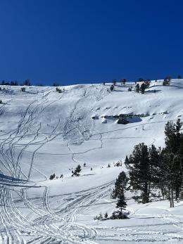
All Regions
It remains possible to trigger avalanches in the snow that fell earlier this week, especially in places where wind has drifted that snow into deeper drifts. The deeper and more recently formed the drift, the more likely you are to trigger a dangerous slide. Winds have been variable and have blown out of unusual directions (including east winds on Wednesday), so be on the lookout for drifts in unusual places. Yesterday, riders north of Cooke City saw a recent snowmobile triggered slide on Crown Butte (details) and skiers triggered a small slide in a wind drift in Bradley’s meadow, north of Bridger Bowl (details). Recent human triggered avalanches are the clearest possible evidence that triggering slides remains possible. There were also slides earlier this week on Mt. Blackmore, in Twin Falls Basin, on Buck Ridge, in Beehive, and at Lionhead.
All the avalanche activity we’ve seen following this last storm seems to have broken in the new snow, but there are also weak layers buried in the top 3 feet of the snowpack that we don’t entirely trust just yet. Dig to assess these weak layers before riding steep slopes (Buck Ridge video) .
If you decide to enter avalanche terrain, cover your bases by carrying rescue gear (avalanche beacon, shovel and probe) and sticking to safe travel protocols by only exposing one person to steep slopes at a time with a partner watching from a safe spot (Bacon Rind video).
Across the advisory area, the avalanche danger is MODERATE.
Please share avalanche, snowpack or weather observations via our website, email (mtavalanche@gmail.com), phone (406-587-6984), or Instagram (#gnfacobs).
Upcoming Avalanche Education and Events
Our education calendar is full of awareness lectures and field courses. Check it out: Events and Education Calendar.
February 19, 10 a.m.-2p.m. Companion Rescue Clinic Field Day in the Bozeman area. Required Online Classroom Session at 6 p.m. on Feb 18. Information and course registration are HERE.
March 3-5, Bozeman Splitfest. More info and register here.
Every Saturday, 10 a.m. - 2:00 p.m. Avalanche Rescue Training, drop in for any amount of time. Round Lake Warming Hut, Cooke City. Free.
Loss in the Outdoors, is a support group for those who have been affected by grief and loss related to outdoor pursuits. Check out the link for more information.
Bruce Jamieson’s videos on Snow Science explain heady topics to the layman. Understanding the avalanche dragon helps keep us alive.