Good morning. This is Doug Chabot with the Gallatin National Forest Avalanche Forecast on Thursday, February 16th at 6:45 a.m. This information is sponsored by Blitz Motorsports and Yamaha, and the Yellowstone Club Community Foundation. This forecast does not apply to operating ski areas.
If you enjoyed yesterday’s weather, you’ll enjoy today even more because it will be warmer. There’s no new snow to report, just clear skies, wind at 10-25 mph out of the W-NW (30-40 mph in the Bridgers) and temperatures in the single digits F. Today will be sunny, mountain temperatures will rise into the 20s F, and wind will change to a SW flow at 10-20 mph. Saturday night will be our next opportunity for snow.

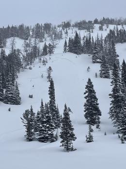
Yesterday had great visibility and offered a chance to see avalanche activity from Tuesday’s storm. All avalanche activity was confined to new snow, and the volume of activity was low. Skiers saw a natural avalanche on the north face of Mount Blackmore (obs and photo) and riders found a small slide on Buck Ridge (photo). Also, a snowmobiler triggered a small slide at Lionhead in Airplane Bowl (photo). Dave and his partner rode in Taylor Fork where the new snow measured 14+” and he titled his field video, We Didn’t See Avalanches. Ian and his partner skied north of Bridger Bowl to the Ramp and found wind-affected snow, but no activity or hair-trigger avalanche conditions (obs and video).
This past storm dropped 12-18” of snow in the Madison and Gallatin Ranges (5-9” elsewhere) which measured up to 1.6” of snow water equivalent, a large load. Wind during the storm switched to the east and ridgelines that would normally be drifted were scoured. Conversely, slopes that are normally stripped of snow are now loaded. Keep in mind these unusual loading patterns as you travel. Although the Bridger Range is windy this morning, it is predicted to lessen quickly which will keep drifting to a minimum. We also have weak layers of faceted snow buried in the top 3 feet of the snowpack that are not immune to avalanching. Although the likelihood of triggering slides is decreasing, there’s still potential for releasing an occasional avalanche. As the danger decreases the snowpack’s instability becomes hidden. This requires us to search, dig and test. Shooting cracks in a wind drift or a poor stability test score will turn us around.
For today, throughout our forecast area, the danger is rated MODERATE on all slopes.
Please share avalanche, snowpack or weather observations via our website, email (mtavalanche@gmail.com), phone (406-587-6984), or Instagram (#gnfacobs).

Tuesday’s storm dropped well over a foot of new snow. Wind is blowing and drifts will grow thicker (Island Park video). Buried weak layers in the upper three feet of the snowpack could result in avalanches breaking deep and wide. As the danger decreases the snowpack’s instability becomes hidden. This requires us to search, dig and test.
Upcoming Avalanche Education and Events
Our education calendar is full of awareness lectures and field courses. Check it out: Events and Education Calendar.
TONIGHT! February 16, FREE Avalanche Awareness night for women at REI Bozeman. Time TBD.
February 19, 10 a.m.-2p.m. Companion Rescue Clinic Field Day in the Bozeman area. Required Online Classroom Session at 6 p.m. on Feb 18. Information and course registration are HERE.
March 3-5, Bozeman Splitfest. More info and register here.
Every Saturday, 10 a.m. - 2:00 p.m. Avalanche Rescue Training, drop in for any amount of time. Round Lake Warming Hut, Cooke City. Free.
Loss in the Outdoors, is a support group for those who have been affected by grief and loss related to outdoor pursuits. Check out the link for more information.
Bruce Jamieson’s videos on Snow Science explain heady topics to the layman. Understanding the avalanche dragon helps keep us alive.