Snow Observations List
Winds blowing hard from the N/NE, 30-40 mph gusts. Graupel falling at start of storm and accumulating fast. Left car at 9am with zero accumulation and returned to 4 inches by 2pm (11/2/22). North facing aspects within the basin had little to no snow left over from the previous storm as slopes were heavily wind scoured. East facing aspects at higher elevations had the most substantial base. Wind loading was observed in large, isolated drifts on top of the Love Chutes and at the rim of Frazier Basin. Snowpack was about 2 feet deep in these drifts with little connection to slopes below.
Full Snow Observation ReportWarmed up a lot today as we climbed Middle in Beehive. Some large rollerball development by the time we were coming out of going home chute.
Full Snow Observation ReportBB skiing in the past few days. Pretty impressive single-storm coverage. Skied from the top of the nose down to the base on Wednesday. Spotted a few micro wind slabs that had peeled during the storm but nothing large.
Full Snow Observation Report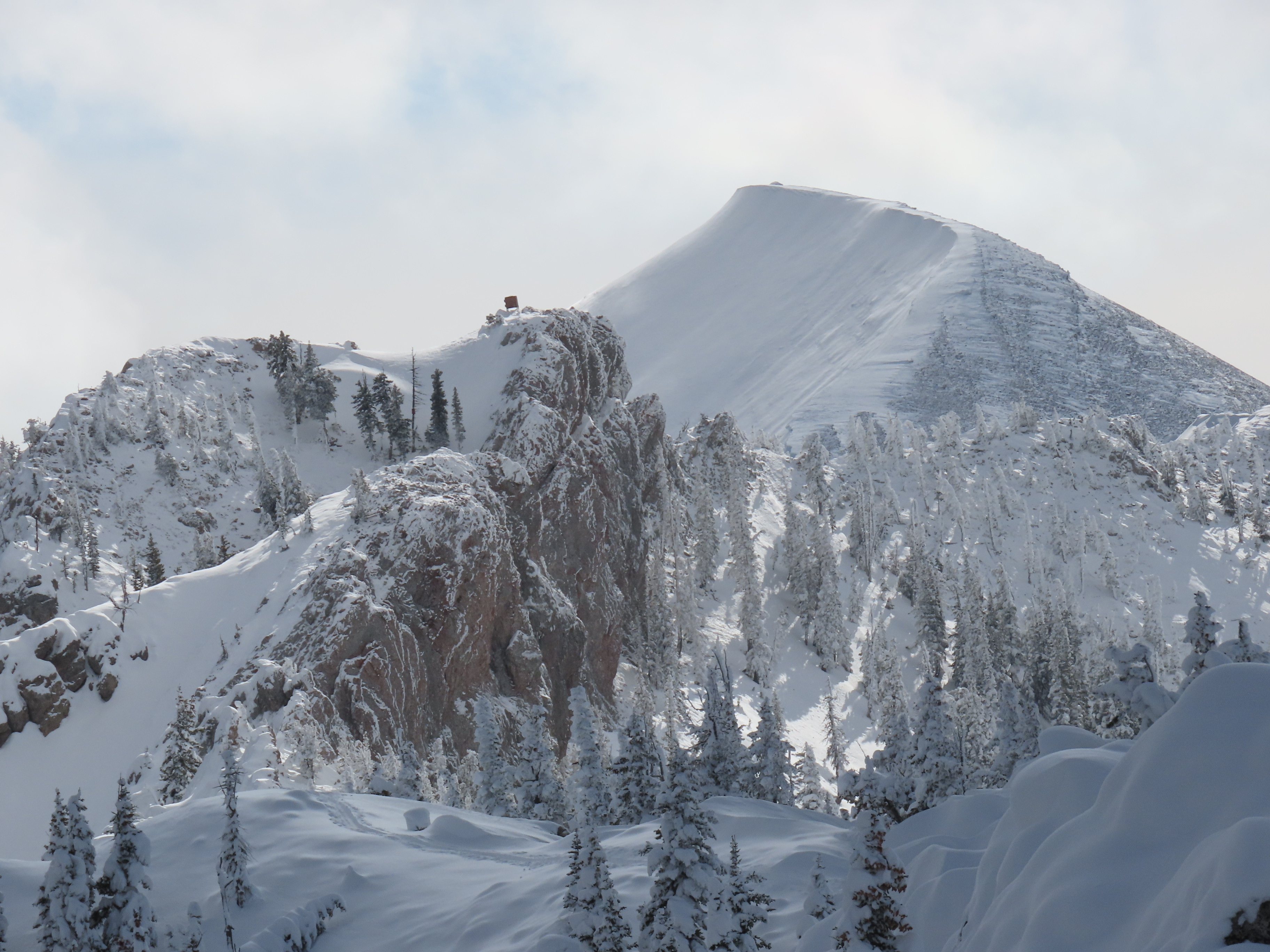
There was a big release down the top center of the Apron yesterday morning. Seen from afar so not certain what initiated the slide.
Full Snow Observation ReportTiny wind slab on a SW facing aspect at 9150 ft
Full Snow Observation Report
Relevant Observations:
Recent large avalanche observed on drive up: HS-U-R1-D2-S (didn't remember the aspect/elevation exactly)
Moderate W winds and blowing snow on drive back
Depth range of 70cm - 100cm observed
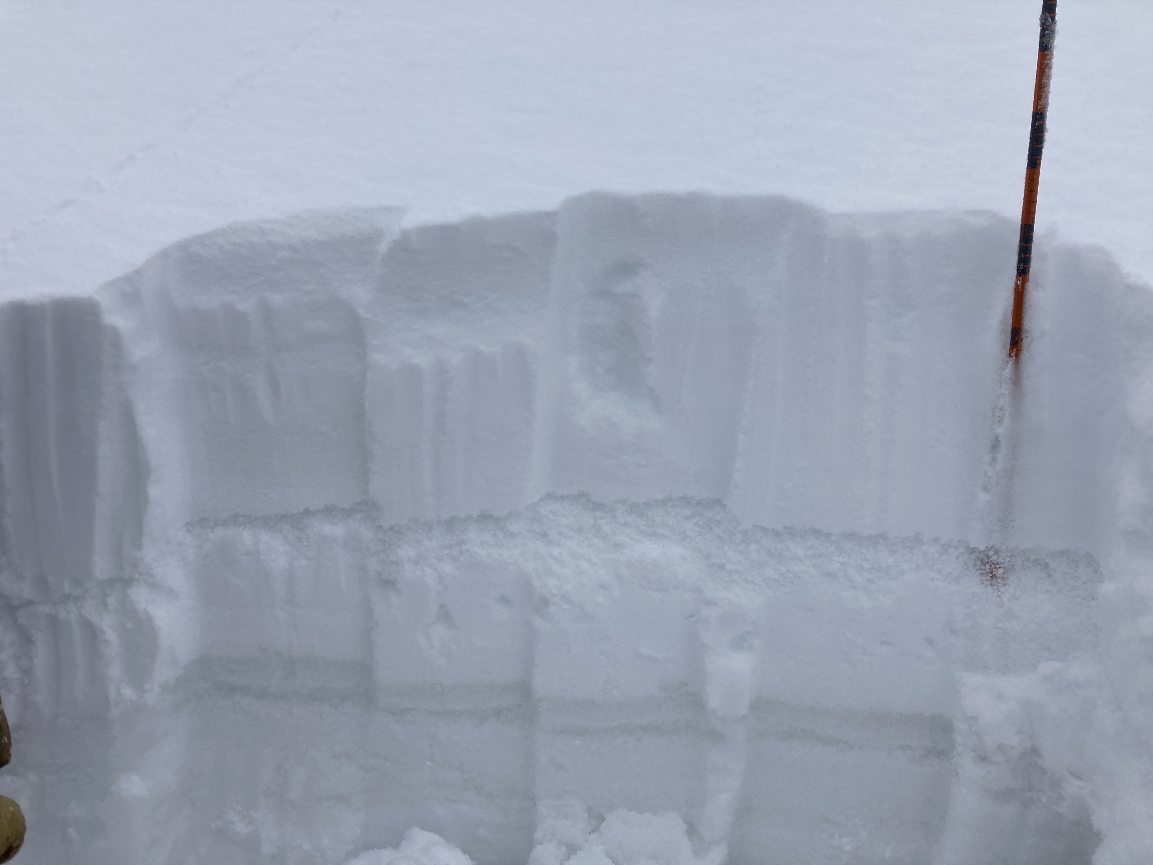
ECTN12 down 43cm (W aspect, 8960ft)
Full Snow Observation Report
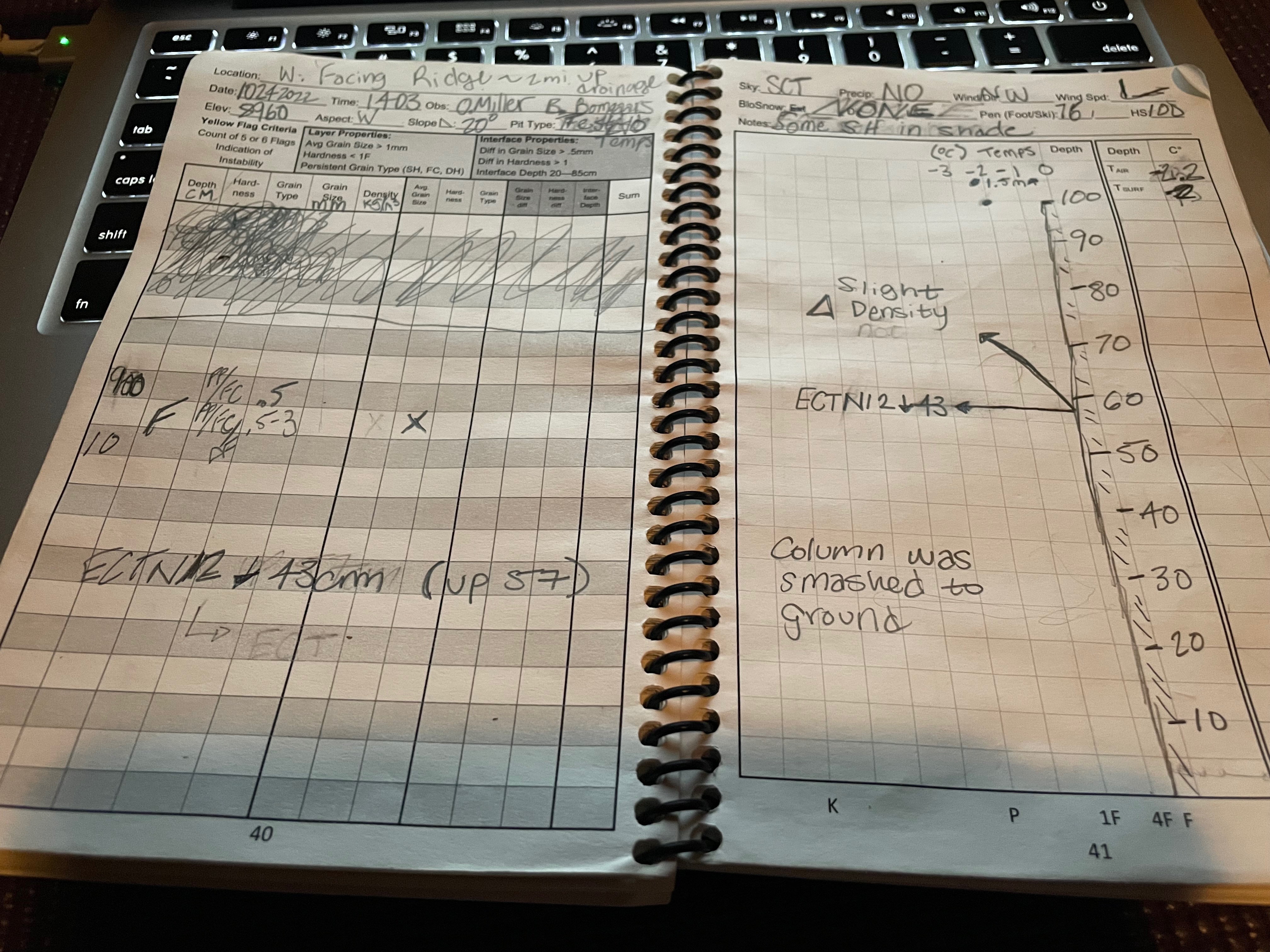
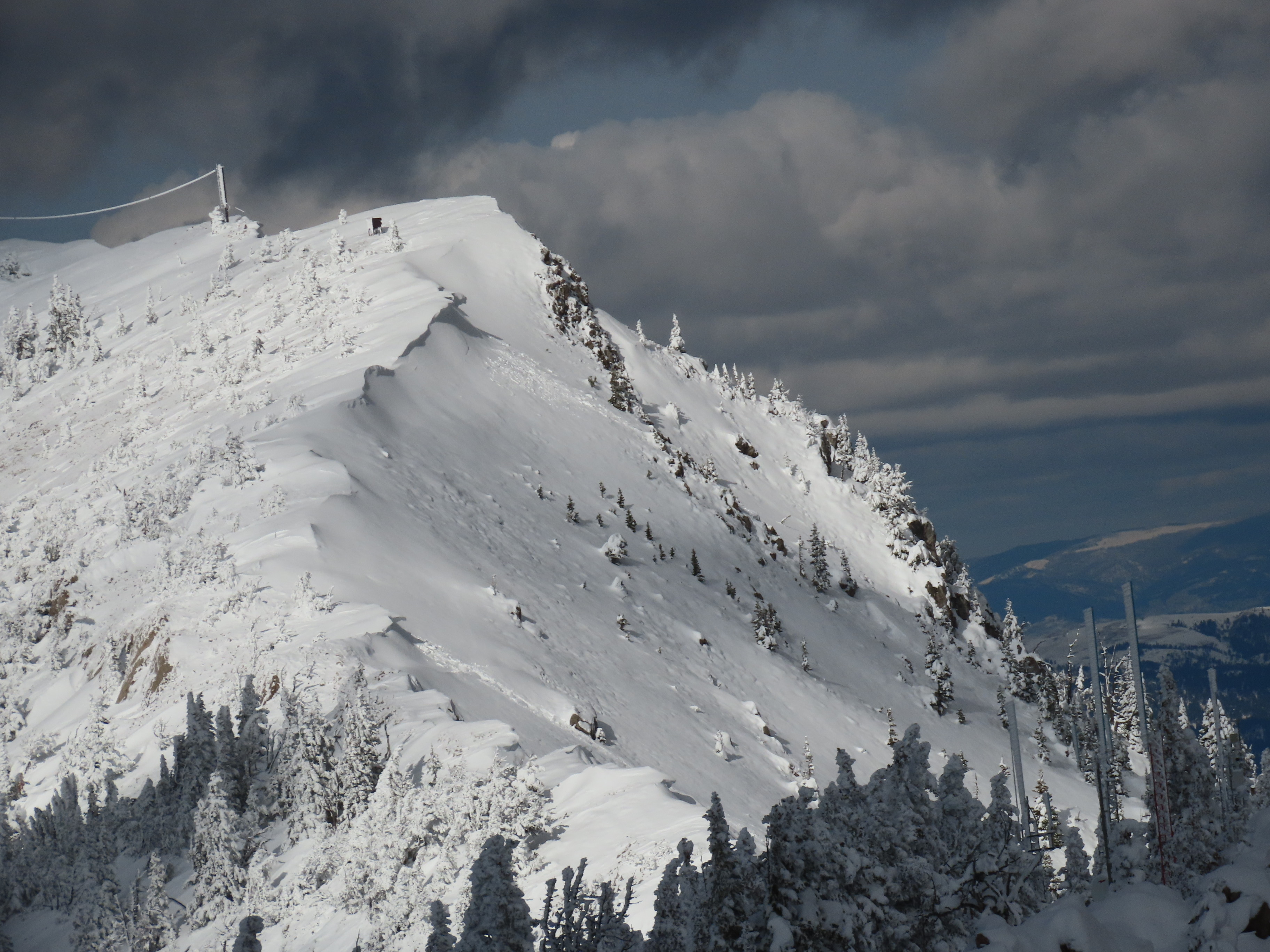
We toured up Bridger Bowl yesterday (10/24). We saw no signs of natural instability on our way up, but the wind was moving snow around with wind lips and cornices forming along road cuts (unreactive to ski penetration). On the upper mountain we found snow depths from 2-4.5 feet depending on aspect, with the higher end of those totals being in sheltered north facing areas. After evaluating several steep wind drifted test slopes, we saw no signs of instability in the drifts. As the day progressed, the snow was becoming sun effected in the upper to mid elevations on solar aspects creating heavier snow on top of lighter density snow. Over all, coverage was decent with minimal rock bashing. On our drive back to town we spotted at least 1 point release south of saddle on a solar aspect above a cliff band.
Full Snow Observation ReportAn observer saw evidence of wind loading creating the conditions for avalanches in the Bridger Range on Sunday. Cracking is an indicator of instability. The observer noted that the relatively small drift he saw was "nothing consequential," but this shows that unstable drifts are forming. They will be more consequential where there is more snow and as the wind creates larger drifts.
Full Snow Observation Report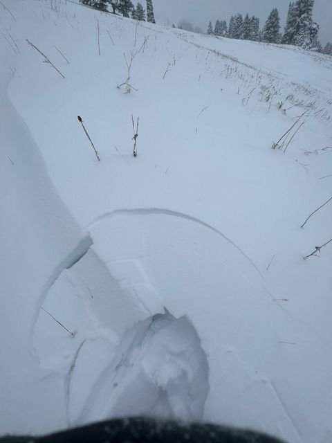
Ian and I completed the setup of a SNOdar snow depth sensor on Sawtelle Peak in the Centennials. Located at 8800 feet elevation. The sensor will record total snow depth and 24 hr snowfall. Data will be displayed on our website soon at: http://www.mtavalanche.com/weaterh/stations/sawtelle-snow.
The snowpack is non-existent in this area. I think the only snow I could see was the north summit snowfield on Lone Peak from the drive.
Full Snow Observation Report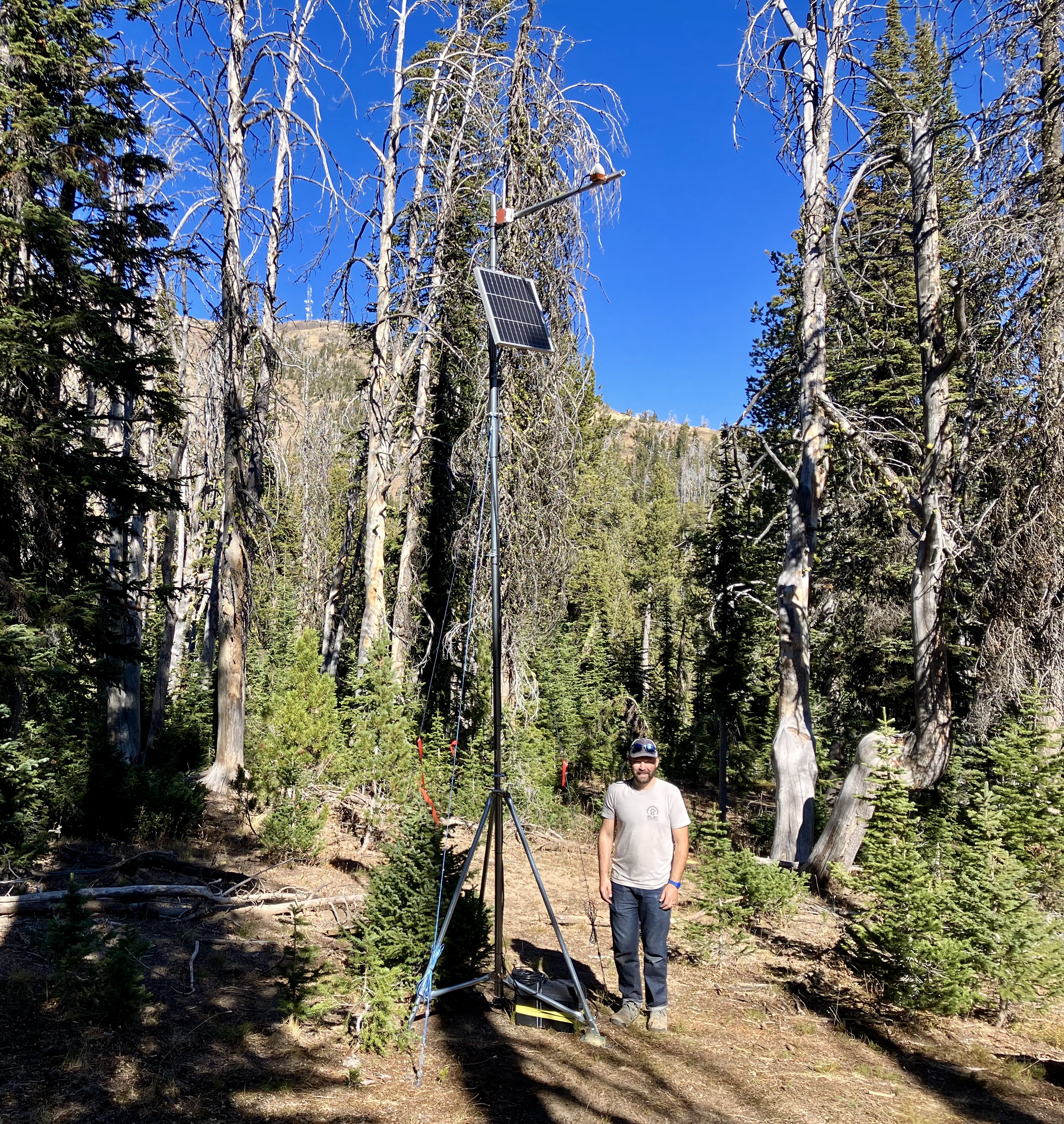
Fresh dusting on the peaks, looks like snow line around 9500’. I bet Al could try to find a way to ski something up there but the rest of you are probably smarter than that.
Current conditions at 7800’, NE aspect a mile or two below the second yellowmule:
Surface is very wet with foot penetration 10-20cm mud. Wind light gusting moderate out of the west, air temp 69 degrees F with scattered clouds.
I got one shooting crack in a boulder I was setting, but luckily the fracture did not propagate all the way across the rock. Stability for that rock was poor but not representative of the rest of the area. Primary concern up here is bear activity. I would say natural bear incidents are possible with human-triggered attacks likely, especially if there is outdoor cooking or game processing involved.
Full Snow Observation Report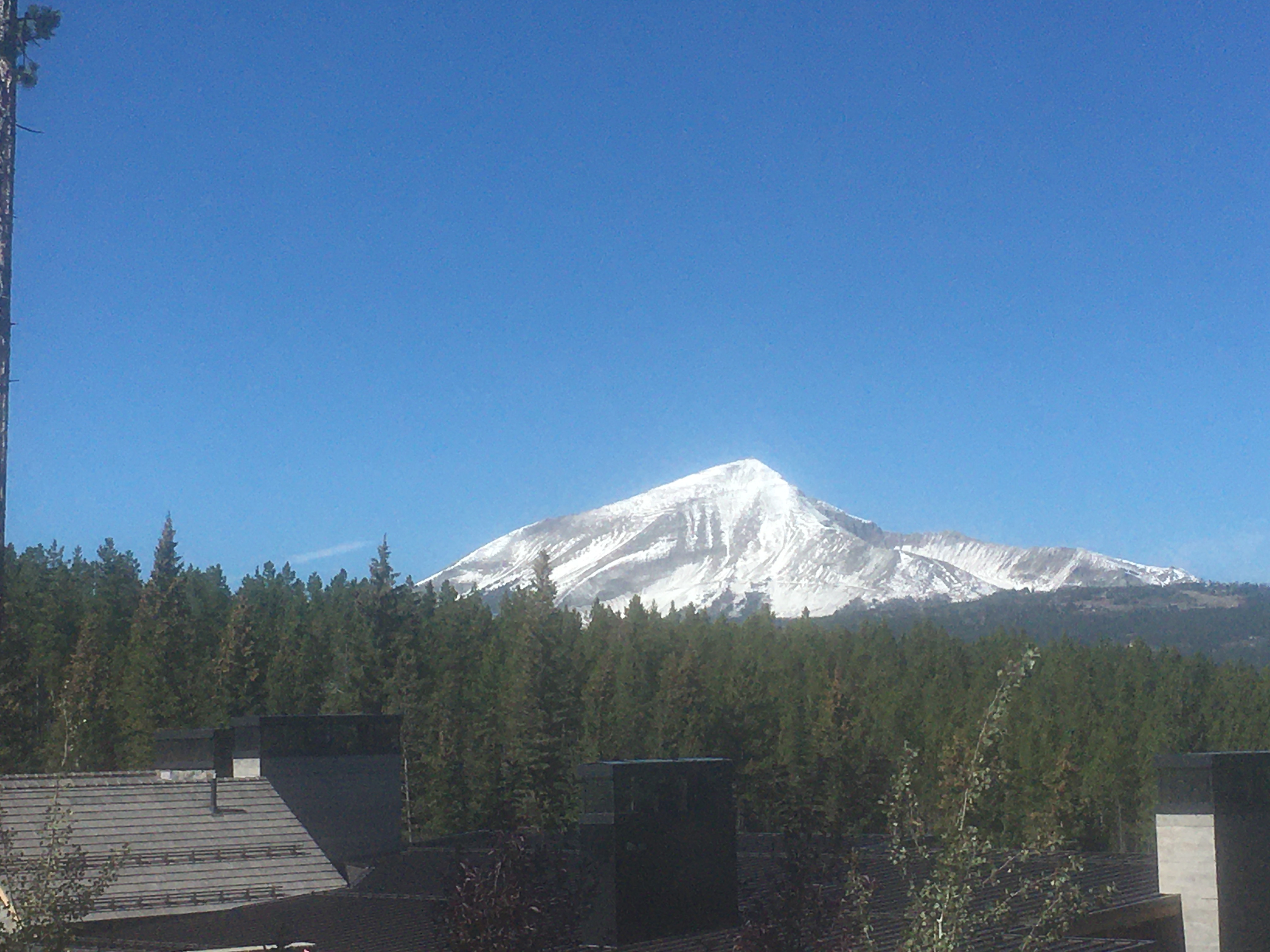
Triggered a small slide underneath the cornice of the southeast chute off of Emigrant peak. The slide was 50 ft wide, 4 inches deep, and ran for about 100 ft. The slide was not large enough to knock you off your feet (D1). The latest storm had deposited about 12 inches of new snow underneath the cornice.
other older slides were visible on a wind loaded NW oriented slopes at the bottom of the basin. Still feels like winter out there with lots of light snow up high!
Full Snow Observation Report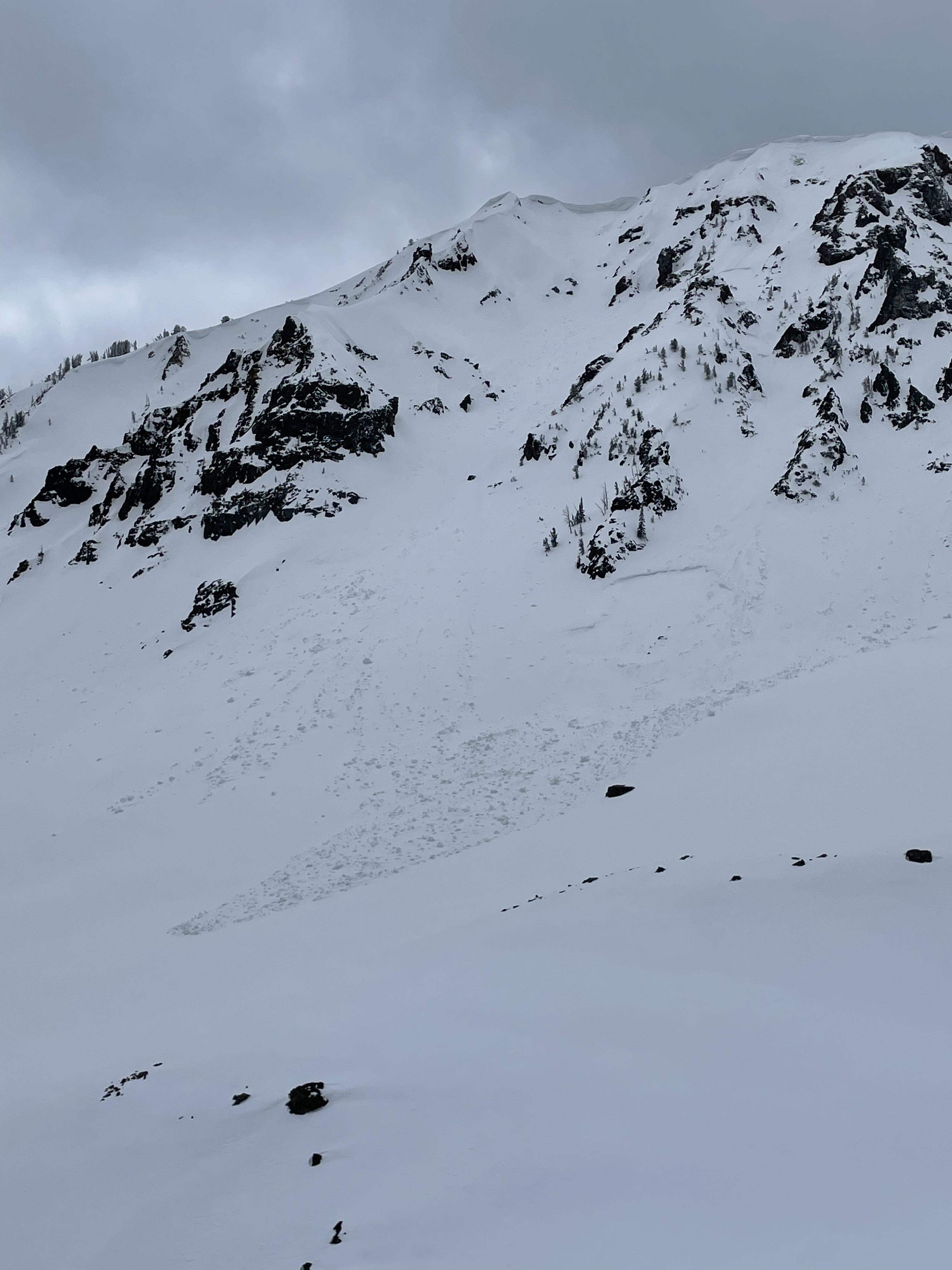
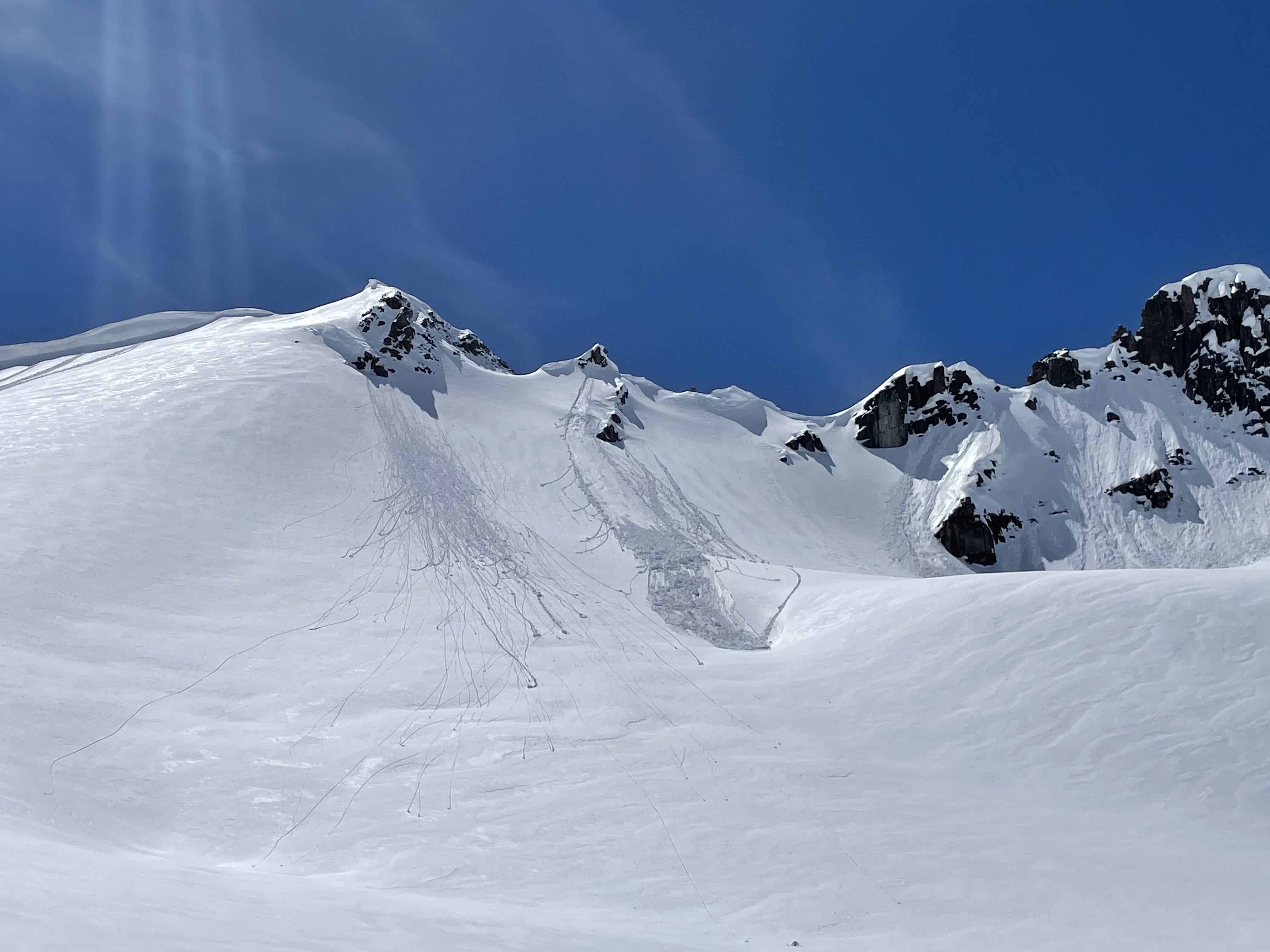
We saw a point release that mobilized a slab of new snow on an East facing slope off of mt fox in cooke city.
cool example of a roller ball turning into a point release and into a wet slide avalanche. The new snow had heated up considerably during the day on Sunday. There were some older crowns below a cornice to the north of mt fox (second photo) with slide debris that extended down the whole face (600ft). Likely slid during a storm within the last week
Full Snow Observation Report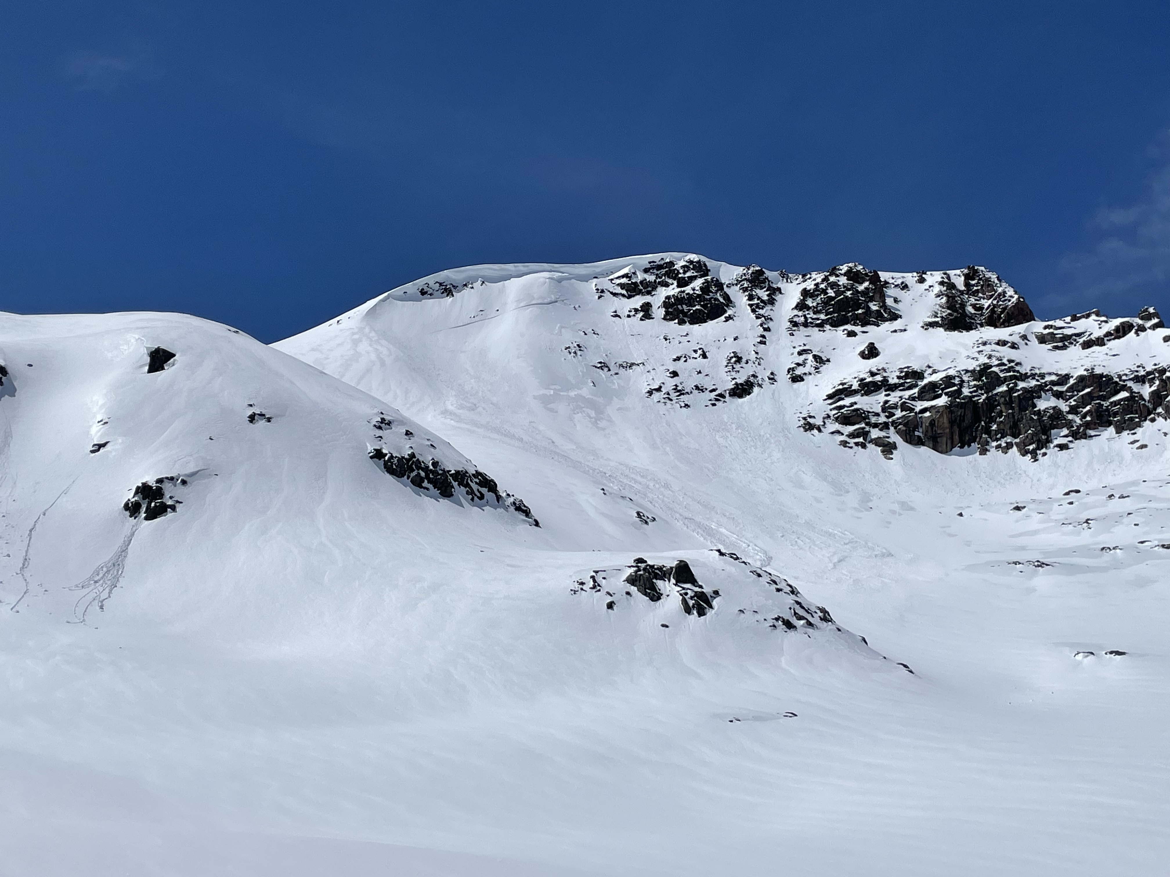
found a intact graupel layer buried by 10-14” of fresh snow. Got cracking on it (ectn 17, ct 18) but no propagation. Also saw lots old of storm slabs/wind slab crowns.
Full Snow Observation Report