This is Alex Marienthal with the avalanche forecast for Monday, February 24th, at 7:00 a.m. sponsored by Cooke City Motorsports, Bozeman Splitfest and BWAGs. This forecast does not apply to operating ski areas.
Since yesterday morning snow totals are:
- 6” (0.9” SWE) in Cooke City
- 3-4” (0.3-0.7” SWE) Island Park, West Yellowstone, Taylor Fork, Big Sky
- 0-2” (0.1-0.2” SWE) Bridger Range and Hyalite
This morning, temperatures are 20s to low 30s F, and wind has been westerly at 15-35 mph with gusts of 45-75 mph with an 88 mph gust in Hyalite.
Today will be partly cloudy with light snow this afternoon. Temperatures will reach mid-30s F and moderate to strong west-southwest wind will continue. A trace to 2” of snow is possible by tomorrow morning.
Heavy new snow and strong wind make human-triggered avalanches likely where the snow is drifted into stiffer slabs. Wind slab avalanches are the primary concern. These will be easy to trigger and could break 1-2 feet deep. Yesterday I was in Republic Creek and found fresh drifts that broke easily (observation and photos). Storm slab avalanches are possible where the snow is not drifted. Watch for cracking around your skis or sled as a sign the new snow could slide on steeper slopes.
We heard of an avalanche triggered by a snowmobiler east of Mt. Abundance on Saturday which broke 2 feet deep, 250’ wide, and was triggered from flat terrain above the slope (observation). It possibly failed on a thin weak layer buried earlier in February (photo). This type of persistent slab instability is not widespread around Cooke City, but with the added weight of today’s snow there might be a couple slopes where an avalanche could break 2-3’ deep and hundreds of feet wide.
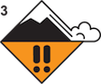
Be cautious of slopes steeper than 30 degrees and steer clear of fresh drifts. The avalanche danger is CONSIDERABLE on wind-loaded slopes and MODERATE on other slopes.

Near West Yellowstone and the southern Madison and southern Gallatin ranges a person can trigger large avalanches that break on weak layers buried 1-3 feet deep. These persistent slab avalanches are tricky as they might be triggered by the first person, or after multiple people have ridden a slope, and not every slope has this instability. Yesterday Mark and Dave went to Tepee Basin to look at a slide that partially buried a rider on Friday (observation, details and photos). Watch their video for insight into this problem and some key takeaways from the group involved. Keep in mind, you aren't good to go by just avoiding the steep, upper-elevation, wind-loaded bowls. Steep slopes at mid-elevations harbor weak snow and have the potential for an avalanche.
Wind slab avalanches will be easy to trigger where today’s snow is drifted into fresh slabs. These might not be very big, but can easily knock you over or carry you down a slope. Be cautious of wind-loaded slopes, especially where a slide could carry you into trees, rocks or over cliffs.
Human-triggered avalanches are possible and avalanche danger is MODERATE.
Across the rest of the forecast area wind slab avalanches can be triggered where strong wind has drifted snow into stiff slabs. Fresh drifts will be easy to trigger, but relatively small, and are most hazardous in terrain with larger consequences such as thick trees or cliffs. Also be cautious of older drifts from earlier in the week (photo), although most of these should be unreactive by now.
Wet loose avalanches are possible due to above freezing temperatures, but cloudy skies and wind should minimize this problem today. Be careful of steep slopes if you find a wet or sticky snow surface.
Steer clear of steep slopes with fresh drifts or a wet snow surface, especially if a slide could push you into trees, over a cliff or pile up deeper in a confined gully. Human-triggered avalanches are possible and the avalanche danger is MODERATE.
Special Note - Roof avalanches
Many roofs have lots of snow on them that may come crashing down as a roof avalanche during the warm temperatures. Avalanche fatalities from roof avalanches are not uncommon. Kids are especially vulnerable because they often play near houses while no one is watching.
Upcoming Avalanche Education and Events
Our education calendar is full of awareness lectures and field courses. Check it out: Events and Education Calendar
February 27, 6-8 p.m. & March 1, 10 a.m - 2 p.m. Companion Rescue Clinic. Evening lecture at REI in Bozeman. Field session at History Rock. Details and signup here.
February 28 - March 2, Bozeman Splitfest 2025 - Celebrate all things Bozeman backcountry and raise funds for GNFAC. Enjoy demos, clinics, free food and beer from MAP. Connect with fellow outdoor enthusiasts and soak up the winter stoke.
Every weekend in Cooke City: Friday at The Antlers at 7 p.m., Free Avalanche Awareness and Current Conditions talk, and Saturday from 10 a.m.-2 p.m. at Round Lake Warming Hut, Free Rescue Practice.