Good morning. This is Doug Chabot with the Gallatin National Forest Avalanche Forecast on Thursday, February 9th at 7:00 a.m. This information is sponsored by Pine Edge Cabins, BWAGs and Advanced Innovation. This forecast does not apply to operating ski areas.
Yesterday’s snowfall measured 4-5” in the Bridger Range and Hyalite, 7" around Big Sky, and 2-3” near West Yellowstone and Cooke City. Wind has decreased from the west to north, averaging 5-15 mph with gusts of 20 mph (32 mph at Bridger). Under sunny skies mountain temperatures will reach the high 20’s F and wind will blow W-NW at 10-20 mph. No new snow is expected in the next few days.
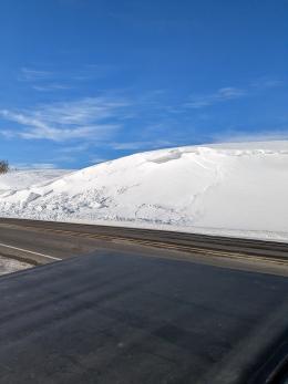
The mountains around Bozeman and Big Sky picked up the most snow and had the most wind with gusts of 50 mph. Weather stations had 4-7” of snow and Dave measured 9” in Maid of the Mist bowl up Hyalite. Ian was riding on Buck Ridge, and both he and Dave plowed through heavy wind drifts as the wind howled all day. Dave commented that there was still a lot of snow to be blown around, which it assuredly did last night. Around midnight wind died down in Hyalite and Big Sky, but strong gusts were still being measured at Bridger Bowl. Although the wind-loading is subsiding, not many hours have passed to allow slopes to adjust. With time these slopes will become less sensitive, but today is a day where triggering wind drifts is still likely. Ian and Dave both made videos of their field day and each have a separate message:
- On Buck Ridge Ian points out how we can see wind-loads without exposing ourselves to them. Being observant goes a long way to being safe (video).
- In Hyalite, Dave found a lingering weak layer under a drift which reminds us that weak layers still exist in the upper 3 feet of the snowpack (video).
Today’s primary stability concern remains wind-drifting that occurred in the last 24 hours. These slopes have a CONSIDERABLE avalanche danger today and should be avoided. On slopes without a wind-load, the danger is MODERATE.
The weather stations south of Big Sky to West Yellowstone and Cooke City measured 2-3” of snow yesterday. Wind was strong and died down last night to 5-10 mph. There is likely a lingering wind-drift that could be triggered, but this instability is not widespread simply because yesterday’s snowfall was not large enough to build thick drifts. In the top 3 feet of the snowpack there are weak layers of feathery surface hoar and sugary facets that continue to break in some stability tests (snowpit profle) and occasionally avalanche (Island Park, Two Top, Sage Peak, Round Lake).
Have heightened awareness around wind drifts and their associated signs of instability, like shooting cracks (photo). This same vigilance should be extended to buried weak layers which have to be uncovered with a snowpit. Given that avalanches are possible on all slopes, either from wind-drifting or buried weak layers, the danger is rated MODERATE.
Please share avalanche, snowpack or weather observations via our website, email (mtavalanche@gmail.com), phone (406-587-6984), or Instagram (#gnfacobs).
The weather stations measured 2-3” of snow yesterday with strong wind. Have heightened awareness around wind drifts and their associated signs of instability, like shooting cracks (photo). This same vigilance should be extended to buried weak layers which have to be uncovered with a snowpit. In the top 3 feet of the snowpack there are weak layers of feathery surface hoar and sugary facets that continue to break in some stability tests (snowpit profle) and occasionally avalanche (Island Park, Two Top, Sage Peak). Avalanches are possible on all slopes, either from wind-drifting or buried weak layers.
Upcoming Avalanche Education and Events
Our education calendar is full of awareness lectures and field courses. Check it out: Events and Education Calendar.
TONIGHT, February 9, FREE Avalanche Awareness at REI Bozeman. More details to come.
February 16, FREE Avalanche Awareness night for women at REI Bozeman. Time TBD.
February 19, 10 a.m.-2p.m. Companion Rescue Clinic Field Day in the Bozeman area. Required Online Classroom Session at 6 p.m. on Feb 18. Information and course registration are HERE.
March 3-5, Bozeman Splitfest. More info and register here.
Every Saturday, 10 a.m. - 2:00 p.m. Avalanche Rescue Training, drop in for any amount of time. Round Lake Warming Hut, Cooke City. Free.
Loss in the Outdoors, is a support group for those who have been affected by grief and loss related to outdoor pursuits. Check out the link for more information.
Bruce Jamieson’s videos on Snow Science explain heady topics to the layman. Understanding the avalanche dragon helps keep us alive.


