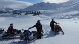
Good morning. This is Alex Marienthal with the Gallatin National Forest Avalanche Forecast on Sunday, January 9th at 7:00 a.m. This information is sponsored by Alpine Orthopedics & Sports Medicine, Stronghold Fabrication and Knoff Group Real Estate. This forecast does not apply to operating ski areas.
Yesterday the mountains near Cooke City got 2” of snow as the storm ended. Elsewhere got no new snow in the last 24 hours. This morning temperatures are single digits to teens F and wind is west-southwest at 10-20 mph with gusts to 40 mph. Today temperatures will reach high teens to mid-20s F with westerly wind at 10-25 mph. No snow is expected for the foreseeable future.
Since Friday morning the mountains near Cooke City got nearly 2.5 feet of snow (2.8” of snow water equivalent) along with strong southerly winds. Dangerous avalanche conditions exist, and human triggered avalanches are likely on steep slopes. Snow and strong wind ended yesterday. Natural avalanches are less likely, but possible on slopes that continue to get wind-loaded today. Yesterday we received reports of a couple natural avalanches that broke on wind-loaded slopes during the storm (photo, photo). On Friday a rider triggered a 2 ft deep slide that broke 100 ft wide while digging out his stuck sled, thankfully he is okay (details). Today avalanches can be triggered 2-3 feet deep in the recent snow, and it remains possible to trigger a much larger avalanche that breaks on weak snow near the bottom of the snowpack. The snowpack needs more time to adjust to the recent heavy storm. Avoid travel on and underneath slopes steeper than 30 degrees. Today the avalanche danger is CONSIDERABLE.
Strong wind over the last week drifted new snow into slabs that can avalanche under the weight of a skier of rider. Avalanches can fail on a weak layer of small facets that was buried by the recent new and wind-drifted snow. Yesterday skiers in Beehive Basin and on Mt. Blackmore in Hyalite found this weak layer buried 1-2 feet down. They got unstable results in their snowpack tests and chose to ride low angle terrain. Avalanches could also break deeper in the snowpack on weak layers near the ground, particularly near West Yellowstone and in the southern Madison and southern Gallatin ranges where more snow fell last week and we saw activity on deeper layers earlier this season.
Careful snowpack assessment is essential before riding on steep slopes. Be cautious of fresh drifts and be certain there are no potentially unstable buried weak layers. Human triggered avalanches are possible, and the avalanche danger is MODERATE.
If you get out, please send us your observations no matter how brief. You can submit them via our website, email (mtavalanche@gmail.com), phone (406-587-6984), or Instagram (#gnfacobs).
Upcoming Education Opportunities
The West Yellowstone Beacon Park is up and running! Stop by to check it out and practice with your rescue gear.
See our education calendar for an up-to-date list of all local classes. Here are a few select upcoming events and opportunities to check out:
January 13, 6:30 p.m., Avalanche Awareness Night at Uphill Pursuits
January 20 + Field day. Our popular Avalanche Fundamentals with Field Course is perfect as a refresher or an introduction to avalanches. We are introducing a new format with four pre-recorded lectures to watch at your convenience, a live question and answer session, and a choice of a snowmobile or ski/ board based field day occurring the following two weekends.
Every Saturday near Cooke City, 10 a.m.-3 p.m. FREE snowpack update and transceiver/rescue training. Stop by for 20 minutes or more at the Round Lake Warming Hut.
Read Doug’s latest article on Popular Avalanche Myth’s published by Explore Big Sky.


