Merry Christmas! This is Alex Marienthal with the Gallatin National Forest Avalanche Forecast on Saturday, Christmas Day, December 25th at 7:00 a.m. This information is sponsored by Gallatin Valley Snowmobile Association, Bridger Bowl, and Cooke City Motorsports. This forecast does not apply to operating ski areas.
Santa’s delivery of snow arrived early. As the storm ended yesterday morning an additional 6-8” of snow fell near West Yellowstone, the southern Madison Range and Cooke City, 1” near Big Sky and Hyalite, and none in the Bridger Range. Southwesterly wind has been 10-15 mph with gusts in the 20s. This morning temperatures are single digits to teens F and west-southwest wind has increased to 15-20 mph with gusts at ridgetops of 45-55 mph. Today these winds will accompany temperatures in the teens to low 20s F. Our next gift of snow should arrive tonight and tomorrow. By morning the mountains near West Yellowstone and Cooke City could have 4-7” new snow with 1-2” near Big Sky and Bozeman.
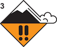
Since Wednesday the mountains near Cooke City got 2 feet of snow equal to 2.4” of snow water equivalent (SWE), and over the last week received at least 4 feet of snow equal to 3.8” SWE. While this new snow is welcome, it creates dangerous avalanches conditions today. Avalanches breaking in the new snow are likely, especially where snow is drifted into stiffer slabs. The snow that fell over the last week makes up 30% of the total snowpack (measured in SWE) near Cooke City. This is a relatively heavy weight for the snowpack and any weak layers need time to adjust. The additional weight of a person could tip the scales and trigger an avalanche deeper in the snowpack which would surely be large and potentially deadly. Today it is best to stay off and out from underneath slopes steeper than 30 degrees. Human triggered avalanches are likely and the avalanche danger is rated CONSIDERABLE.

Near West Yellowstone and in the Southern Madison and Gallatin ranges 14-20” (1.3 to 1.9” SWE) of snow fell since Wednesday. Today avalanches involving this new snow are possible to trigger. Increased wind speeds will form stiffer slabs of wind-drifted snow which a person could trigger. Ian and I rode in Taylor Fork yesterday and saw minimal signs of instability in the new snow (video), but that could change with more wind today. Avalanches could also break on weak layers near the ground (video). Yesterday skiers near Bacon Rind reported collapsing and “whumphing” of the snowpack and stability tests breaking on buried weak layers (details). Before riding steep slopes carefully assess the potential for unstable buried weak layers. If you suspect buried weak layers or see signs that new snow or fresh drifts are unstable, avoid steep slopes. Today avalanches are possible and the avalanche danger is MODERATE.
Yesterday morning the Bridger Range got 3-10” of snow (0.3-0.7” SWE) while Hyalite and Big Sky got 3-4” of snow (0.2-0.4” SWE). Today avalanches are possible to trigger where this new snow is drifted into stiffer, thicker slabs. Watch for signs that drifts of new snow are unstable, such as fresh avalanches or cracks in the snow from your skis. If you see these signs, stay off of steep freshly wind-loaded slopes. Right now avalanches breaking deeper in the snowpack are not likely (Saddle Peak video, Buck Ridge video, Beehive video), but on Thursday Big Sky Ski Patrol used explosives to trigger a 5 ft deep avalanche that broke on weak snow near the ground. This is our reminder to not forget about the potential weak layers deeper in the snowpack. Today, the avalanche danger is rated MODERATE on wind-loaded slopes and LOW on all others.
If you get out, please send us your observations no matter how brief. You can submit them via our website, email (mtavalanche@gmail.com), phone (406-587-6984), or Instagram (#gnfacobs).
Upcoming Education Opportunities:
Get your avalanche brain ready for the season at one of the many classes listed on our education calendar, and list of upcoming events below.
Every Saturday near Cooke City, 10 a.m.-3 p.m. FREE snowpack update and transceiver/rescue training. Stop by for 20 minutes or more at the Round Lake Warming Hut.
Friends of GNFAC Powder Blast Fundraiser
The Friends of the Avalanche Center are hosting the Virtual Powder Blast fundraiser. With only $1,000 left to go, help us reach the $65,000 goal. Your donations support free and low-cost avalanche education, beacon checkers at trailheads, beacon parks, weather stations, and GNFAC programs!
We are sad to report, yesterday in Colorado a skier was killed in an avalanche near Cameron Pass (Link to preliminary report). Our deepest condolences go out to those affected by this tragic accident.