Good Morning. This is Ian Hoyer with the Gallatin National Forest Avalanche Forecast on Friday, December 17th at 7:00 a.m. This information is sponsored by Yellowstone Ski Tours, Gastrognome and Wild Montana. This forecast does not apply to operating ski areas.
Most areas picked up 3-4” of new snow in the last 24 hours with 6” near Big Sky. Winds are 15-20 mph out of the west, gusting 30-40 mph. Temperatures in the single digits and teens this morning won’t rise much if at all today. Moderate winds will shift a bit more northwest today. Another inch or two of snow is possible this morning before skies clear.

Peak instability from this week’s storm has passed, but don’t let your guard down just yet. You could still trigger an avalanche today. Over the past week nearly 3 ft of snow fell in the southern portions of our advisory area with around a foot in the north.
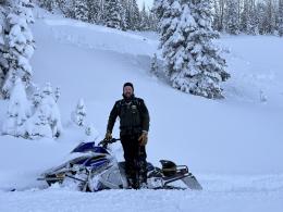
Especially in the southern regions, this storm pushed the snowpack to its breaking point. On Wednesday, Dave and I triggered a small avalanche in the Taylor Fork on the first steep slope we approached while still 100’ away and saw numerous larger avalanches that broke 2-3 ft deep naturally during the storm (video, details). A skier nearby at Bacon Rind triggered an avalanche from the flats above a steep slope (details, photo). Yesterday, a skier triggered and was caught in an avalanche that broke 8” deep near The Apron at Bridger Bowl (the ski area is closed and backcountry conditions exist). Luckily, nobody was injured (photos and details).
Without active heavy loading, the snowpack is working to adjust to the weight of the storm snow, but the added force of a skier or rider may still be enough for it to break and avalanche. Our primary concern remains avalanches breaking beneath the new snow, especially in areas with recent drifting. We also still have some early season uncertainty about the deeper weak layers, so dig and evaluate them if you’re considering riding in avalanche terrain.
Human triggered avalanches are possible today and the avalanche danger is MODERATE.
On wind-loaded slopes, you could trigger an avalanche 1-3 ft deep beneath this week’s new snow. Look out for these wind-loaded slopes and signs of instability such as cracks shooting out in front of you. Pay close attention to the snow beneath your feet or sled as last night’s new snow may obscure the obvious visible signs of wind loading. Avalanches are unlikely to fail on deeper weak layers until they get loaded more heavily.
On wind-loaded slopes the avalanche danger is MODERATE because human-triggered avalanches are possible. On other slopes the avalanche danger is LOW.
If you get out, please send us your observations no matter how brief. You can submit them via our website, email (mtavalanche@gmail.com), phone (406-587-6984), or Instagram (#gnfacobs).
Upcoming Education Opportunities:
Get your avalanche brain ready for the season at one of the many classes listed on our education calendar, and list of upcoming events below. Don’t delay preparing and inspecting your avalanche gear. Get some tips from Dave Zinn in this Pre-Season gear check video.
Every Saturday near Cooke City, 10a.m.-3p.m. FREE snowpack update and transceiver/rescue training. Stop by for 20 minutes or more at the Round Lake Warming Hut.
Friends of GNFAC Powder Blast Fundraiser
The Friends of the Avalanche Center are hosting the Virtual Powder Blast fundraiser. With only $2,000 left to go, help us reach the $65,000 goal. Your donations support free and low-cost avalanche education, beacon checkers at trailheads, beacon parks, weather stations, and GNFAC programs!
Bridger Bowl will be closed to uphill travel at dark on Sunday (12/19). Please stay off the hill after Sunday as they prepare to open Tuesday (12/21). Thank you.